Property Record
1862 Tollgate Rd, Palm, PA 18070


NEARBY LISTINGS FOR SALE OR LEASE
Property Detail
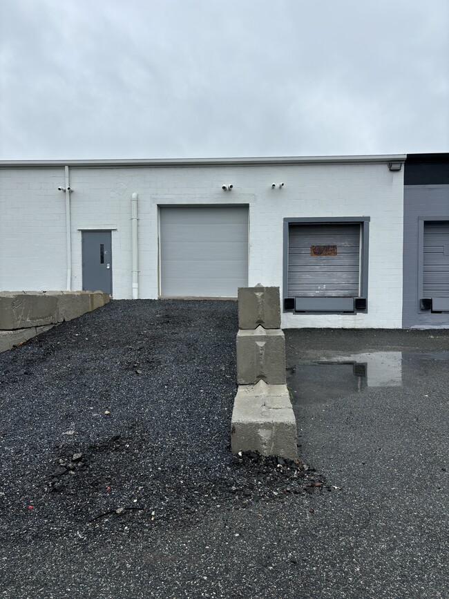
1862 Tollgate Rd
52-6410-01-25-1695
Palm Indust Center
Warehouse
Berks
AE
Pennsylvania
42091C0016G
1
2025
25.62 AC
2025
Berks
013301
Philadelphia
94,597 SF
Reading, PA
DEMOGRAPHICS near 1862 Tollgate Rd
1 Mile
3 Mile
5 Mile
2024 Total Population
549
9,380
31,361
2029 Population
546
9,452
31,666
Pop Growth 2024-2029
(0.55%)
+ 0.77%
+ 0.97%
Average Age
44
42
42
2024 Total Households
213
3,644
11,834
HH Growth 2024-2029
(0.47%)
+ 0.74%
+ 0.89%
Median Household Inc
$105,303
$83,937
$88,709
Avg Household Size
2.60
2.60
2.60
2024 Avg HH Vehicles
2.00
2.00
2.00
Median Home Value
$333,898
$263,068
$286,733
Median Year Built
1969
1971
1976
Nearby Places
Map Layers
Map Styles
 Street
 Aerial
- Restaurants
- Banks
- Shops
- Fitness
- Groceries
PUBLIC TRANSPORTATION
AIRPORT
Lehigh Valley International
DRIVE
WALK
Distance
Lehigh Valley International
40 min
20.7 mi
Freight Ports
Port of Philadelphia
DRIVE
WALK
Distance
Port of Philadelphia
75 min
44.1 mi
SALE & LEASE HISTORY
LISTING DATE
SALE/LEASE

Sep 27, 2018
For Lease
Sep 06, 2018
For Lease
Nov 26, 2024
For Lease
May 23, 2025
For Lease
May 20, 2019
For Lease
Mar 09, 2021
For Lease
Jun 27, 2024
For Lease
Aug 31, 2020
For Lease
Aug 20, 2020
For Lease
Aug 12, 2021
For Lease
Nearby Properties
Address
Land Use
TOTAL SIZE
Lot Size
Zoning
Address
Land Use
TOTAL SIZE
Lot Size
Zoning
155,554 SF
20.09 AC
LIC
Address
Land Use
TOTAL SIZE
Lot Size
Zoning
137,273 SF
18.06 AC
IN
Address
Land Use
TOTAL SIZE
Lot Size
Zoning
326,512 SF
51.39 AC
LI
Address
Land Use
TOTAL SIZE
Lot Size
Zoning
419,340 SF
20.99 AC
LI
Address
Land Use
TOTAL SIZE
Lot Size
Zoning
427,573 SF
37.69 AC
LI
Address
Land Use
TOTAL SIZE
Lot Size
Zoning
42,045 SF
2.81 AC
I
Address
Land Use
TOTAL SIZE
Lot Size
Zoning
237,905 SF
22.23 AC
LI
Address
Land Use
TOTAL SIZE
Lot Size
Zoning
118,910 SF
4.08 AC
LI
Address
Land Use
TOTAL SIZE
Lot Size
Zoning
34,896 SF
26.97 AC
R1
Address
Land Use
TOTAL SIZE
Lot Size
Zoning
35,570 SF
4.84 AC
LIC
Address
Land Use
TOTAL SIZE
Lot Size
Zoning
81,423 SF
4.70 AC
LI
Address
Land Use
TOTAL SIZE
Lot Size
Zoning
5,590 SF
4.16 AC
Address
Land Use
TOTAL SIZE
Lot Size
Zoning
237,686 SF
17.13 AC
LI
Address
Land Use
TOTAL SIZE
Lot Size
Zoning
60,237 SF
5.31 AC
LI
Address
Land Use
TOTAL SIZE
Lot Size
Zoning
3,402 SF
0.59 AC
R2
Address
Land Use
TOTAL SIZE
Lot Size
Zoning
27,844 SF
8.11 AC
LIC
Address
Land Use
TOTAL SIZE
Lot Size
Zoning
155,575 SF
9.12 AC
Address
Land Use
TOTAL SIZE
Lot Size
Zoning
141,608 SF
3.87 AC
Address
Land Use
TOTAL SIZE
Lot Size
Zoning
26,893 SF
2.21 AC
R2
Address
Land Use
TOTAL SIZE
Lot Size
Zoning
19,995 SF
83.78 AC
R2
Address
Land Use
TOTAL SIZE
Lot Size
Zoning
24,932 SF
1.56 AC
Address
Land Use
TOTAL SIZE
Lot Size
Zoning
107,744 SF
7.95 AC
Address
Land Use
TOTAL SIZE
Lot Size
Zoning
28,400 SF
5.41 AC
LI
Address
Land Use
TOTAL SIZE
Lot Size
Zoning
31,320 SF
5.43 AC
LI
Address
Land Use
TOTAL SIZE
Lot Size
Zoning
11,876 SF
1.10 AC
IN
Address
Land Use
TOTAL SIZE
Lot Size
Zoning
4,043 SF
1.67 AC
LIC
Address
Land Use
TOTAL SIZE
Lot Size
Zoning
48,750 SF
5.93 AC
LI
Address
Land Use
TOTAL SIZE
Lot Size
Zoning
26,013 SF
187.69 AC
R1
Address
Land Use
TOTAL SIZE
Lot Size
Zoning
3,732 SF
6.45 AC
The World's #1 Commercial Real Estate Marketplace
Connect with us
© 2025 CoStar Group
The information above has been obtained from sources believed reliable. While we do not doubt its accuracy we have not verified it and make no guarantee, warranty or representation about it. It is your responsibility to independently confirm its accuracy and completeness. Any projections, opinions, assumptions, or estimates used are for example only and do not represent the current or future performance of the property. The value of this transaction to you depends on tax and other factors which should be evaluated by your tax, financial, and legal advisors. You and your advisors should conduct a careful, independent investigation of the property to determine to your satisfaction the suitability of the property for your needs.