Property Record
18630 Mathis Rd, Waller, TX 77484


Property Detail
18630 Mathis Rd
1502850010001
RES A BLK 1 MATHIS ROAD BUSINESS PARK
Outdoorrecreationbeachmountaindesert
HARRIS
B and X Area of moderate flood hazard, usually the area between the limits of the 100-year and 500-year floods.
Texas
2024
6.12 AC
2025
Northwest Outliers
543100
Houston
25,544 SF
Houston-Pasadena-The Woodlands, TX
NEARBY LISTINGS FOR SALE OR LEASE
DEMOGRAPHICS near 18630 Mathis Rd
1 mile
3 mile
5 mile
2025 Total Population
562
5,176
10,576
2030 Population
626
5,658
11,627
Pop Growth 2025-2030
+ 11.39%
+ 9.31%
+ 9.94%
Average Age
37
38
38
2025 Total Households
191
1,821
3,703
HH Growth 2025-2030
+ 11.52%
+ 9.23%
+ 9.80%
Median Household Inc
$67,941
$53,915
$52,642
Avg Household Size
3.00
2.90
2.80
2025 Avg HH Vehicles
2.00
2.00
2.00
Median Home Value
$266,666
$233,514
$265,024
Median Year Built
2006
1993
1995
Nearby Places
Map Layers
Map Styles
 Street
 Aerial
Transit
 Traffic
 Biking
Places
Listings with unknown addresses are not visible on the map
- Restaurants
- Banks
- Shops
- Fitness
- Groceries
PUBLIC TRANSPORTATION
AIRPORT
George Bush Intcntl/Houston
Drive
Walk
Distance
George Bush Intcntl/Houston
58 min
41.3 mi
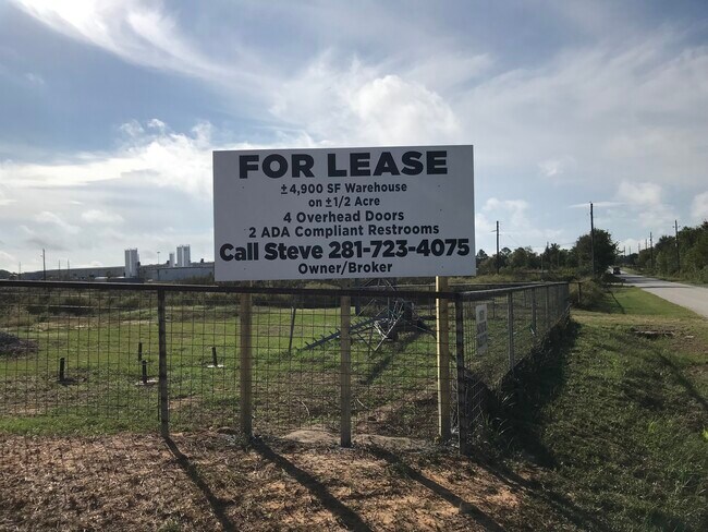
SALE & LEASE HISTORY
LISTING DATE
SALE/LEASE

Mar 28, 2018
For Lease
Nearby Properties
Address
Land Use
TOTAL SIZE
Lot Size
Zoning
Address
Land Use
TOTAL SIZE
Lot Size
Zoning
283.61 AC
Address
Land Use
TOTAL SIZE
Lot Size
Zoning
512,325 SF
63.88 AC
Address
Land Use
TOTAL SIZE
Lot Size
Zoning
463,544 SF
31.14 AC
Address
Land Use
TOTAL SIZE
Lot Size
Zoning
496,333 SF
86.70 AC
Address
Land Use
TOTAL SIZE
Lot Size
Zoning
189,034 SF
9.49 AC
Address
Land Use
TOTAL SIZE
Lot Size
Zoning
474.77 AC
Address
Land Use
TOTAL SIZE
Lot Size
Zoning
123,444 SF
23.37 AC
Address
Land Use
TOTAL SIZE
Lot Size
Zoning
114,480 SF
49.86 AC
Address
Land Use
TOTAL SIZE
Lot Size
Zoning
68,500 SF
16.73 AC
Address
Land Use
TOTAL SIZE
Lot Size
Zoning
62,388 SF
16.54 AC
Address
Land Use
TOTAL SIZE
Lot Size
Zoning
164.11 AC
Address
Land Use
TOTAL SIZE
Lot Size
Zoning
17,400 SF
21.16 AC
Address
Land Use
TOTAL SIZE
Lot Size
Zoning
77,880 SF
20 AC
Address
Land Use
TOTAL SIZE
Lot Size
Zoning
121,600 SF
10.06 AC
Address
Land Use
TOTAL SIZE
Lot Size
Zoning
111,160 SF
40 AC
Address
Land Use
TOTAL SIZE
Lot Size
Zoning
337.84 AC
Address
Land Use
TOTAL SIZE
Lot Size
Zoning
123,852 SF
7.80 AC
Address
Land Use
TOTAL SIZE
Lot Size
Zoning
96,437 SF
12.86 AC
Address
Land Use
TOTAL SIZE
Lot Size
Zoning
283.44 AC
Address
Land Use
TOTAL SIZE
Lot Size
Zoning
146,248 SF
14.62 AC
Address
Land Use
TOTAL SIZE
Lot Size
Zoning
69,623 SF
10 AC
Address
Land Use
TOTAL SIZE
Lot Size
Zoning
8,167 SF
19.47 AC
Address
Land Use
TOTAL SIZE
Lot Size
Zoning
76,920 SF
16 AC
Address
Land Use
TOTAL SIZE
Lot Size
Zoning
66,520 SF
10.15 AC
Address
Land Use
TOTAL SIZE
Lot Size
Zoning
Address
Land Use
TOTAL SIZE
Lot Size
Zoning
105 AC
Address
Land Use
TOTAL SIZE
Lot Size
Zoning
30,748 SF
17.20 AC
Address
Land Use
TOTAL SIZE
Lot Size
Zoning
83,411 SF
9.10 AC
Address
Land Use
TOTAL SIZE
Lot Size
Zoning
48,648 SF
2.25 AC
Address
Land Use
TOTAL SIZE
Lot Size
Zoning
175 AC
The World's #1 Commercial Real Estate Marketplace
Connect with us
© 2026 CoStar Group
The information above has been obtained from sources believed reliable. While we do not doubt its accuracy we have not verified it and make no guarantee, warranty or representation about it. It is your responsibility to independently confirm its accuracy and completeness. Any projections, opinions, assumptions, or estimates used are for example only and do not represent the current or future performance of the property. The value of this transaction to you depends on tax and other factors which should be evaluated by your tax, financial, and legal advisors. You and your advisors should conduct a careful, independent investigation of the property to determine to your satisfaction the suitability of the property for your needs.