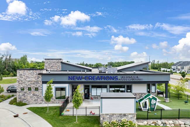
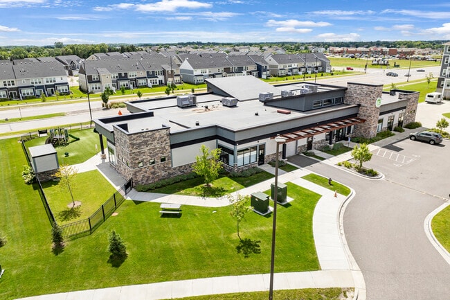
Property Record
18655 73Rd Ave N, Maple Grove, MN 55311

NEARBY LISTINGS FOR SALE OR LEASE
-
-
View all Maple Grove listings for sale on LoopNet.com
Property Detail
18655 73Rd Ave N
Minneapolis/St Paul
Southwest Crossroads Seventh Addn
Minneapolis-St. Paul-Bloomington, MN-WI
LOT 001 BLOCK 001 A SOUTHWEST CROSSROADS SEVENTH ADDN IRREGULAR
30-119-22-31-0101
Hennepin
Commercialnec
Minnesota
2024
1
2024
1.55 AC
026719
Maple Grove
DEMOGRAPHICS near 18655 73Rd Ave N
1 mile
3 mile
5 mile
2024 Total Population
8,180
46,597
105,959
2029 Population
8,169
46,129
104,648
Pop Growth 2024-2029
(0.13%)
(1.00%)
(1.24%)
Average Age
38
38
39
2024 Total Households
2,780
15,508
38,761
HH Growth 2024-2029
(0.29%)
(1.25%)
(1.45%)
Median Household Inc
$155,836
$158,555
$136,970
Avg Household Size
2.90
3.00
2.70
2024 Avg HH Vehicles
2.00
2.00
2.00
Median Home Value
$505,519
$484,925
$437,234
Median Year Built
2005
2001
1996
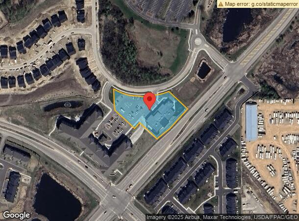
Nearby Places
Map Layers
Map Styles
 Street
 Aerial
Transit
 Traffic
 Biking
Places
Listings with unknown addresses are not visible on the map
- Restaurants
- Banks
- Shops
- Fitness
- Groceries
PUBLIC TRANSPORTATION
AIRPORT
Minneapolis-St Paul International/Wold-Chamberlain
Drive
Walk
Distance
Minneapolis-St Paul International/Wold-Chamberlain
42 min
29.5 mi
Freight Ports
Port Milwaukee
Drive
Walk
Distance
Port Milwaukee
400 min
358.7 mi
SALE & LEASE HISTORY
LISTING DATE
SALE/LEASE

Sep 21, 2023
For Sale
Sep 12, 2024
For Sale
May 21, 2024
For Sale
Mar 23, 2023
For Sale
Jun 22, 2023
For Sale
Jan 19, 2024
For Sale
Apr 11, 2024
For Sale
Nearby Properties
Address
Land Use
TOTAL SIZE
Lot Size
Zoning
Address
Land Use
TOTAL SIZE
Lot Size
Zoning
68.12 AC
Address
Land Use
TOTAL SIZE
Lot Size
Zoning
Address
Land Use
TOTAL SIZE
Lot Size
Zoning
Address
Land Use
TOTAL SIZE
Lot Size
Zoning
218,144 SF
3.71 AC
Address
Land Use
TOTAL SIZE
Lot Size
Zoning
219,980 SF
18.09 AC
Address
Land Use
TOTAL SIZE
Lot Size
Zoning
Address
Land Use
TOTAL SIZE
Lot Size
Zoning
2,170 SF
14.43 AC
Address
Land Use
TOTAL SIZE
Lot Size
Zoning
12.89 AC
Address
Land Use
TOTAL SIZE
Lot Size
Zoning
11.19 AC
Address
Land Use
TOTAL SIZE
Lot Size
Zoning
2,916 SF
28.57 AC
Address
Land Use
TOTAL SIZE
Lot Size
Zoning
Address
Land Use
TOTAL SIZE
Lot Size
Zoning
Address
Land Use
TOTAL SIZE
Lot Size
Zoning
Address
Land Use
TOTAL SIZE
Lot Size
Zoning
Address
Land Use
TOTAL SIZE
Lot Size
Zoning
Address
Land Use
TOTAL SIZE
Lot Size
Zoning
143,599 SF
4.20 AC
Address
Land Use
TOTAL SIZE
Lot Size
Zoning
Address
Land Use
TOTAL SIZE
Lot Size
Zoning
Address
Land Use
TOTAL SIZE
Lot Size
Zoning
10.70 AC
Address
Land Use
TOTAL SIZE
Lot Size
Zoning
54,576 SF
8.40 AC
Address
Land Use
TOTAL SIZE
Lot Size
Zoning
163,632 SF
2.23 AC
Address
Land Use
TOTAL SIZE
Lot Size
Zoning
10.34 AC
Address
Land Use
TOTAL SIZE
Lot Size
Zoning
10.79 AC
Address
Land Use
TOTAL SIZE
Lot Size
Zoning
Address
Land Use
TOTAL SIZE
Lot Size
Zoning
1,369 SF
2.48 AC
Address
Land Use
TOTAL SIZE
Lot Size
Zoning
3.85 AC
Address
Land Use
TOTAL SIZE
Lot Size
Zoning
Address
Land Use
TOTAL SIZE
Lot Size
Zoning
5.39 AC
Address
Land Use
TOTAL SIZE
Lot Size
Zoning
198.87 AC
Address
Land Use
TOTAL SIZE
Lot Size
Zoning
16.62 AC
The World's #1 Commercial Real Estate Marketplace
Connect with us
© 2026 CoStar Group
The information above has been obtained from sources believed reliable. While we do not doubt its accuracy we have not verified it and make no guarantee, warranty or representation about it. It is your responsibility to independently confirm its accuracy and completeness. Any projections, opinions, assumptions, or estimates used are for example only and do not represent the current or future performance of the property. The value of this transaction to you depends on tax and other factors which should be evaluated by your tax, financial, and legal advisors. You and your advisors should conduct a careful, independent investigation of the property to determine to your satisfaction the suitability of the property for your needs.