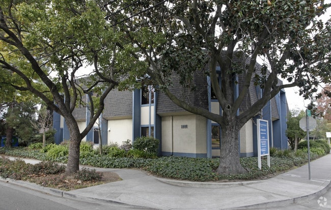
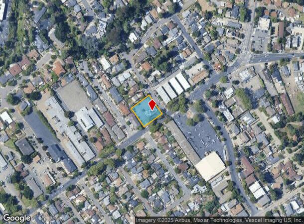
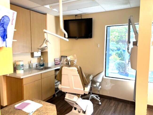
Property Record
1866 B St, Hayward, CA 94541

Current Lease Availabilities
NEARBY LISTINGS FOR SALE OR LEASE
Property Detail
1866 B St
Oakland-Hayward-Berkeley, CA
Bonnie Brae
416-0120-014-02
PORTION LOT4
Medicalbuilding
Alameda
X
California
06001C0287G
1-4
2024
0.42 AC
2025
Hayward/Castro Valley
435300
East Bay/Oakland
6,240 SF
DEMOGRAPHICS near 1866 B St
1 Mile
3 Mile
5 Mile
2024 Total Population
25,742
176,553
325,182
2029 Population
25,024
170,752
314,432
Pop Growth 2024-2029
(2.79%)
(3.29%)
(3.31%)
Average Age
41
40
40
2024 Total Households
9,485
57,942
104,862
HH Growth 2024-2029
(2.94%)
(3.47%)
(3.50%)
Median Household Inc
$99,120
$100,469
$97,680
Avg Household Size
2.60
2.90
3.00
2024 Avg HH Vehicles
2.00
2.00
2.00
Median Home Value
$747,455
$815,211
$774,940
Median Year Built
1968
1967
1967
Nearby Places
- Restaurants
- Banks
- Shops
- Fitness
- Groceries
PUBLIC TRANSPORTATION
COMMUTER RAIL
Hayward Amtrak (Capitol Corridor - Amtrak)
DRIVE
WALK
Distance
Hayward Amtrak (Capitol Corridor - Amtrak)
6 min
2.4 mi
Hayward (Capitol Corridor - Capitol Corridor Joint Powers Authority)
DRIVE
WALK
Distance
Hayward (Capitol Corridor - Capitol Corridor Joint Powers Authority)
6 min
2.4 mi
AIRPORT
Metro Oakland International
DRIVE
WALK
Distance
Metro Oakland International
17 min
11.4 mi
San Francisco International
DRIVE
WALK
Distance
San Francisco International
34 min
24.3 mi
Norman Y Mineta San Jose International
DRIVE
WALK
Distance
Norman Y Mineta San Jose International
38 min
28.9 mi
Freight Ports
Port of Oakland
DRIVE
WALK
Distance
Port of Oakland
22 min
15.9 mi
Nearby Properties
Address
Land Use
TOTAL SIZE
Lot Size
Zoning
Address
Land Use
TOTAL SIZE
Lot Size
Zoning
710,091 SF
50.34 AC
Address
Land Use
TOTAL SIZE
Lot Size
Zoning
4.90 AC
Address
Land Use
TOTAL SIZE
Lot Size
Zoning
2.48 AC
Address
Land Use
TOTAL SIZE
Lot Size
Zoning
470,929 SF
31.62 AC
Address
Land Use
TOTAL SIZE
Lot Size
Zoning
1.50 AC
Address
Land Use
TOTAL SIZE
Lot Size
Zoning
150,856 SF
5.99 AC
Address
Land Use
TOTAL SIZE
Lot Size
Zoning
187,926 SF
1.19 AC
Address
Land Use
TOTAL SIZE
Lot Size
Zoning
160,987 SF
7.20 AC
Address
Land Use
TOTAL SIZE
Lot Size
Zoning
297,592 SF
11.65 AC
Address
Land Use
TOTAL SIZE
Lot Size
Zoning
310,072 SF
14.96 AC
Address
Land Use
TOTAL SIZE
Lot Size
Zoning
228,736 SF
5.95 AC
Address
Land Use
TOTAL SIZE
Lot Size
Zoning
169,371 SF
4.63 AC
Address
Land Use
TOTAL SIZE
Lot Size
Zoning
116,750 SF
4.72 AC
Address
Land Use
TOTAL SIZE
Lot Size
Zoning
89,968 SF
5 AC
Address
Land Use
TOTAL SIZE
Lot Size
Zoning
329,346 SF
29.36 AC
Address
Land Use
TOTAL SIZE
Lot Size
Zoning
119,800 SF
5.72 AC
Address
Land Use
TOTAL SIZE
Lot Size
Zoning
57,497 SF
4.92 AC
Address
Land Use
TOTAL SIZE
Lot Size
Zoning
84,690 SF
6.25 AC
CN
Address
Land Use
TOTAL SIZE
Lot Size
Zoning
120,441 SF
1.34 AC
Address
Land Use
TOTAL SIZE
Lot Size
Zoning
152,950 SF
4.96 AC
Address
Land Use
TOTAL SIZE
Lot Size
Zoning
115,648 SF
11.19 AC
Address
Land Use
TOTAL SIZE
Lot Size
Zoning
92,534 SF
3.04 AC
Address
Land Use
TOTAL SIZE
Lot Size
Zoning
137,422 SF
5.56 AC
RH
Address
Land Use
TOTAL SIZE
Lot Size
Zoning
94,485 SF
8.31 AC
Address
Land Use
TOTAL SIZE
Lot Size
Zoning
Address
Land Use
TOTAL SIZE
Lot Size
Zoning
25,000 SF
1.24 AC
Address
Land Use
TOTAL SIZE
Lot Size
Zoning
57,120 SF
3.24 AC
Address
Land Use
TOTAL SIZE
Lot Size
Zoning
98,216 SF
4.68 AC
RH
Address
Land Use
TOTAL SIZE
Lot Size
Zoning
124,513 SF
7.52 AC
Address
Land Use
TOTAL SIZE
Lot Size
Zoning
42,359 SF
3.79 AC
The World's #1 Commercial Real Estate Marketplace
Connect with us
© 2025 CoStar Group
The information above has been obtained from sources believed reliable. While we do not doubt its accuracy we have not verified it and make no guarantee, warranty or representation about it. It is your responsibility to independently confirm its accuracy and completeness. Any projections, opinions, assumptions, or estimates used are for example only and do not represent the current or future performance of the property. The value of this transaction to you depends on tax and other factors which should be evaluated by your tax, financial, and legal advisors. You and your advisors should conduct a careful, independent investigation of the property to determine to your satisfaction the suitability of the property for your needs.