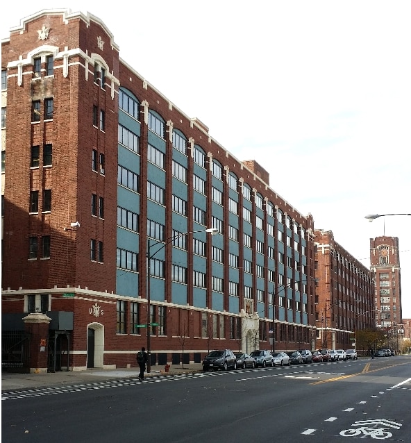
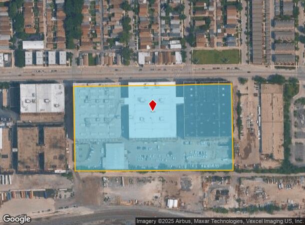
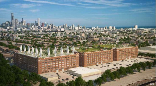
Property Record
1831 W Pershing Rd, Chicago, IL 60609
NEARBY LISTINGS FOR SALE OR LEASE
Property Detail
1831 W Pershing Rd
20-06-200-005-0000
Cook
Taxexempt
Illinois
X
10 AC
17031C0508J
South Chicago
0
Chicago
2024
Chicago-Naperville-Elgin, IL-IN-WI
610300
DEMOGRAPHICS near 1831 W Pershing Rd
1 Mile
3 Mile
5 Mile
2024 Total Population
23,157
278,430
811,898
2029 Population
21,076
257,219
770,893
Pop Growth 2024-2029
(8.99%)
(7.62%)
(5.05%)
Average Age
37
37
36
2024 Total Households
7,565
93,382
312,980
HH Growth 2024-2029
(9.46%)
(7.83%)
(4.74%)
Median Household Inc
$53,210
$45,873
$54,079
Avg Household Size
3.00
2.80
2.40
2024 Avg HH Vehicles
1.00
1.00
1.00
Median Home Value
$260,119
$247,162
$267,603
Median Year Built
1947
1948
1954
Nearby Places
Map Layers
Map Styles
 Street
 Aerial
- Restaurants
- Banks
- Shops
- Fitness
- Groceries
PUBLIC TRANSPORTATION
TRANSIT/SUBWAY
35Th/Archer Station (Orange Line - Chicago Transit Authority "L" Trains (The "L"))
DRIVE
WALK
Distance
35Th/Archer Station (Orange Line - Chicago Transit Authority "L" Trains (The "L"))
2 min
16 min
0.9 mi
COMMUTER RAIL
35Th St. - Lou Jones (Rock Island - Metra)
DRIVE
WALK
Distance
35Th St. - Lou Jones (Rock Island - Metra)
5 min
2.8 mi
Western Avenue Station (Bnsf) (Burlington Northern-Santa Fe Railway Line - Northeast Illinois Regional Commuter Railroad (Metra))
DRIVE
WALK
Distance
Western Avenue Station (Bnsf) (Burlington Northern-Santa Fe Railway Line - Northeast Illinois Regional Commuter Railroad (Metra))
6 min
3.1 mi
AIRPORT
Chicago Midway International
DRIVE
WALK
Distance
Chicago Midway International
10 min
5.2 mi
Chicago O'Hare International
DRIVE
WALK
Distance
Chicago O'Hare International
34 min
21.4 mi
Freight Ports
Port Milwaukee
DRIVE
WALK
Distance
Port Milwaukee
112 min
89.6 mi
SALE & LEASE HISTORY
LISTING DATE
SALE/LEASE

Sep 25, 2016
For Lease
Sep 24, 2016
For Sale
Sep 23, 2016
For Sale
Sep 23, 2016
For Sale
Mar 01, 2017
For Sale
Nearby Properties
Address
Land Use
TOTAL SIZE
Lot Size
Zoning
Address
Land Use
TOTAL SIZE
Lot Size
Zoning
474,979 SF
29.67 AC
PD 553
Address
Land Use
TOTAL SIZE
Lot Size
Zoning
4.71 AC
PD 1196
Address
Land Use
TOTAL SIZE
Lot Size
Zoning
4.11 AC
M2-3
Address
Land Use
TOTAL SIZE
Lot Size
Zoning
2.98 AC
PD 1196
Address
Land Use
TOTAL SIZE
Lot Size
Zoning
134,800 SF
2.53 AC
PD 1273
Address
Land Use
TOTAL SIZE
Lot Size
Zoning
1.82 AC
PD 30
Address
Land Use
TOTAL SIZE
Lot Size
Zoning
250,040 SF
15.70 AC
PD 1169
Address
Land Use
TOTAL SIZE
Lot Size
Zoning
27.31 AC
PD 1424
Address
Land Use
TOTAL SIZE
Lot Size
Zoning
136,720 SF
0.54 AC
PD 1
Address
Land Use
TOTAL SIZE
Lot Size
Zoning
133,354 SF
PD 1198
Address
Land Use
TOTAL SIZE
Lot Size
Zoning
169,435 SF
11.35 AC
PD 307
Address
Land Use
TOTAL SIZE
Lot Size
Zoning
307,277 SF
9.90 AC
PMD 11
Address
Land Use
TOTAL SIZE
Lot Size
Zoning
10 AC
PD 1169
Address
Land Use
TOTAL SIZE
Lot Size
Zoning
475,000 SF
14.01 AC
PMD 8
Address
Land Use
TOTAL SIZE
Lot Size
Zoning
Address
Land Use
TOTAL SIZE
Lot Size
Zoning
0.84 AC
B1-3
Address
Land Use
TOTAL SIZE
Lot Size
Zoning
633,057 SF
34.96 AC
PMD 8
Address
Land Use
TOTAL SIZE
Lot Size
Zoning
240,400 SF
1.34 AC
PMD 11
Address
Land Use
TOTAL SIZE
Lot Size
Zoning
72,893 SF
4.43 AC
PD 90
Address
Land Use
TOTAL SIZE
Lot Size
Zoning
38,214 SF
0.92 AC
C2-3
Address
Land Use
TOTAL SIZE
Lot Size
Zoning
1.09 AC
B2-2
Address
Land Use
TOTAL SIZE
Lot Size
Zoning
430,548 SF
13.12 AC
PMD 11
Address
Land Use
TOTAL SIZE
Lot Size
Zoning
1,023,467 SF
21.45 AC
PD 1424
Address
Land Use
TOTAL SIZE
Lot Size
Zoning
794,288 SF
6.53 AC
PD 41
Address
Land Use
TOTAL SIZE
Lot Size
Zoning
283,180 SF
1.41 AC
M2-3
Address
Land Use
TOTAL SIZE
Lot Size
Zoning
0.73 AC
PD 1072
Address
Land Use
TOTAL SIZE
Lot Size
Zoning
131,261 SF
7.04 AC
PD 172
Address
Land Use
TOTAL SIZE
Lot Size
Zoning
151,303 SF
0.88 AC
PD 568
Address
Land Use
TOTAL SIZE
Lot Size
Zoning
1.65 AC
B2-3
Address
Land Use
TOTAL SIZE
Lot Size
Zoning
460,333 SF
2.62 AC
C2-3
The World's #1 Commercial Real Estate Marketplace
Connect with us
© 2025 CoStar Group
The information above has been obtained from sources believed reliable. While we do not doubt its accuracy we have not verified it and make no guarantee, warranty or representation about it. It is your responsibility to independently confirm its accuracy and completeness. Any projections, opinions, assumptions, or estimates used are for example only and do not represent the current or future performance of the property. The value of this transaction to you depends on tax and other factors which should be evaluated by your tax, financial, and legal advisors. You and your advisors should conduct a careful, independent investigation of the property to determine to your satisfaction the suitability of the property for your needs.