Property Record
187 E Kiowa Ave E, Elizabeth, CO 80107
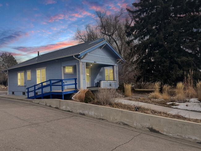

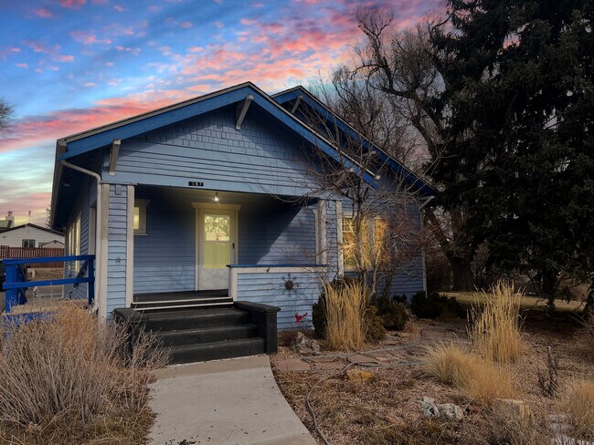
Property Detail
187 E Kiowa Ave E
Denver-Aurora-Centennial, CO
SECTION: 7 TOWNSHIP: 8 RANGE: 64SUBDIVISION: ELIZABETH GARLANDS ADD LOT: 5 SCHOOL HOUSE
R107928
ELBERT
Commercialnec
Colorado
RC
5
B and X Area of moderate flood hazard, usually the area between the limits of the 100-year and 500-year floods.
0.30 AC
2024
Elbert County
2025
Denver
961208
NEARBY LISTINGS FOR SALE OR LEASE
-
-
View all Elizabeth listings for lease on LoopNet.com
DEMOGRAPHICS near 187 E Kiowa Ave E
1 mile
3 mile
5 mile
2025 Total Population
1,943
6,617
12,115
2030 Population
2,156
7,267
13,207
Pop Growth 2025-2030
+ 10.96%
+ 9.82%
+ 9.01%
Average Age
43
44
44
2025 Total Households
726
2,451
4,441
HH Growth 2025-2030
+ 11.02%
+ 9.91%
+ 9.12%
Median Household Inc
$119,865
$123,595
$132,848
Avg Household Size
2.70
2.70
2.70
2025 Avg HH Vehicles
3.00
3.00
3.00
Median Home Value
$677,576
$711,146
$760,416
Median Year Built
1998
1995
1994
Nearby Places
Map Layers
Map Styles
 Street
 Aerial
Transit
 Traffic
 Biking
Places
Listings with unknown addresses are not visible on the map
- Restaurants
- Banks
- Shops
- Fitness
- Groceries
PUBLIC TRANSPORTATION
AIRPORT
Denver International
Drive
Walk
Distance
Denver International
59 min
47.8 mi
SALE & LEASE HISTORY
LISTING DATE
SALE/LEASE

Mar 19, 2024
For Lease
Nearby Properties
Address
Land Use
TOTAL SIZE
Lot Size
Zoning
Address
Land Use
TOTAL SIZE
Lot Size
Zoning
60 AC
P-I
Address
Land Use
TOTAL SIZE
Lot Size
Zoning
152,840 SF
15.55 AC
PUD
Address
Land Use
TOTAL SIZE
Lot Size
Zoning
1,128 SF
10.25 AC
RC
Address
Land Use
TOTAL SIZE
Lot Size
Zoning
39,052 SF
10.61 AC
PUD
Address
Land Use
TOTAL SIZE
Lot Size
Zoning
15.12 AC
P-I
Address
Land Use
TOTAL SIZE
Lot Size
Zoning
6.33 AC
RC
Address
Land Use
TOTAL SIZE
Lot Size
Zoning
9,638 SF
1.64 AC
PUD
Address
Land Use
TOTAL SIZE
Lot Size
Zoning
1.09 AC
RC
Address
Land Use
TOTAL SIZE
Lot Size
Zoning
3.15 AC
RC
Address
Land Use
TOTAL SIZE
Lot Size
Zoning
40 AC
P-I
Address
Land Use
TOTAL SIZE
Lot Size
Zoning
4.24 AC
P-I
Address
Land Use
TOTAL SIZE
Lot Size
Zoning
13,000 SF
4.74 AC
RC
Address
Land Use
TOTAL SIZE
Lot Size
Zoning
1.32 AC
RC
Address
Land Use
TOTAL SIZE
Lot Size
Zoning
Address
Land Use
TOTAL SIZE
Lot Size
Zoning
5,774 SF
26.66 AC
A-2
Address
Land Use
TOTAL SIZE
Lot Size
Zoning
1.08 AC
PUD
Address
Land Use
TOTAL SIZE
Lot Size
Zoning
11,766 SF
4.83 AC
P-I
Address
Land Use
TOTAL SIZE
Lot Size
Zoning
2,800 SF
0.79 AC
PUD
Address
Land Use
TOTAL SIZE
Lot Size
Zoning
2.19 AC
PUD
Address
Land Use
TOTAL SIZE
Lot Size
Zoning
1.11 AC
PUD
Address
Land Use
TOTAL SIZE
Lot Size
Zoning
6,035 SF
1.41 AC
RC
Address
Land Use
TOTAL SIZE
Lot Size
Zoning
1.51 AC
RC
Address
Land Use
TOTAL SIZE
Lot Size
Zoning
0.88 AC
RC
Address
Land Use
TOTAL SIZE
Lot Size
Zoning
Address
Land Use
TOTAL SIZE
Lot Size
Zoning
10 AC
I
Address
Land Use
TOTAL SIZE
Lot Size
Zoning
0.59 AC
LI
Address
Land Use
TOTAL SIZE
Lot Size
Zoning
1.08 AC
PUD
Address
Land Use
TOTAL SIZE
Lot Size
Zoning
0.85 AC
RC
Address
Land Use
TOTAL SIZE
Lot Size
Zoning
1.09 AC
PUD
Address
Land Use
TOTAL SIZE
Lot Size
Zoning
0.74 AC
PUD
The World's #1 Commercial Real Estate Marketplace
Connect with us
© 2026 CoStar Group
The information above has been obtained from sources believed reliable. While we do not doubt its accuracy we have not verified it and make no guarantee, warranty or representation about it. It is your responsibility to independently confirm its accuracy and completeness. Any projections, opinions, assumptions, or estimates used are for example only and do not represent the current or future performance of the property. The value of this transaction to you depends on tax and other factors which should be evaluated by your tax, financial, and legal advisors. You and your advisors should conduct a careful, independent investigation of the property to determine to your satisfaction the suitability of the property for your needs.