Property Record
187 Rd Collins Rd, Franklinton, NC 27525
Property Detail
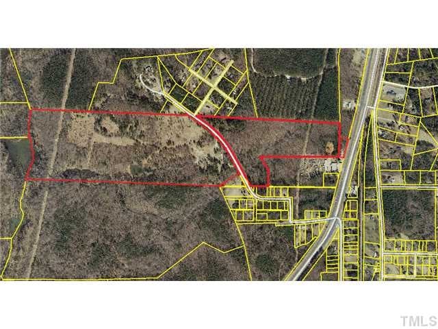
187 Rd Collins Rd
Raleigh-Cary, NC
PLAT ON FILE/HOLDER
008387
FRANKLIN
Vacantlandnec
North Carolina
C-3H
b
AE The base floodplain where base flood elevations are provided. AE Zones are now used on new format FIRMs instead of A1-A30 Zones.
88.47 AC
2025
Franklin County
2025
Raleigh/Durham
060401
NEARBY LISTINGS FOR SALE OR LEASE
DEMOGRAPHICS near 187 Rd Collins Rd
1 mile
3 mile
5 mile
2025 Total Population
1,165
7,500
16,609
2030 Population
1,329
8,583
18,845
Pop Growth 2025-2030
+ 14.08%
+ 14.44%
+ 13.46%
Average Age
41
40
40
2025 Total Households
500
3,047
6,532
HH Growth 2025-2030
+ 14.60%
+ 14.87%
+ 13.85%
Median Household Inc
$56,854
$61,728
$66,723
Avg Household Size
2.30
2.50
2.50
2025 Avg HH Vehicles
2.00
2.00
2.00
Median Home Value
$206,195
$246,018
$304,654
Median Year Built
1983
1994
1999
Nearby Places
Map Layers
Map Styles
 Street
 Aerial
Layers
 Traffic
 Biking
Places
Listings with unknown addresses are not visible on the map
- Restaurants
- Banks
- Shops
- Fitness
- Groceries
PUBLIC TRANSPORTATION
AIRPORT
Raleigh-Durham International
Drive
Walk
Distance
Raleigh-Durham International
47 min
31.9 mi
Freight Ports
Virginia Port Authority - Richmond
Drive
Walk
Distance
Virginia Port Authority - Richmond
147 min
123.7 mi
Nearby Properties
Address
Land Use
TOTAL SIZE
Lot Size
Zoning
Address
Land Use
TOTAL SIZE
Lot Size
Zoning
63,604 SF
3.49 AC
C-2D
Address
Land Use
TOTAL SIZE
Lot Size
Zoning
3,813 SF
8.58 AC
MUD
Address
Land Use
TOTAL SIZE
Lot Size
Zoning
27,618 SF
10 AC
C-3H
Address
Land Use
TOTAL SIZE
Lot Size
Zoning
1,680 SF
6.20 AC
RSH
Address
Land Use
TOTAL SIZE
Lot Size
Zoning
58,186 SF
63.99 AC
FCO HI
Address
Land Use
TOTAL SIZE
Lot Size
Zoning
82.67 AC
LI
Address
Land Use
TOTAL SIZE
Lot Size
Zoning
4,271 SF
40.76 AC
C-3H
Address
Land Use
TOTAL SIZE
Lot Size
Zoning
12,600 SF
2.34 AC
C 3H
Address
Land Use
TOTAL SIZE
Lot Size
Zoning
10,956 SF
1.49 AC
C-3H
Address
Land Use
TOTAL SIZE
Lot Size
Zoning
306.51 AC
FCO AR
Address
Land Use
TOTAL SIZE
Lot Size
Zoning
0.15 AC
LI
Address
Land Use
TOTAL SIZE
Lot Size
Zoning
8,700 SF
1.12 AC
C-3H
Address
Land Use
TOTAL SIZE
Lot Size
Zoning
285.97 AC
FCO AR
Address
Land Use
TOTAL SIZE
Lot Size
Zoning
11,002 SF
1.51 AC
C-3H
Address
Land Use
TOTAL SIZE
Lot Size
Zoning
5,857 SF
1.55 AC
C-2D
Address
Land Use
TOTAL SIZE
Lot Size
Zoning
4,464 SF
35.87 AC
PD
Address
Land Use
TOTAL SIZE
Lot Size
Zoning
384.51 AC
FCO R-80
Address
Land Use
TOTAL SIZE
Lot Size
Zoning
2,670 SF
1.86 AC
C-3H
Address
Land Use
TOTAL SIZE
Lot Size
Zoning
820 SF
4.18 AC
RMF
Address
Land Use
TOTAL SIZE
Lot Size
Zoning
4,150 SF
16.81 AC
FCO HI
Address
Land Use
TOTAL SIZE
Lot Size
Zoning
10,024 SF
1.27 AC
RDT
Address
Land Use
TOTAL SIZE
Lot Size
Zoning
19,781 SF
17 AC
RSH
Address
Land Use
TOTAL SIZE
Lot Size
Zoning
6,874 SF
0.97 AC
C-3H
Address
Land Use
TOTAL SIZE
Lot Size
Zoning
2,498 SF
6 AC
C-3H
Address
Land Use
TOTAL SIZE
Lot Size
Zoning
170.16 AC
FCO AR
Address
Land Use
TOTAL SIZE
Lot Size
Zoning
3,596 SF
0.69 AC
C 3H
Address
Land Use
TOTAL SIZE
Lot Size
Zoning
6,230 SF
0.16 AC
C-2D
Address
Land Use
TOTAL SIZE
Lot Size
Zoning
1,940 SF
1.45 AC
C-3H
Address
Land Use
TOTAL SIZE
Lot Size
Zoning
6,960 SF
123.08 AC
R-1A
Address
Land Use
TOTAL SIZE
Lot Size
Zoning
9,100 SF
1.01 AC
C-3H
The World's #1 Commercial Real Estate Marketplace
Connect with us
© 2026 CoStar Group
The information above has been obtained from sources believed reliable. While we do not doubt its accuracy we have not verified it and make no guarantee, warranty or representation about it. It is your responsibility to independently confirm its accuracy and completeness. Any projections, opinions, assumptions, or estimates used are for example only and do not represent the current or future performance of the property. The value of this transaction to you depends on tax and other factors which should be evaluated by your tax, financial, and legal advisors. You and your advisors should conduct a careful, independent investigation of the property to determine to your satisfaction the suitability of the property for your needs.