Property Record
187 Stateline Rd E, Southaven, MS 38671
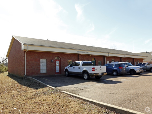

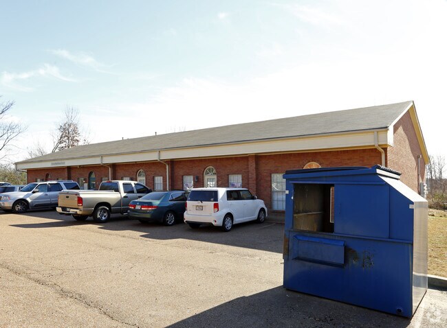
Property Detail
187 Stateline Rd E
1074191000000400
GREENBROOK PLAZA LOT 4
Officebuilding
Desoto
C-1
Mississippi
B and X Area of moderate flood hazard, usually the area between the limits of the 100-year and 500-year floods.
4
2025
1.15 AC
2025
DeSoto County
070521
Memphis
12,058 SF
Memphis, TN-MS-AR
NEARBY LISTINGS FOR SALE OR LEASE
DEMOGRAPHICS near 187 Stateline Rd E
1 mile
3 mile
5 mile
2025 Total Population
3,300
49,094
130,048
2030 Population
3,380
49,924
132,538
Pop Growth 2025-2030
+ 2.42%
+ 1.69%
+ 1.91%
Average Age
38
38
38
2025 Total Households
1,228
18,748
49,391
HH Growth 2025-2030
+ 2.44%
+ 1.71%
+ 1.94%
Median Household Inc
$60,508
$59,207
$55,749
Avg Household Size
2.70
2.60
2.60
2025 Avg HH Vehicles
2.00
2.00
2.00
Median Home Value
$151,621
$172,943
$177,427
Median Year Built
1978
1977
1978
Nearby Places
Map Layers
Map Styles
 Street
 Aerial
Transit
 Traffic
 Biking
Places
Listings with unknown addresses are not visible on the map
- Restaurants
- Banks
- Shops
- Fitness
- Groceries
PUBLIC TRANSPORTATION
AIRPORT
Memphis International
Drive
Walk
Distance
Memphis International
10 min
5.5 mi
Nearby Properties
Address
Land Use
TOTAL SIZE
Lot Size
Zoning
Address
Land Use
TOTAL SIZE
Lot Size
Zoning
1,013,319 SF
38.86 AC
EMP
Address
Land Use
TOTAL SIZE
Lot Size
Zoning
986,374 SF
68.79 AC
CA
Address
Land Use
TOTAL SIZE
Lot Size
Zoning
717,155 SF
83.34 AC
CA
Address
Land Use
TOTAL SIZE
Lot Size
Zoning
897,076 SF
47.33 AC
CA
Address
Land Use
TOTAL SIZE
Lot Size
Zoning
865,065 SF
51.05 AC
CA
Address
Land Use
TOTAL SIZE
Lot Size
Zoning
732,894 SF
79.73 AC
WD
Address
Land Use
TOTAL SIZE
Lot Size
Zoning
586,847 SF
37 AC
CA
Address
Land Use
TOTAL SIZE
Lot Size
Zoning
1,009,363 SF
78.56 AC
EMP
Address
Land Use
TOTAL SIZE
Lot Size
Zoning
328,300 SF
33.78 AC
CA
Address
Land Use
TOTAL SIZE
Lot Size
Zoning
853,440 SF
39.22 AC
EMP
Address
Land Use
TOTAL SIZE
Lot Size
Zoning
321.59 AC
R-8
Address
Land Use
TOTAL SIZE
Lot Size
Zoning
265,600 SF
22.03 AC
CA
Address
Land Use
TOTAL SIZE
Lot Size
Zoning
63,842 SF
11 AC
R-6
Address
Land Use
TOTAL SIZE
Lot Size
Zoning
432,700 SF
28.16 AC
EMP
Address
Land Use
TOTAL SIZE
Lot Size
Zoning
338,368 SF
15.70 AC
R-8
Address
Land Use
TOTAL SIZE
Lot Size
Zoning
344,016 SF
16.50 AC
R-8
Address
Land Use
TOTAL SIZE
Lot Size
Zoning
810,225 SF
47.71 AC
M-1
Address
Land Use
TOTAL SIZE
Lot Size
Zoning
188,404 SF
59.17 AC
R-8
Address
Land Use
TOTAL SIZE
Lot Size
Zoning
165,227 SF
25.12 AC
RU-3
Address
Land Use
TOTAL SIZE
Lot Size
Zoning
298,852 SF
18.75 AC
RU-2
Address
Land Use
TOTAL SIZE
Lot Size
Zoning
581,346 SF
39.98 AC
PUD
Address
Land Use
TOTAL SIZE
Lot Size
Zoning
740,964 SF
34.89 AC
PBP
Address
Land Use
TOTAL SIZE
Lot Size
Zoning
245,848 SF
12.06 AC
CA
Address
Land Use
TOTAL SIZE
Lot Size
Zoning
61,164 SF
36.95 AC
RU-3
Address
Land Use
TOTAL SIZE
Lot Size
Zoning
230,103 SF
22.07 AC
CMU-2
Address
Land Use
TOTAL SIZE
Lot Size
Zoning
48.35 AC
EMP
Address
Land Use
TOTAL SIZE
Lot Size
Zoning
779,632 SF
46.22 AC
PBP
Address
Land Use
TOTAL SIZE
Lot Size
Zoning
222,932 SF
19.52 AC
C-1
Address
Land Use
TOTAL SIZE
Lot Size
Zoning
702,792 SF
37.11 AC
PBP
Address
Land Use
TOTAL SIZE
Lot Size
Zoning
619,021 SF
28.71 AC
PBP
The World's #1 Commercial Real Estate Marketplace
Connect with us
© 2026 CoStar Group
The information above has been obtained from sources believed reliable. While we do not doubt its accuracy we have not verified it and make no guarantee, warranty or representation about it. It is your responsibility to independently confirm its accuracy and completeness. Any projections, opinions, assumptions, or estimates used are for example only and do not represent the current or future performance of the property. The value of this transaction to you depends on tax and other factors which should be evaluated by your tax, financial, and legal advisors. You and your advisors should conduct a careful, independent investigation of the property to determine to your satisfaction the suitability of the property for your needs.