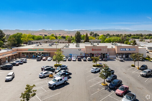
Property Record
187 W Polk St, Coalinga, CA 93210


Save to a Folder
{{folder.Name}}
{{folder.ListingIds.length}} Properties
{{folder.ListingIds.length}} Property
Create a New Folder
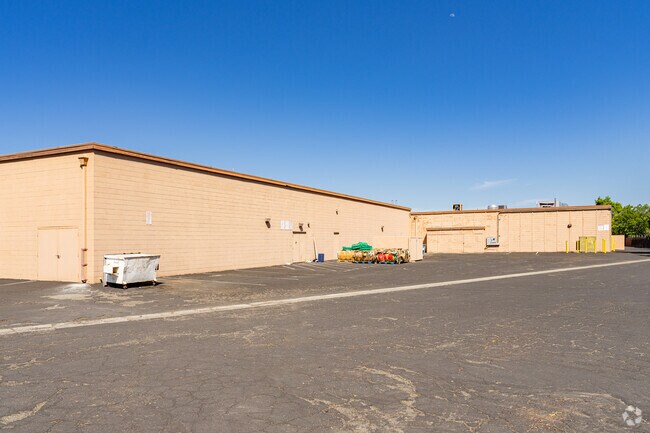
Property Detail
187 W Polk St
083-080-77S
SUR RT 1.59 AC IN PARCEL 1 P/M 005 BK 27 PG 86
Storebuilding
FRESNO
C5
California
B and X Area of moderate flood hazard, usually the area between the limits of the 100-year and 500-year floods.
1.59 AC
2025
Coalinga
2025
Fresno
008000
Fresno, CA
23,565 SF
NEARBY LISTINGS FOR SALE OR LEASE
DEMOGRAPHICS near 187 W Polk St
1 mile
3 mile
5 mile
2025 Total Population
9,775
16,933
17,128
2030 Population
9,963
17,133
17,328
Pop Growth 2025-2030
+ 1.92%
+ 1.18%
+ 1.17%
Average Age
35
37
37
2025 Total Households
3,260
4,500
4,519
HH Growth 2025-2030
+ 1.87%
+ 1.53%
+ 1.53%
Median Household Inc
$65,221
$75,522
$75,593
Avg Household Size
3.00
3.00
3.00
2025 Avg HH Vehicles
2.00
2.00
2.00
Median Home Value
$299,117
$305,263
$305,168
Median Year Built
1981
1984
1984
Nearby Places
Map Layers
Map Styles
 Street
 Aerial
Layers
 Traffic
 Biking
Places
Listings with unknown addresses are not visible on the map
- Restaurants
- Banks
- Shops
- Fitness
- Groceries
SALE & LEASE HISTORY
LISTING DATE
SALE/LEASE

Nov 07, 2016
For Lease
Aug 18, 2023
For Lease
Nearby Properties
Address
Land Use
TOTAL SIZE
Lot Size
Zoning
Address
Land Use
TOTAL SIZE
Lot Size
Zoning
13,270 SF
640 AC
AE40
Address
Land Use
TOTAL SIZE
Lot Size
Zoning
165,207 SF
22.91 AC
M1
Address
Land Use
TOTAL SIZE
Lot Size
Zoning
89,292 SF
5.22 AC
RHD
Address
Land Use
TOTAL SIZE
Lot Size
Zoning
87,159 SF
7 AC
R3
Address
Land Use
TOTAL SIZE
Lot Size
Zoning
36,108 SF
1.47 AC
M3
Address
Land Use
TOTAL SIZE
Lot Size
Zoning
320 AC
AE20
Address
Land Use
TOTAL SIZE
Lot Size
Zoning
82,269 SF
4.86 AC
R3
Address
Land Use
TOTAL SIZE
Lot Size
Zoning
49,822 SF
4.25 AC
C5
Address
Land Use
TOTAL SIZE
Lot Size
Zoning
66,338 SF
5 AC
R3
Address
Land Use
TOTAL SIZE
Lot Size
Zoning
44,783 SF
1.95 AC
R3
Address
Land Use
TOTAL SIZE
Lot Size
Zoning
45,456 SF
2.77 AC
C6
Address
Land Use
TOTAL SIZE
Lot Size
Zoning
68,184 SF
6.02 AC
R3
Address
Land Use
TOTAL SIZE
Lot Size
Zoning
340.67 AC
AE20
Address
Land Use
TOTAL SIZE
Lot Size
Zoning
14,820 SF
1.54 AC
CM
Address
Land Use
TOTAL SIZE
Lot Size
Zoning
70,951 SF
5.33 AC
R3
Address
Land Use
TOTAL SIZE
Lot Size
Zoning
233.05 AC
AE20
Address
Land Use
TOTAL SIZE
Lot Size
Zoning
25,160 SF
1.75 AC
R3
Address
Land Use
TOTAL SIZE
Lot Size
Zoning
44,167 SF
5.19 AC
R3
Address
Land Use
TOTAL SIZE
Lot Size
Zoning
35,863 SF
4.22 AC
R3
Address
Land Use
TOTAL SIZE
Lot Size
Zoning
100,035 SF
7.75 AC
C5
Address
Land Use
TOTAL SIZE
Lot Size
Zoning
41,872 SF
3.51 AC
R3
Address
Land Use
TOTAL SIZE
Lot Size
Zoning
32,320 SF
1.40 AC
R3
Address
Land Use
TOTAL SIZE
Lot Size
Zoning
30,208 SF
1.28 AC
R3TWR
Address
Land Use
TOTAL SIZE
Lot Size
Zoning
6,600 SF
0.58 AC
CM
Address
Land Use
TOTAL SIZE
Lot Size
Zoning
17,042 SF
1.44 AC
C5
Address
Land Use
TOTAL SIZE
Lot Size
Zoning
12,800 SF
1.03 AC
The World's #1 Commercial Real Estate Marketplace
Connect with us
© 2026 CoStar Group
The information above has been obtained from sources believed reliable. While we do not doubt its accuracy we have not verified it and make no guarantee, warranty or representation about it. It is your responsibility to independently confirm its accuracy and completeness. Any projections, opinions, assumptions, or estimates used are for example only and do not represent the current or future performance of the property. The value of this transaction to you depends on tax and other factors which should be evaluated by your tax, financial, and legal advisors. You and your advisors should conduct a careful, independent investigation of the property to determine to your satisfaction the suitability of the property for your needs.