Property Record
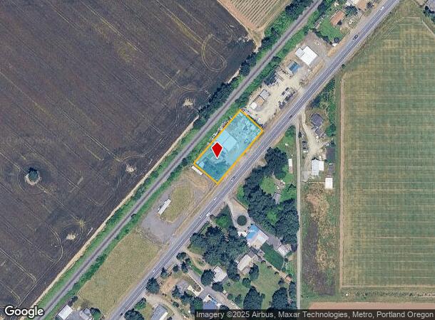
18707 Highway 99E, Hubbard, OR 97032
NEARBY LISTINGS FOR SALE OR LEASE
-
-
View all Hubbard listings for sale on LoopNet.com
Property Detail
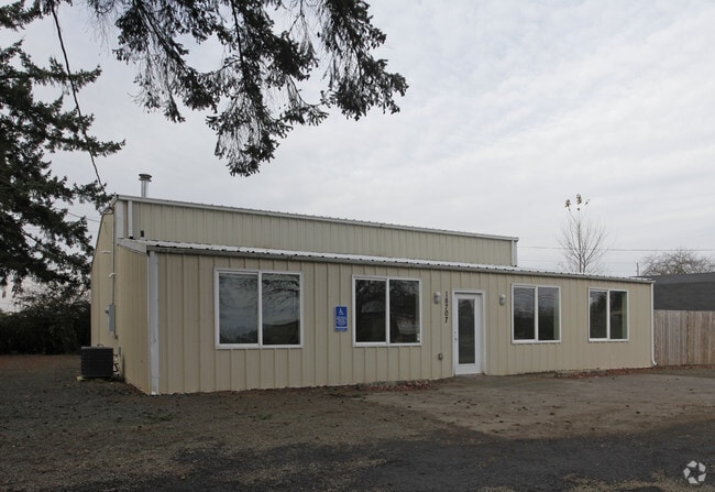
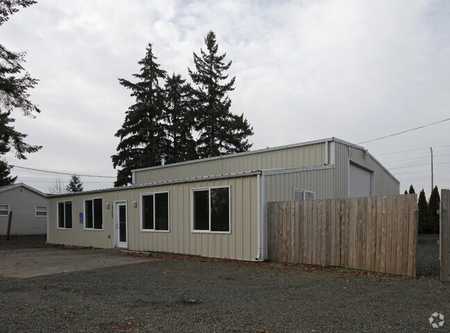
18707 Highway 99E
511250
Charles Hubbard Claim
Officebuilding
ACRES .74
X
Marion
41005C0485D
Oregon
2024
0.74 AC
2025
Marion County
010202
Portland
4,854 SF
Salem, OR
DEMOGRAPHICS near 18707 Highway 99E
1 Mile
3 Mile
5 Mile
2024 Total Population
3,478
8,443
33,233
2029 Population
3,500
8,515
33,507
Pop Growth 2024-2029
+ 0.63%
+ 0.85%
+ 0.82%
Average Age
37
38
39
2024 Total Households
1,116
2,718
10,757
HH Growth 2024-2029
+ 0.72%
+ 0.81%
+ 0.85%
Median Household Inc
$83,316
$78,112
$59,005
Avg Household Size
3.10
3.10
3.00
2024 Avg HH Vehicles
2.00
2.00
2.00
Median Home Value
$420,408
$419,785
$366,587
Median Year Built
1977
1979
1975
Nearby Places
Map Layers
Map Styles
 Street
 Aerial
- Restaurants
- Banks
- Shops
- Fitness
- Groceries
PUBLIC TRANSPORTATION
COMMUTER RAIL
Wilsonville (Westside Express Service - Tri-County Metropolitan Transportation District of Oregon Rail (TriMet Rail))
DRIVE
WALK
Distance
Wilsonville (Westside Express Service - Tri-County Metropolitan Transportation District of Oregon Rail (TriMet Rail))
15 min
9.4 mi
AIRPORT
Portland International
DRIVE
WALK
Distance
Portland International
53 min
37.0 mi
Freight Ports
Port of Portland
DRIVE
WALK
Distance
Port of Portland
39 min
28.2 mi
Nearby Properties
Address
Land Use
TOTAL SIZE
Lot Size
Zoning
Address
Land Use
TOTAL SIZE
Lot Size
Zoning
198,139 SF
8.60 AC
CG
Address
Land Use
TOTAL SIZE
Lot Size
Zoning
Address
Land Use
TOTAL SIZE
Lot Size
Zoning
20 SF
100.66 AC
P
Address
Land Use
TOTAL SIZE
Lot Size
Zoning
Address
Land Use
TOTAL SIZE
Lot Size
Zoning
152,390 SF
20.40 AC
IP
Address
Land Use
TOTAL SIZE
Lot Size
Zoning
6.22 AC
IL
Address
Land Use
TOTAL SIZE
Lot Size
Zoning
47,709 SF
29.13 AC
IP
Address
Land Use
TOTAL SIZE
Lot Size
Zoning
39,666 SF
8.39 AC
I
Address
Land Use
TOTAL SIZE
Lot Size
Zoning
81,772 SF
3.92 AC
IC
Address
Land Use
TOTAL SIZE
Lot Size
Zoning
39,323 SF
15.38 AC
IL
Address
Land Use
TOTAL SIZE
Lot Size
Zoning
10.65 AC
IP
Address
Land Use
TOTAL SIZE
Lot Size
Zoning
10.65 AC
IP
Address
Land Use
TOTAL SIZE
Lot Size
Zoning
86,020 SF
3.83 AC
IC
Address
Land Use
TOTAL SIZE
Lot Size
Zoning
Address
Land Use
TOTAL SIZE
Lot Size
Zoning
8.33 AC
IP
Address
Land Use
TOTAL SIZE
Lot Size
Zoning
40,900 SF
10.91 AC
IP
Address
Land Use
TOTAL SIZE
Lot Size
Zoning
7,339 SF
5.67 AC
RI
Address
Land Use
TOTAL SIZE
Lot Size
Zoning
Address
Land Use
TOTAL SIZE
Lot Size
Zoning
Address
Land Use
TOTAL SIZE
Lot Size
Zoning
50,000 SF
2.38 AC
I
Address
Land Use
TOTAL SIZE
Lot Size
Zoning
38,681 SF
2.08 AC
I
Address
Land Use
TOTAL SIZE
Lot Size
Zoning
21,280 SF
0.52 AC
Address
Land Use
TOTAL SIZE
Lot Size
Zoning
5.24 AC
IL
Address
Land Use
TOTAL SIZE
Lot Size
Zoning
34,800 SF
1.79 AC
C
Address
Land Use
TOTAL SIZE
Lot Size
Zoning
Address
Land Use
TOTAL SIZE
Lot Size
Zoning
25,685 SF
3.19 AC
I
Address
Land Use
TOTAL SIZE
Lot Size
Zoning
Address
Land Use
TOTAL SIZE
Lot Size
Zoning
30,845 SF
4.38 AC
IC
Address
Land Use
TOTAL SIZE
Lot Size
Zoning
25,480 SF
1.73 AC
I
Address
Land Use
TOTAL SIZE
Lot Size
Zoning
30,736 SF
8.16 AC
I
The World's #1 Commercial Real Estate Marketplace
Connect with us
© 2026 CoStar Group
The information above has been obtained from sources believed reliable. While we do not doubt its accuracy we have not verified it and make no guarantee, warranty or representation about it. It is your responsibility to independently confirm its accuracy and completeness. Any projections, opinions, assumptions, or estimates used are for example only and do not represent the current or future performance of the property. The value of this transaction to you depends on tax and other factors which should be evaluated by your tax, financial, and legal advisors. You and your advisors should conduct a careful, independent investigation of the property to determine to your satisfaction the suitability of the property for your needs.