Property Record
1873 E Cooke Rd, Columbus, OH 43224

Property Detail
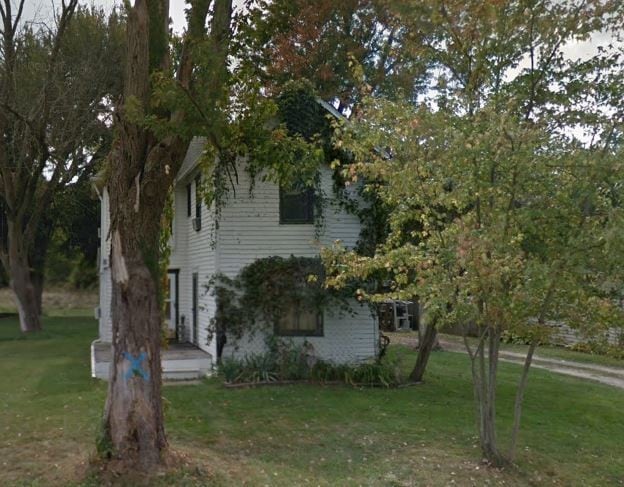
1873 E Cooke Rd
Columbus, OH
1873 E COOKE RD ACRES .213 LOT 16
010-045381
Franklin
Recreationalacreage
Ohio
B and X Area of moderate flood hazard, usually the area between the limits of the 100-year and 500-year floods.
16
2024
5.73 AC
2025
North Central
007722
Columbus
NEARBY LISTINGS FOR SALE OR LEASE
DEMOGRAPHICS near 1873 E Cooke Rd
1 mile
3 mile
5 mile
2025 Total Population
18,816
148,731
363,939
2030 Population
19,394
152,782
375,358
Pop Growth 2025-2030
+ 3.07%
+ 2.72%
+ 3.14%
Average Age
36
37
36
2025 Total Households
7,407
58,460
146,717
HH Growth 2025-2030
+ 3.09%
+ 2.82%
+ 3.35%
Median Household Inc
$47,591
$56,252
$58,693
Avg Household Size
2.50
2.50
2.30
2025 Avg HH Vehicles
2.00
2.00
2.00
Median Home Value
$163,556
$236,836
$278,863
Median Year Built
1960
1963
1970
Nearby Places
Map Layers
Map Styles
 Street
 Aerial
Layers
 Traffic
 Biking
Places
Listings with unknown addresses are not visible on the map
- Restaurants
- Banks
- Shops
- Fitness
- Groceries
PUBLIC TRANSPORTATION
AIRPORT
John Glenn Columbus International
Drive
Walk
Distance
John Glenn Columbus International
14 min
7.2 mi
Rickenbacker International
Drive
Walk
Distance
Rickenbacker International
33 min
20.3 mi
Freight Ports
Port of Toledo
Drive
Walk
Distance
Port of Toledo
180 min
145.1 mi
SALE & LEASE HISTORY
LISTING DATE
SALE/LEASE

Mar 13, 2024
For Sale
Feb 21, 2018
For Sale
Nearby Properties
Address
Land Use
TOTAL SIZE
Lot Size
Zoning
Address
Land Use
TOTAL SIZE
Lot Size
Zoning
2,299,970 SF
60.76 AC
Address
Land Use
TOTAL SIZE
Lot Size
Zoning
449,494 SF
9.75 AC
Address
Land Use
TOTAL SIZE
Lot Size
Zoning
284,481 SF
94.09 AC
Address
Land Use
TOTAL SIZE
Lot Size
Zoning
770,975 SF
64.63 AC
Address
Land Use
TOTAL SIZE
Lot Size
Zoning
516,485 SF
50.03 AC
Address
Land Use
TOTAL SIZE
Lot Size
Zoning
242,064 SF
18.02 AC
Address
Land Use
TOTAL SIZE
Lot Size
Zoning
240,432 SF
16.59 AC
Address
Land Use
TOTAL SIZE
Lot Size
Zoning
214,424 SF
18.57 AC
Address
Land Use
TOTAL SIZE
Lot Size
Zoning
668,209 SF
61.10 AC
Address
Land Use
TOTAL SIZE
Lot Size
Zoning
35,434 SF
17.56 AC
Address
Land Use
TOTAL SIZE
Lot Size
Zoning
165,944 SF
14.21 AC
Address
Land Use
TOTAL SIZE
Lot Size
Zoning
218,403 SF
9.98 AC
Address
Land Use
TOTAL SIZE
Lot Size
Zoning
425,872 SF
10.05 AC
Address
Land Use
TOTAL SIZE
Lot Size
Zoning
331,458 SF
15.37 AC
Address
Land Use
TOTAL SIZE
Lot Size
Zoning
152,684 SF
20.94 AC
Address
Land Use
TOTAL SIZE
Lot Size
Zoning
67,166 SF
11.03 AC
Address
Land Use
TOTAL SIZE
Lot Size
Zoning
500,376 SF
3 AC
Address
Land Use
TOTAL SIZE
Lot Size
Zoning
202,956 SF
13.40 AC
Address
Land Use
TOTAL SIZE
Lot Size
Zoning
120,412 SF
30.67 AC
Address
Land Use
TOTAL SIZE
Lot Size
Zoning
194,750 SF
13.53 AC
Address
Land Use
TOTAL SIZE
Lot Size
Zoning
281,405 SF
32.82 AC
Address
Land Use
TOTAL SIZE
Lot Size
Zoning
135,898 SF
0.78 AC
Address
Land Use
TOTAL SIZE
Lot Size
Zoning
167,479 SF
36.79 AC
Address
Land Use
TOTAL SIZE
Lot Size
Zoning
171,832 SF
17.77 AC
Address
Land Use
TOTAL SIZE
Lot Size
Zoning
75,649 SF
19.54 AC
Address
Land Use
TOTAL SIZE
Lot Size
Zoning
142,560 SF
16.23 AC
Address
Land Use
TOTAL SIZE
Lot Size
Zoning
95,086 SF
18.68 AC
Address
Land Use
TOTAL SIZE
Lot Size
Zoning
236,677 SF
22.31 AC
Address
Land Use
TOTAL SIZE
Lot Size
Zoning
198,207 SF
4.74 AC
Address
Land Use
TOTAL SIZE
Lot Size
Zoning
358,807 SF
1.77 AC
The World's #1 Commercial Real Estate Marketplace
Connect with us
© 2026 CoStar Group
The information above has been obtained from sources believed reliable. While we do not doubt its accuracy we have not verified it and make no guarantee, warranty or representation about it. It is your responsibility to independently confirm its accuracy and completeness. Any projections, opinions, assumptions, or estimates used are for example only and do not represent the current or future performance of the property. The value of this transaction to you depends on tax and other factors which should be evaluated by your tax, financial, and legal advisors. You and your advisors should conduct a careful, independent investigation of the property to determine to your satisfaction the suitability of the property for your needs.