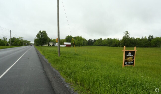
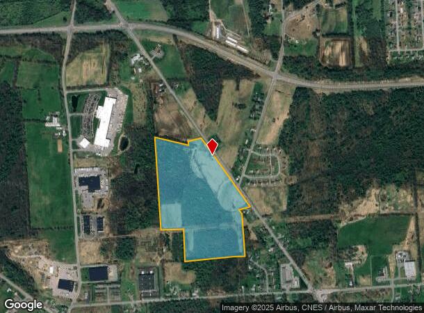
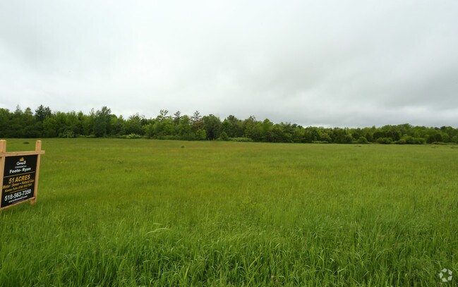
Property Record
1876 Military Tpke, Plattsburgh, NY 12901
NEARBY LISTINGS FOR SALE OR LEASE
Property Detail
1876 Military Tpke
094200-206-000-0001-001-001-0000
PAT POP
Miscresidentialimprovement
Clinton
X
New York
36019C0583E
1.001
2025
51 AC
2024
Upstate New York Area
103000
Other Market Areas
1,652 SF
Plattsburgh, NY
DEMOGRAPHICS near 1876 Military Tpke
1 Mile
3 Mile
5 Mile
2024 Total Population
1,259
9,862
32,157
2029 Population
1,253
9,786
31,936
Pop Growth 2024-2029
(0.48%)
(0.77%)
(0.69%)
Average Age
45
43
42
2024 Total Households
536
4,143
14,655
HH Growth 2024-2029
(0.56%)
(0.92%)
(0.71%)
Median Household Inc
$65,806
$60,606
$54,802
Avg Household Size
2.30
2.30
2.10
2024 Avg HH Vehicles
2.00
2.00
2.00
Median Home Value
$172,812
$154,377
$152,110
Median Year Built
1984
1985
1973
Nearby Places
- Restaurants
- Banks
- Shops
- Fitness
- Groceries
PUBLIC TRANSPORTATION
COMMUTER RAIL
Plattsburgh Amtrak Station (Adirondack - Amtrak)
DRIVE
WALK
Distance
Plattsburgh Amtrak Station (Adirondack - Amtrak)
8 min
5.1 mi
AIRPORT
Plattsburgh International
DRIVE
WALK
Distance
Plattsburgh International
12 min
7.4 mi
Patrick Leahy Burlington International
DRIVE
WALK
Distance
Patrick Leahy Burlington International
72 min
35.2 mi
Freight Ports
Montreal
DRIVE
WALK
Distance
Montreal
91 min
68.8 mi
Nearby Properties
Address
Land Use
TOTAL SIZE
Lot Size
Zoning
Address
Land Use
TOTAL SIZE
Lot Size
Zoning
131,558 SF
53.50 AC
T5
Address
Land Use
TOTAL SIZE
Lot Size
Zoning
99,232 SF
21.27 AC
SD
Address
Land Use
TOTAL SIZE
Lot Size
Zoning
87,442 SF
5.32 AC
02 - SINGL
Address
Land Use
TOTAL SIZE
Lot Size
Zoning
128,028 SF
38.20 AC
T4
Address
Land Use
TOTAL SIZE
Lot Size
Zoning
83,261 SF
24.35 AC
T5
Address
Land Use
TOTAL SIZE
Lot Size
Zoning
73,095 SF
6.28 AC
T4
Address
Land Use
TOTAL SIZE
Lot Size
Zoning
101,758 SF
5.64 AC
T5
Address
Land Use
TOTAL SIZE
Lot Size
Zoning
578,793 SF
75.50 AC
T5
Address
Land Use
TOTAL SIZE
Lot Size
Zoning
87,939 SF
8.20 AC
T5
Address
Land Use
TOTAL SIZE
Lot Size
Zoning
2.96 AC
R-2
Address
Land Use
TOTAL SIZE
Lot Size
Zoning
64,343 SF
2.30 AC
C
Address
Land Use
TOTAL SIZE
Lot Size
Zoning
145,190 SF
26.57 AC
IP
Address
Land Use
TOTAL SIZE
Lot Size
Zoning
126,842 SF
10 AC
T5
Address
Land Use
TOTAL SIZE
Lot Size
Zoning
62,148 SF
2.66 AC
T4
Address
Land Use
TOTAL SIZE
Lot Size
Zoning
50,078 SF
3.80 AC
T5
Address
Land Use
TOTAL SIZE
Lot Size
Zoning
76,598 SF
14.90 AC
12
Address
Land Use
TOTAL SIZE
Lot Size
Zoning
137,664 SF
4.82 AC
T5
Address
Land Use
TOTAL SIZE
Lot Size
Zoning
123.50 AC
Address
Land Use
TOTAL SIZE
Lot Size
Zoning
67,111 SF
10.46 AC
T5
Address
Land Use
TOTAL SIZE
Lot Size
Zoning
156,030 SF
10.70 AC
SD
Address
Land Use
TOTAL SIZE
Lot Size
Zoning
47,082 SF
2.40 AC
T5
Address
Land Use
TOTAL SIZE
Lot Size
Zoning
6,860 SF
257.90 AC
I
Address
Land Use
TOTAL SIZE
Lot Size
Zoning
29,751 SF
5.11 AC
T4
Address
Land Use
TOTAL SIZE
Lot Size
Zoning
20.41 AC
T4
Address
Land Use
TOTAL SIZE
Lot Size
Zoning
1,464 SF
31.70 AC
R-5
Address
Land Use
TOTAL SIZE
Lot Size
Zoning
7,680 SF
6.44 AC
03 - MULTI
Address
Land Use
TOTAL SIZE
Lot Size
Zoning
3,259 SF
6.62 AC
T5
Address
Land Use
TOTAL SIZE
Lot Size
Zoning
52,710 SF
7.86 AC
T5
Address
Land Use
TOTAL SIZE
Lot Size
Zoning
107,750 SF
6.80 AC
SD
Address
Land Use
TOTAL SIZE
Lot Size
Zoning
51,533 SF
22.70 AC
The World's #1 Commercial Real Estate Marketplace
Connect with us
© 2025 CoStar Group
The information above has been obtained from sources believed reliable. While we do not doubt its accuracy we have not verified it and make no guarantee, warranty or representation about it. It is your responsibility to independently confirm its accuracy and completeness. Any projections, opinions, assumptions, or estimates used are for example only and do not represent the current or future performance of the property. The value of this transaction to you depends on tax and other factors which should be evaluated by your tax, financial, and legal advisors. You and your advisors should conduct a careful, independent investigation of the property to determine to your satisfaction the suitability of the property for your needs.