Property Record
1877 Hubbard Ln, Grants Pass, OR 97527


Property Detail
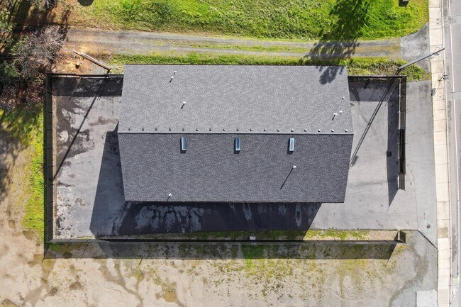
1877 Hubbard Ln
R340781
P.P. 1999-30, PARCEL 1, ACRES 0.38
Commercialnec
Josephine
C-5
Oregon
B and X Area of moderate flood hazard, usually the area between the limits of the 100-year and 500-year floods.
0.38 AC
2024
Medford/Grants Pass
2025
Other Market Areas
361102
Grants Pass, OR
7,120 SF
NEARBY LISTINGS FOR SALE OR LEASE
-
-
View all Grants Pass listings for sale on LoopNet.com
DEMOGRAPHICS near 1877 Hubbard Ln
1 mile
3 mile
5 mile
2024 Total Population
6,598
26,410
56,656
2029 Population
6,631
26,463
56,700
Pop Growth 2024-2029
+ 0.50%
+ 0.20%
+ 0.08%
Average Age
44
45
45
2024 Total Households
2,700
10,654
22,952
HH Growth 2024-2029
+ 0.56%
+ 0.23%
+ 0.08%
Median Household Inc
$42,899
$49,749
$49,808
Avg Household Size
2.40
2.40
2.40
2024 Avg HH Vehicles
2.00
2.00
2.00
Median Home Value
$331,739
$354,831
$364,738
Median Year Built
1996
1987
1981
Nearby Places
Map Layers
Map Styles
 Street
 Aerial
Transit
 Traffic
 Biking
Places
Listings with unknown addresses are not visible on the map
- Restaurants
- Banks
- Shops
- Fitness
- Groceries
PUBLIC TRANSPORTATION
AIRPORT
Rogue Valley International - Medford
Drive
Walk
Distance
Rogue Valley International - Medford
42 min
30.4 mi
SALE & LEASE HISTORY
LISTING DATE
SALE/LEASE

Feb 21, 2024
For Sale
Nearby Properties
Address
Land Use
TOTAL SIZE
Lot Size
Zoning
Address
Land Use
TOTAL SIZE
Lot Size
Zoning
1,324,134 SF
9.03 AC
R-1-6
Address
Land Use
TOTAL SIZE
Lot Size
Zoning
74,405 SF
11.34 AC
GC
Address
Land Use
TOTAL SIZE
Lot Size
Zoning
41,944 SF
7.80 AC
R-3
Address
Land Use
TOTAL SIZE
Lot Size
Zoning
3.93 AC
R-3
Address
Land Use
TOTAL SIZE
Lot Size
Zoning
498 SF
40.34 AC
R-3
Address
Land Use
TOTAL SIZE
Lot Size
Zoning
3.56 AC
GC
Address
Land Use
TOTAL SIZE
Lot Size
Zoning
112,259 SF
6.40 AC
GC
Address
Land Use
TOTAL SIZE
Lot Size
Zoning
76,830 SF
16.12 AC
R-3
Address
Land Use
TOTAL SIZE
Lot Size
Zoning
25,131 SF
5.22 AC
GC
Address
Land Use
TOTAL SIZE
Lot Size
Zoning
26,000 SF
9.12 AC
R-1-8
Address
Land Use
TOTAL SIZE
Lot Size
Zoning
20,000 SF
19.04 AC
R-1-8
Address
Land Use
TOTAL SIZE
Lot Size
Zoning
4,363 SF
15.58 AC
GC
Address
Land Use
TOTAL SIZE
Lot Size
Zoning
59,641 SF
4.99 AC
GC
Address
Land Use
TOTAL SIZE
Lot Size
Zoning
52,746 SF
14.66 AC
R-1-8
Address
Land Use
TOTAL SIZE
Lot Size
Zoning
87,976 SF
1.07 AC
GC
Address
Land Use
TOTAL SIZE
Lot Size
Zoning
126,000 SF
3.47 AC
GC
Address
Land Use
TOTAL SIZE
Lot Size
Zoning
18,486 SF
2.19 AC
R-3
Address
Land Use
TOTAL SIZE
Lot Size
Zoning
37,733 SF
3.29 AC
R-4
Address
Land Use
TOTAL SIZE
Lot Size
Zoning
30,823 SF
2.69 AC
GC
Address
Land Use
TOTAL SIZE
Lot Size
Zoning
9.25 AC
GC
Address
Land Use
TOTAL SIZE
Lot Size
Zoning
18,532 SF
1.27 AC
GC
Address
Land Use
TOTAL SIZE
Lot Size
Zoning
15,011 SF
1.26 AC
GC
Address
Land Use
TOTAL SIZE
Lot Size
Zoning
5,710 SF
28.69 AC
R-1-8
Address
Land Use
TOTAL SIZE
Lot Size
Zoning
5,528 SF
2.97 AC
GC
Address
Land Use
TOTAL SIZE
Lot Size
Zoning
1,669 SF
1.85 AC
GC
Address
Land Use
TOTAL SIZE
Lot Size
Zoning
39,998 SF
1.70 AC
GC
Address
Land Use
TOTAL SIZE
Lot Size
Zoning
23,412 SF
1.68 AC
GC
Address
Land Use
TOTAL SIZE
Lot Size
Zoning
216 SF
BP
Address
Land Use
TOTAL SIZE
Lot Size
Zoning
9,000 SF
3.84 AC
R-3
Address
Land Use
TOTAL SIZE
Lot Size
Zoning
35,959 SF
2.03 AC
R-3
The World's #1 Commercial Real Estate Marketplace
Connect with us
© 2026 CoStar Group
The information above has been obtained from sources believed reliable. While we do not doubt its accuracy we have not verified it and make no guarantee, warranty or representation about it. It is your responsibility to independently confirm its accuracy and completeness. Any projections, opinions, assumptions, or estimates used are for example only and do not represent the current or future performance of the property. The value of this transaction to you depends on tax and other factors which should be evaluated by your tax, financial, and legal advisors. You and your advisors should conduct a careful, independent investigation of the property to determine to your satisfaction the suitability of the property for your needs.