Property Record
1877 Kawai Rd, Lincolnton, NC 28092


NEARBY LISTINGS FOR SALE OR LEASE
-
-
View all Lincolnton listings for sale on LoopNet.com
Property Detail
1877 Kawai Rd
Charlotte-Concord-Gastonia, NC-SC
James Mauney & Associates
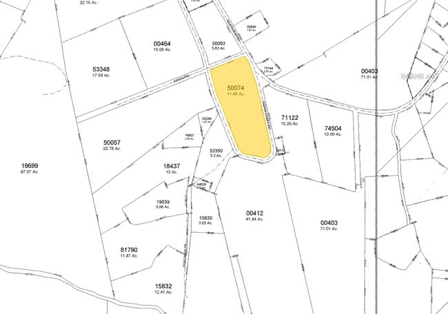
50074
PLANT/RD 1236
Manufacturinglight
Lincoln
2025
North Carolina
2025
11.45 AC
070400
Lincoln County
144,596 SF
Charlotte
DEMOGRAPHICS near 1877 Kawai Rd
1 Mile
3 Mile
5 Mile
2024 Total Population
823
10,293
27,734
2029 Population
948
11,872
31,729
Pop Growth 2024-2029
+ 15.19%
+ 15.34%
+ 14.40%
Average Age
43
43
42
2024 Total Households
338
4,306
11,294
HH Growth 2024-2029
+ 15.38%
+ 15.72%
+ 14.78%
Median Household Inc
$75,577
$52,984
$56,694
Avg Household Size
2.40
2.30
2.40
2024 Avg HH Vehicles
2.00
2.00
2.00
Median Home Value
$141,666
$154,660
$172,809
Median Year Built
1974
1979
1981
Nearby Places
Map Layers
Map Styles
 Street
 Aerial
- Restaurants
- Banks
- Shops
- Fitness
- Groceries
PUBLIC TRANSPORTATION
AIRPORT
Charlotte/Douglas International
DRIVE
WALK
Distance
Charlotte/Douglas International
54 min
33.2 mi
Freight Ports
North Charleston Terminal
DRIVE
WALK
Distance
North Charleston Terminal
268 min
229.2 mi
Nearby Properties
Address
Land Use
TOTAL SIZE
Lot Size
Zoning
Address
Land Use
TOTAL SIZE
Lot Size
Zoning
99,626 SF
21.55 AC
R-SF
Address
Land Use
TOTAL SIZE
Lot Size
Zoning
322,560 SF
132.94 AC
I-G
Address
Land Use
TOTAL SIZE
Lot Size
Zoning
1,488 SF
10.65 AC
O-I CU
Address
Land Use
TOTAL SIZE
Lot Size
Zoning
4,475 SF
14.98 AC
R-15
Address
Land Use
TOTAL SIZE
Lot Size
Zoning
52,000 SF
10.06 AC
O-I
Address
Land Use
TOTAL SIZE
Lot Size
Zoning
66,527 SF
2.10 AC
R-15
Address
Land Use
TOTAL SIZE
Lot Size
Zoning
125,620 SF
16.65 AC
I-G
Address
Land Use
TOTAL SIZE
Lot Size
Zoning
220,297 SF
41.47 AC
I-G
Address
Land Use
TOTAL SIZE
Lot Size
Zoning
39,474 SF
1.39 AC
C-B
Address
Land Use
TOTAL SIZE
Lot Size
Zoning
41,025 SF
23.14 AC
R-15
Address
Land Use
TOTAL SIZE
Lot Size
Zoning
59,178 SF
13.65 AC
R-25
Address
Land Use
TOTAL SIZE
Lot Size
Zoning
361,982 SF
37.47 AC
GMC
Address
Land Use
TOTAL SIZE
Lot Size
Zoning
22,034 SF
9.69 AC
R-SF
Address
Land Use
TOTAL SIZE
Lot Size
Zoning
63,677 SF
22.71 AC
I-G
Address
Land Use
TOTAL SIZE
Lot Size
Zoning
21,570 SF
19.06 AC
R-S
Address
Land Use
TOTAL SIZE
Lot Size
Zoning
47,680 SF
10.29 AC
P-B
Address
Land Use
TOTAL SIZE
Lot Size
Zoning
13,617 SF
0.66 AC
R-15
Address
Land Use
TOTAL SIZE
Lot Size
Zoning
5,606 SF
32.82 AC
GMC
Address
Land Use
TOTAL SIZE
Lot Size
Zoning
82,469 SF
20.48 AC
GMC
Address
Land Use
TOTAL SIZE
Lot Size
Zoning
121,823 SF
11.15 AC
GMC
Address
Land Use
TOTAL SIZE
Lot Size
Zoning
7,362 SF
4.85 AC
R-SF
Address
Land Use
TOTAL SIZE
Lot Size
Zoning
3,807 SF
3.56 AC
R-25
Address
Land Use
TOTAL SIZE
Lot Size
Zoning
120,855 SF
67.21 AC
INDS1
Address
Land Use
TOTAL SIZE
Lot Size
Zoning
6,985 SF
1.93 AC
R-25
Address
Land Use
TOTAL SIZE
Lot Size
Zoning
62,600 SF
10.29 AC
I-G
Address
Land Use
TOTAL SIZE
Lot Size
Zoning
23,260 SF
10.66 AC
I-G
Address
Land Use
TOTAL SIZE
Lot Size
Zoning
6,652 SF
0.50 AC
C-B
Address
Land Use
TOTAL SIZE
Lot Size
Zoning
23,264 SF
34.65 AC
R-8
Address
Land Use
TOTAL SIZE
Lot Size
Zoning
14,912 SF
1.31 AC
R-10
The World's #1 Commercial Real Estate Marketplace
Connect with us
© 2025 CoStar Group
The information above has been obtained from sources believed reliable. While we do not doubt its accuracy we have not verified it and make no guarantee, warranty or representation about it. It is your responsibility to independently confirm its accuracy and completeness. Any projections, opinions, assumptions, or estimates used are for example only and do not represent the current or future performance of the property. The value of this transaction to you depends on tax and other factors which should be evaluated by your tax, financial, and legal advisors. You and your advisors should conduct a careful, independent investigation of the property to determine to your satisfaction the suitability of the property for your needs.