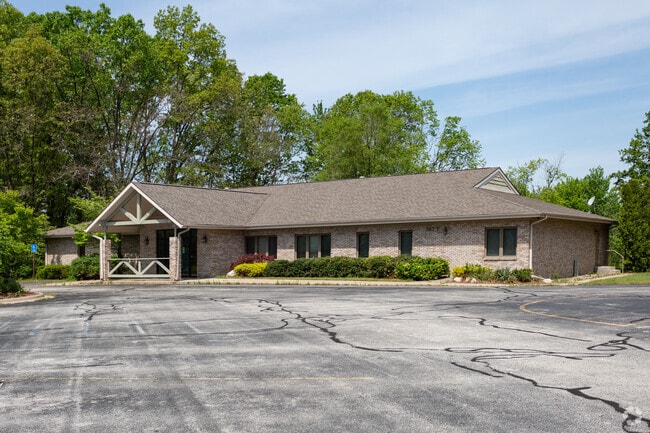
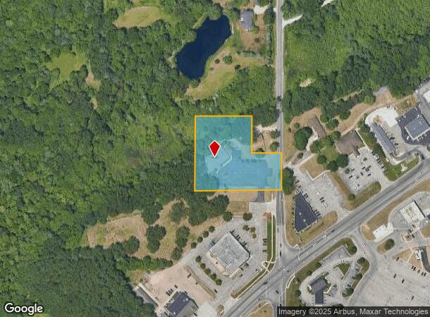
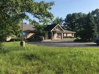
Property Record
1877 N Getty St, Muskegon, MI 49445
NEARBY LISTINGS FOR SALE OR LEASE
Property Detail
1877 N Getty St
10-005-200-0011-00
MUSKEGON CHARTER TOWNSHIP SEC 5 T10N R16W MU-114 C COMM AT A PT ON E LN OF SEC 5 320 FT N OF E 1/4 POST FOR POB TH W 350 FT,
Commercialnec
Muskegon
X
Michigan
26121C0165D
2.41 AC
2024
Northern Muskegon County
2025
West Michigan
001800
Muskegon, MI
6,192 SF
DEMOGRAPHICS near 1877 N Getty St
1 Mile
3 Mile
5 Mile
2024 Total Population
2,741
13,400
57,811
2029 Population
2,745
13,447
58,272
Pop Growth 2024-2029
+ 0.15%
+ 0.35%
+ 0.80%
Average Age
41
40
39
2024 Total Households
1,054
5,218
22,256
HH Growth 2024-2029
+ 0.19%
+ 0.33%
+ 0.80%
Median Household Inc
$57,182
$64,468
$49,700
Avg Household Size
2.60
2.50
2.40
2024 Avg HH Vehicles
2.00
2.00
2.00
Median Home Value
$149,603
$160,085
$140,079
Median Year Built
1971
1973
1961
Nearby Places
Map Layers
Map Styles
 Street
 Aerial
- Restaurants
- Banks
- Shops
- Fitness
- Groceries
SALE & LEASE HISTORY
LISTING DATE
SALE/LEASE

Jul 12, 2018
For Sale
Dec 02, 2020
For Sale
Dec 02, 2020
For Lease
Nearby Properties
Address
Land Use
TOTAL SIZE
Lot Size
Zoning
Address
Land Use
TOTAL SIZE
Lot Size
Zoning
Address
Land Use
TOTAL SIZE
Lot Size
Zoning
183,891 SF
391.21 AC
IP
Address
Land Use
TOTAL SIZE
Lot Size
Zoning
191,930 SF
37.12 AC
C2
Address
Land Use
TOTAL SIZE
Lot Size
Zoning
892,516 SF
57.88 AC
I
Address
Land Use
TOTAL SIZE
Lot Size
Zoning
59,396 SF
Address
Land Use
TOTAL SIZE
Lot Size
Zoning
191,930 SF
35 AC
C2
Address
Land Use
TOTAL SIZE
Lot Size
Zoning
163,658 SF
14.70 AC
RM-1
Address
Land Use
TOTAL SIZE
Lot Size
Zoning
14,022 SF
13 AC
LI
Address
Land Use
TOTAL SIZE
Lot Size
Zoning
103,364 SF
4.35 AC
R-3HIGH
Address
Land Use
TOTAL SIZE
Lot Size
Zoning
18,844 SF
99.10 AC
WI-PUD
Address
Land Use
TOTAL SIZE
Lot Size
Zoning
37,872 SF
36.61 AC
RMH
Address
Land Use
TOTAL SIZE
Lot Size
Zoning
4,420 SF
5.30 AC
R-1
Address
Land Use
TOTAL SIZE
Lot Size
Zoning
37,876 SF
5.34 AC
RM-1
Address
Land Use
TOTAL SIZE
Lot Size
Zoning
41,845 SF
7.66 AC
M
Address
Land Use
TOTAL SIZE
Lot Size
Zoning
52.37 AC
WI-PUD
Address
Land Use
TOTAL SIZE
Lot Size
Zoning
55,386 SF
5.72 AC
IND
Address
Land Use
TOTAL SIZE
Lot Size
Zoning
16,312 SF
15.99 AC
I-2
Address
Land Use
TOTAL SIZE
Lot Size
Zoning
27,624 SF
1.70 AC
GC
Address
Land Use
TOTAL SIZE
Lot Size
Zoning
37,376 SF
1.95 AC
RM-1
Address
Land Use
TOTAL SIZE
Lot Size
Zoning
39,232 SF
2.65 AC
PUD
Address
Land Use
TOTAL SIZE
Lot Size
Zoning
75,672 SF
5.15 AC
LI
Address
Land Use
TOTAL SIZE
Lot Size
Zoning
40,148 SF
5.26 AC
C1
Address
Land Use
TOTAL SIZE
Lot Size
Zoning
18,067 SF
1.70 AC
R-2-MED
Address
Land Use
TOTAL SIZE
Lot Size
Zoning
14,476 SF
2.12 AC
C1
Address
Land Use
TOTAL SIZE
Lot Size
Zoning
21,273 SF
3.66 AC
R-1
Address
Land Use
TOTAL SIZE
Lot Size
Zoning
13,782 SF
3.31 AC
C1
Address
Land Use
TOTAL SIZE
Lot Size
Zoning
888 SF
10.75 AC
M
Address
Land Use
TOTAL SIZE
Lot Size
Zoning
12,697 SF
1.77 AC
GC
Address
Land Use
TOTAL SIZE
Lot Size
Zoning
45,000 SF
14.57 AC
C2-REG COM
Address
Land Use
TOTAL SIZE
Lot Size
Zoning
4,084 SF
2.80 AC
C1
The World's #1 Commercial Real Estate Marketplace
Connect with us
© 2026 CoStar Group
The information above has been obtained from sources believed reliable. While we do not doubt its accuracy we have not verified it and make no guarantee, warranty or representation about it. It is your responsibility to independently confirm its accuracy and completeness. Any projections, opinions, assumptions, or estimates used are for example only and do not represent the current or future performance of the property. The value of this transaction to you depends on tax and other factors which should be evaluated by your tax, financial, and legal advisors. You and your advisors should conduct a careful, independent investigation of the property to determine to your satisfaction the suitability of the property for your needs.