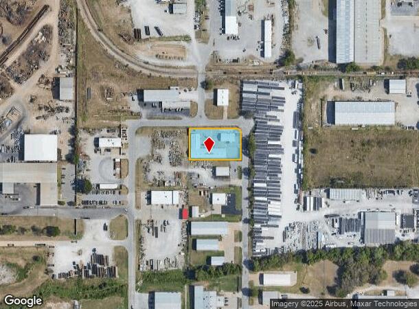
Property Record
1878 N 168Th East Ave, Tulsa, OK 74116


NEARBY LISTINGS FOR SALE OR LEASE
Property Detail
1878 N 168Th East Ave
Tulsa, OK
Eastpark Second Amd
660069501
LOT 24 BLOCK 2 EASTPARK SECOND AMENDED
Warehouse
Rogers
X
Oklahoma
40131C0350J
24
2025
0.77 AC
2025
Rogers County
050407
Tulsa
10,400 SF
DEMOGRAPHICS near 1878 N 168Th East Ave
1 Mile
3 Mile
5 Mile
2024 Total Population
1,075
10,971
48,741
2029 Population
1,169
11,853
51,119
Pop Growth 2024-2029
+ 8.74%
+ 8.04%
+ 4.88%
Average Age
42
39
36
2024 Total Households
403
4,211
17,775
HH Growth 2024-2029
+ 8.68%
+ 8.17%
+ 5.00%
Median Household Inc
$79,044
$58,413
$49,799
Avg Household Size
2.70
2.60
2.60
2024 Avg HH Vehicles
2.00
2.00
2.00
Median Home Value
$170,426
$152,218
$121,589
Median Year Built
1980
1978
1974
Nearby Places
Map Layers
Map Styles
 Street
 Aerial
- Restaurants
- Banks
- Shops
- Fitness
- Groceries
PUBLIC TRANSPORTATION
AIRPORT
Tulsa International
DRIVE
WALK
Distance
Tulsa International
18 min
10.7 mi
Freight Ports
Tulsa Port Of Catoosa
DRIVE
WALK
Distance
Tulsa Port Of Catoosa
12 min
6.8 mi
SALE & LEASE HISTORY
LISTING DATE
SALE/LEASE

Jul 12, 2017
For Sale
Feb 02, 2018
For Sale
Dec 12, 2017
For Sale
Nearby Properties
Address
Land Use
TOTAL SIZE
Lot Size
Zoning
Address
Land Use
TOTAL SIZE
Lot Size
Zoning
349,823 SF
203.39 AC
IL
Address
Land Use
TOTAL SIZE
Lot Size
Zoning
725,973 SF
122.30 AC
IM
Address
Land Use
TOTAL SIZE
Lot Size
Zoning
11,184 SF
638.56 AC
Address
Land Use
TOTAL SIZE
Lot Size
Zoning
129,087 SF
43.40 AC
IR
Address
Land Use
TOTAL SIZE
Lot Size
Zoning
492,786 SF
76.58 AC
IL
Address
Land Use
TOTAL SIZE
Lot Size
Zoning
3,720 SF
158.66 AC
Address
Land Use
TOTAL SIZE
Lot Size
Zoning
219,538 SF
20.13 AC
IL
Address
Land Use
TOTAL SIZE
Lot Size
Zoning
6,000 SF
346.13 AC
Address
Land Use
TOTAL SIZE
Lot Size
Zoning
137,668 SF
13.67 AC
IM
Address
Land Use
TOTAL SIZE
Lot Size
Zoning
6,000 SF
0.68 AC
Address
Land Use
TOTAL SIZE
Lot Size
Zoning
64.90 AC
AG
Address
Land Use
TOTAL SIZE
Lot Size
Zoning
62,644 SF
12.38 AC
Address
Land Use
TOTAL SIZE
Lot Size
Zoning
153,297 SF
16.29 AC
Address
Land Use
TOTAL SIZE
Lot Size
Zoning
103,820 SF
2.70 AC
Address
Land Use
TOTAL SIZE
Lot Size
Zoning
133,875 SF
7.68 AC
Address
Land Use
TOTAL SIZE
Lot Size
Zoning
220,126 SF
16.39 AC
IL
Address
Land Use
TOTAL SIZE
Lot Size
Zoning
7,490 SF
4.62 AC
AG
Address
Land Use
TOTAL SIZE
Lot Size
Zoning
87,500 SF
4.12 AC
IL
Address
Land Use
TOTAL SIZE
Lot Size
Zoning
136,635 SF
31.05 AC
IL
Address
Land Use
TOTAL SIZE
Lot Size
Zoning
81,689 SF
6.84 AC
IM
Address
Land Use
TOTAL SIZE
Lot Size
Zoning
68,250 SF
73.94 AC
IM
Address
Land Use
TOTAL SIZE
Lot Size
Zoning
14,196 SF
1.75 AC
RS1
Address
Land Use
TOTAL SIZE
Lot Size
Zoning
12,294 SF
1.57 AC
RS3
Address
Land Use
TOTAL SIZE
Lot Size
Zoning
15,523 SF
7 AC
AG
Address
Land Use
TOTAL SIZE
Lot Size
Zoning
2,456 SF
2.18 AC
Address
Land Use
TOTAL SIZE
Lot Size
Zoning
68,725 SF
2.74 AC
Address
Land Use
TOTAL SIZE
Lot Size
Zoning
76,134 SF
9.04 AC
IL
Address
Land Use
TOTAL SIZE
Lot Size
Zoning
1,440 SF
4.84 AC
Address
Land Use
TOTAL SIZE
Lot Size
Zoning
11,115 SF
2.61 AC
RS3
Address
Land Use
TOTAL SIZE
Lot Size
Zoning
57,268 SF
6.87 AC
The World's #1 Commercial Real Estate Marketplace
Connect with us
© 2025 CoStar Group
The information above has been obtained from sources believed reliable. While we do not doubt its accuracy we have not verified it and make no guarantee, warranty or representation about it. It is your responsibility to independently confirm its accuracy and completeness. Any projections, opinions, assumptions, or estimates used are for example only and do not represent the current or future performance of the property. The value of this transaction to you depends on tax and other factors which should be evaluated by your tax, financial, and legal advisors. You and your advisors should conduct a careful, independent investigation of the property to determine to your satisfaction the suitability of the property for your needs.