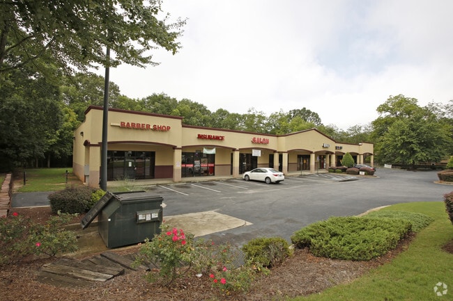
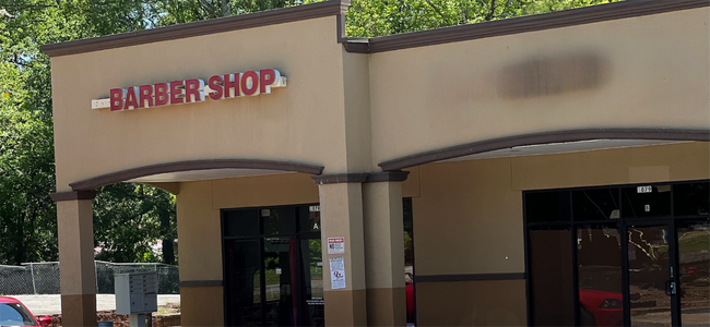
Property Record
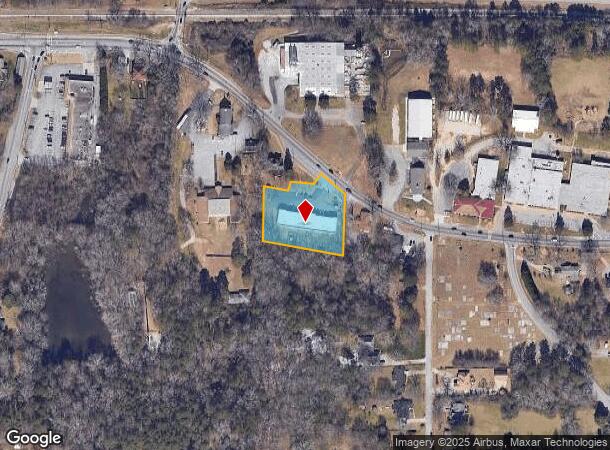
1879 Stone Mountain Lithonia Rd, Lithonia, GA 30058
Current Lease Availabilities
General Retail LEASE
$17.00 SF/YR
1,000 - 2,000 SF
NEARBY LISTINGS FOR SALE OR LEASE
Property Detail
1879 Stone Mountain Lithonia Rd
16-093-06-024
TRACT 21-NOV-05 1.132AC 46 X 57 X 200 X 264 X...
Regionalshoppingcenterormallwithanchorstore
DeKalb
X
Georgia
13089C0157J
93
2025
1.13 AC
2025
Stone Mtn/Clarkston
023313
Atlanta
7,680 SF
Atlanta-Sandy Springs-Roswell, GA
DEMOGRAPHICS near 1879 Stone Mountain Lithonia Rd
1 Mile
3 Mile
5 Mile
2024 Total Population
6,430
74,028
171,299
2029 Population
6,377
73,598
170,213
Pop Growth 2024-2029
(0.82%)
(0.58%)
(0.63%)
Average Age
40
38
38
2024 Total Households
2,147
26,430
62,405
HH Growth 2024-2029
(0.79%)
(0.64%)
(0.73%)
Median Household Inc
$63,329
$64,500
$61,395
Avg Household Size
3.00
2.70
2.70
2024 Avg HH Vehicles
2.00
2.00
2.00
Median Home Value
$185,056
$187,270
$194,600
Median Year Built
1992
1990
1988
Nearby Places
- Restaurants
- Banks
- Shops
- Fitness
- Groceries
PUBLIC TRANSPORTATION
AIRPORT
Hartsfield - Jackson Atlanta International
DRIVE
WALK
Distance
Hartsfield - Jackson Atlanta International
30 min
23.7 mi
Freight Ports
Georgia Ports - Savannah
DRIVE
WALK
Distance
Georgia Ports - Savannah
1 min
206.4 mi
Nearby Properties
Address
Land Use
TOTAL SIZE
Lot Size
Zoning
Address
Land Use
TOTAL SIZE
Lot Size
Zoning
614,505 SF
97.30 AC
Address
Land Use
TOTAL SIZE
Lot Size
Zoning
208,447 SF
26.56 AC
RM100
Address
Land Use
TOTAL SIZE
Lot Size
Zoning
764,622 SF
48.38 AC
M
Address
Land Use
TOTAL SIZE
Lot Size
Zoning
271,666 SF
33.72 AC
RM100
Address
Land Use
TOTAL SIZE
Lot Size
Zoning
118,007 SF
14.31 AC
Address
Land Use
TOTAL SIZE
Lot Size
Zoning
81,537 SF
9.27 AC
C1
Address
Land Use
TOTAL SIZE
Lot Size
Zoning
189,472 SF
30.90 AC
RM100
Address
Land Use
TOTAL SIZE
Lot Size
Zoning
814,943 SF
40.83 AC
M
Address
Land Use
TOTAL SIZE
Lot Size
Zoning
267,899 SF
47.90 AC
X
Address
Land Use
TOTAL SIZE
Lot Size
Zoning
283,988 SF
29 AC
RM100
Address
Land Use
TOTAL SIZE
Lot Size
Zoning
249,668 SF
16.76 AC
RM100
Address
Land Use
TOTAL SIZE
Lot Size
Zoning
198,140 SF
18 AC
RM100
Address
Land Use
TOTAL SIZE
Lot Size
Zoning
218,152 SF
18.80 AC
RM100
Address
Land Use
TOTAL SIZE
Lot Size
Zoning
36,951 SF
8 AC
Address
Land Use
TOTAL SIZE
Lot Size
Zoning
372,399 SF
12.63 AC
M
Address
Land Use
TOTAL SIZE
Lot Size
Zoning
138,876 SF
20 AC
RM100
Address
Land Use
TOTAL SIZE
Lot Size
Zoning
174,655 SF
14.12 AC
X
Address
Land Use
TOTAL SIZE
Lot Size
Zoning
7,384 SF
15.80 AC
M
Address
Land Use
TOTAL SIZE
Lot Size
Zoning
215,422 SF
33.84 AC
M
Address
Land Use
TOTAL SIZE
Lot Size
Zoning
227,648 SF
14.56 AC
X
Address
Land Use
TOTAL SIZE
Lot Size
Zoning
72,755 SF
5.17 AC
C1
Address
Land Use
TOTAL SIZE
Lot Size
Zoning
32,000 SF
6.86 AC
X
Address
Land Use
TOTAL SIZE
Lot Size
Zoning
116,473 SF
15.63 AC
C-1
Address
Land Use
TOTAL SIZE
Lot Size
Zoning
33,448 SF
2.07 AC
C-1
Address
Land Use
TOTAL SIZE
Lot Size
Zoning
207,446 SF
12.21 AC
M
Address
Land Use
TOTAL SIZE
Lot Size
Zoning
92,416 SF
5.48 AC
OD
Address
Land Use
TOTAL SIZE
Lot Size
Zoning
258,641 SF
17.77 AC
M: INDUSTR
Address
Land Use
TOTAL SIZE
Lot Size
Zoning
253,861 SF
19.28 AC
X
Address
Land Use
TOTAL SIZE
Lot Size
Zoning
123,401 SF
9.27 AC
RCD
Address
Land Use
TOTAL SIZE
Lot Size
Zoning
128,508 SF
11.62 AC
RCD
The World's #1 Commercial Real Estate Marketplace
Connect with us
© 2025 CoStar Group
The information above has been obtained from sources believed reliable. While we do not doubt its accuracy we have not verified it and make no guarantee, warranty or representation about it. It is your responsibility to independently confirm its accuracy and completeness. Any projections, opinions, assumptions, or estimates used are for example only and do not represent the current or future performance of the property. The value of this transaction to you depends on tax and other factors which should be evaluated by your tax, financial, and legal advisors. You and your advisors should conduct a careful, independent investigation of the property to determine to your satisfaction the suitability of the property for your needs.