Property Record
188 W Brooke Rd, Winchester, VA 22603
NEARBY LISTINGS FOR SALE OR LEASE
Property Detail
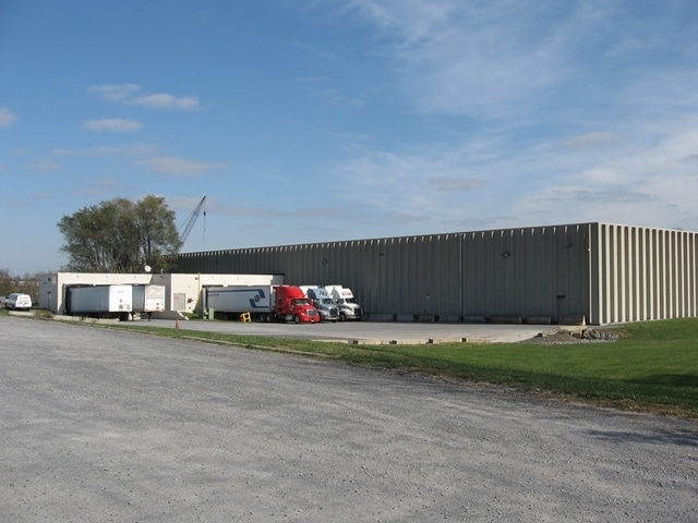
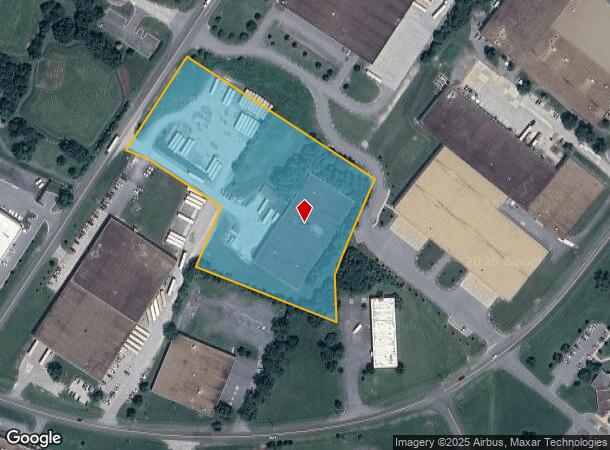
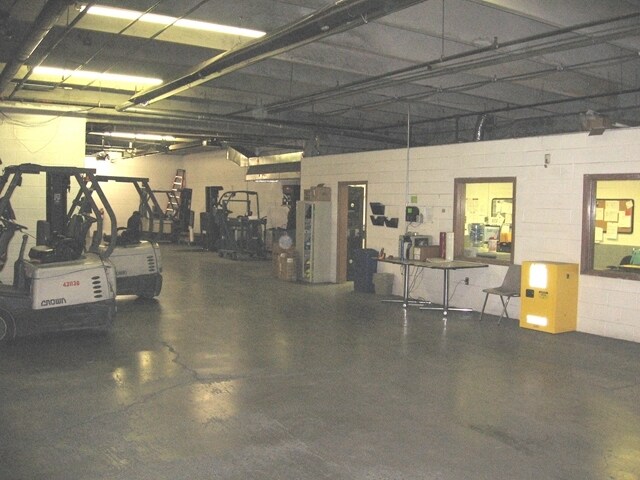
188 W Brooke Rd
541-D
5
Multipleuses
6.83 ACRES
X
Frederick
51069C0209E
Virginia
2025
6.83 AC
2025
Frederick County VA
050200
Washington, DC
51,200 SF
Winchester, VA-WV
DEMOGRAPHICS near 188 W Brooke Rd
1 Mile
3 Mile
5 Mile
2024 Total Population
6,079
44,932
69,580
2029 Population
6,299
47,159
73,668
Pop Growth 2024-2029
+ 3.62%
+ 4.96%
+ 5.88%
Average Age
36
39
40
2024 Total Households
2,083
16,781
26,416
HH Growth 2024-2029
+ 2.78%
+ 4.59%
+ 5.54%
Median Household Inc
$52,316
$69,745
$72,786
Avg Household Size
2.70
2.50
2.50
2024 Avg HH Vehicles
2.00
2.00
2.00
Median Home Value
$179,824
$292,038
$309,760
Median Year Built
1976
1982
1985
Nearby Places
- Restaurants
- Banks
- Shops
- Fitness
- Groceries
Nearby Properties
Address
Land Use
TOTAL SIZE
Lot Size
Zoning
Address
Land Use
TOTAL SIZE
Lot Size
Zoning
979,509 SF
161.49 AC
MC
Address
Land Use
TOTAL SIZE
Lot Size
Zoning
31,710 SF
47.28 AC
HE1
Address
Land Use
TOTAL SIZE
Lot Size
Zoning
79,038 SF
128.48 AC
RA
Address
Land Use
TOTAL SIZE
Lot Size
Zoning
10,821 SF
68.86 AC
RA
Address
Land Use
TOTAL SIZE
Lot Size
Zoning
40,820 SF
31.78 AC
M1
Address
Land Use
TOTAL SIZE
Lot Size
Zoning
465,856 SF
43.50 AC
M1
Address
Land Use
TOTAL SIZE
Lot Size
Zoning
400,400 SF
27.18 AC
M1
Address
Land Use
TOTAL SIZE
Lot Size
Zoning
161,923 SF
17.10 AC
M1
Address
Land Use
TOTAL SIZE
Lot Size
Zoning
33,264 SF
10.59 AC
MR
Address
Land Use
TOTAL SIZE
Lot Size
Zoning
331,925 SF
21.17 AC
M1
Address
Land Use
TOTAL SIZE
Lot Size
Zoning
191,138 SF
35 AC
EIP
Address
Land Use
TOTAL SIZE
Lot Size
Zoning
11,979 SF
10.82 AC
HR
Address
Land Use
TOTAL SIZE
Lot Size
Zoning
462,500 SF
53.51 AC
B2
Address
Land Use
TOTAL SIZE
Lot Size
Zoning
330,050 SF
25.05 AC
M1
Address
Land Use
TOTAL SIZE
Lot Size
Zoning
423,360 SF
24.23 AC
M1
Address
Land Use
TOTAL SIZE
Lot Size
Zoning
287,000 SF
19.29 AC
M1
Address
Land Use
TOTAL SIZE
Lot Size
Zoning
27,464 SF
8.53 AC
B2
Address
Land Use
TOTAL SIZE
Lot Size
Zoning
325,000 SF
18.09 AC
M1
Address
Land Use
TOTAL SIZE
Lot Size
Zoning
300,000 SF
29.04 AC
M1
Address
Land Use
TOTAL SIZE
Lot Size
Zoning
65,320 SF
2.62 AC
B1
Address
Land Use
TOTAL SIZE
Lot Size
Zoning
347,200 SF
25.50 AC
M1
Address
Land Use
TOTAL SIZE
Lot Size
Zoning
153,024 SF
33.47 AC
EIP
Address
Land Use
TOTAL SIZE
Lot Size
Zoning
1,530 SF
14.10 AC
RP
Address
Land Use
TOTAL SIZE
Lot Size
Zoning
64,711 SF
18.10 AC
B2
Address
Land Use
TOTAL SIZE
Lot Size
Zoning
56,746 SF
30 AC
M1
Address
Land Use
TOTAL SIZE
Lot Size
Zoning
80,744 SF
21.41 AC
B2
Address
Land Use
TOTAL SIZE
Lot Size
Zoning
5,293 SF
195.07 AC
LR
Address
Land Use
TOTAL SIZE
Lot Size
Zoning
96,721 SF
9.19 AC
EIP
Address
Land Use
TOTAL SIZE
Lot Size
Zoning
257,491 SF
24.40 AC
M1
Address
Land Use
TOTAL SIZE
Lot Size
Zoning
94,606 SF
4.92 AC
B2
The World's #1 Commercial Real Estate Marketplace
Connect with us
© 2025 CoStar Group
The information above has been obtained from sources believed reliable. While we do not doubt its accuracy we have not verified it and make no guarantee, warranty or representation about it. It is your responsibility to independently confirm its accuracy and completeness. Any projections, opinions, assumptions, or estimates used are for example only and do not represent the current or future performance of the property. The value of this transaction to you depends on tax and other factors which should be evaluated by your tax, financial, and legal advisors. You and your advisors should conduct a careful, independent investigation of the property to determine to your satisfaction the suitability of the property for your needs.