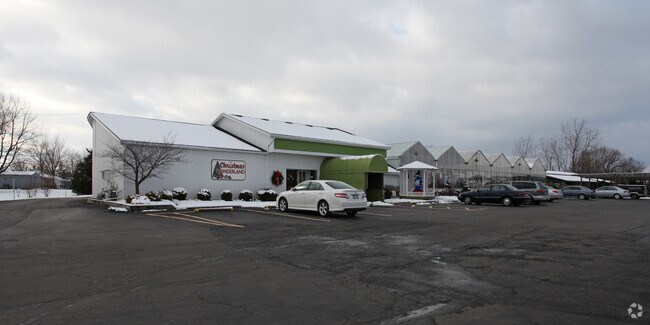
Property Record
1880 State Route 332, Canandaigua, NY 14424
NEARBY LISTINGS FOR SALE OR LEASE
-
-
View all Canandaigua listings for sale on LoopNet.com
Property Detail
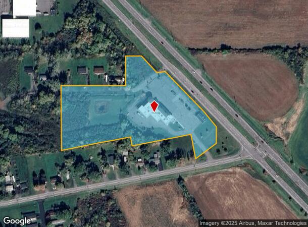
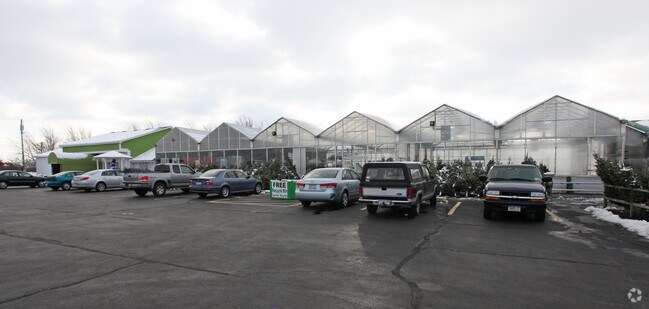
1880 State Route 332
Rochester, NY
Ontario
322400-055-002-0001-007-100
New York
Storebuilding
7.100
2025
6.80 AC
2024
Outlying Ontario County
050603
Rochester
11,022 SF
DEMOGRAPHICS near 1880 State Route 332
1 Mile
3 Mile
5 Mile
2024 Total Population
1,724
11,139
34,620
2029 Population
1,747
11,196
34,678
Pop Growth 2024-2029
+ 1.33%
+ 0.51%
+ 0.17%
Average Age
40
39
42
2024 Total Households
719
4,443
14,893
HH Growth 2024-2029
+ 1.53%
+ 0.50%
+ 0.13%
Median Household Inc
$92,187
$86,599
$72,528
Avg Household Size
2.40
2.50
2.30
2024 Avg HH Vehicles
2.00
2.00
2.00
Median Home Value
$248,275
$194,921
$192,413
Median Year Built
2000
1992
1983
Nearby Places
- Restaurants
- Banks
- Shops
- Fitness
- Groceries
PUBLIC TRANSPORTATION
AIRPORT
Frederick Douglass/Greater Rochester International
DRIVE
WALK
Distance
Frederick Douglass/Greater Rochester International
37 min
25.9 mi
Freight Ports
Albany, NY Port
DRIVE
WALK
Distance
Albany, NY Port
249 min
212.1 mi
Nearby Properties
Address
Land Use
TOTAL SIZE
Lot Size
Zoning
Address
Land Use
TOTAL SIZE
Lot Size
Zoning
2,728 SF
229 AC
05 - COMME
Address
Land Use
TOTAL SIZE
Lot Size
Zoning
800,000 SF
102 AC
IND M
Address
Land Use
TOTAL SIZE
Lot Size
Zoning
74,343 SF
88.50 AC
IND M
Address
Land Use
TOTAL SIZE
Lot Size
Zoning
10,306 SF
29.60 AC
PUD
Address
Land Use
TOTAL SIZE
Lot Size
Zoning
Address
Land Use
TOTAL SIZE
Lot Size
Zoning
3,816 SF
32.10 AC
05 - COMME
Address
Land Use
TOTAL SIZE
Lot Size
Zoning
Address
Land Use
TOTAL SIZE
Lot Size
Zoning
40,000 SF
14.90 AC
05 - COMME
Address
Land Use
TOTAL SIZE
Lot Size
Zoning
48,000 SF
33.60 AC
IND
Address
Land Use
TOTAL SIZE
Lot Size
Zoning
7,735 SF
8.40 AC
03 - MULTI
Address
Land Use
TOTAL SIZE
Lot Size
Zoning
38,000 SF
28 AC
IND
Address
Land Use
TOTAL SIZE
Lot Size
Zoning
115,200 SF
10 AC
PUD
Address
Land Use
TOTAL SIZE
Lot Size
Zoning
51,151 SF
14.20 AC
05 - COMME
Address
Land Use
TOTAL SIZE
Lot Size
Zoning
42.30 AC
05 - COMME
Address
Land Use
TOTAL SIZE
Lot Size
Zoning
193,692 SF
13 AC
M1
Address
Land Use
TOTAL SIZE
Lot Size
Zoning
Address
Land Use
TOTAL SIZE
Lot Size
Zoning
5,320 SF
8.90 AC
PUD
Address
Land Use
TOTAL SIZE
Lot Size
Zoning
192,000 SF
14.90 AC
05 - COMME
Address
Land Use
TOTAL SIZE
Lot Size
Zoning
8,824 SF
15 AC
03 - MULTI
Address
Land Use
TOTAL SIZE
Lot Size
Zoning
108,722 SF
4.84 AC
M1
Address
Land Use
TOTAL SIZE
Lot Size
Zoning
Address
Land Use
TOTAL SIZE
Lot Size
Zoning
29,900 SF
2.10 AC
05 - COMME
Address
Land Use
TOTAL SIZE
Lot Size
Zoning
6,332 SF
11.50 AC
03 - MULTI
Address
Land Use
TOTAL SIZE
Lot Size
Zoning
30,900 SF
10.20 AC
06 - INDUS
Address
Land Use
TOTAL SIZE
Lot Size
Zoning
2,504 SF
6.30 AC
PUD
Address
Land Use
TOTAL SIZE
Lot Size
Zoning
1,232 SF
86.90 AC
MH
Address
Land Use
TOTAL SIZE
Lot Size
Zoning
62,645 SF
11 AC
CC
Address
Land Use
TOTAL SIZE
Lot Size
Zoning
79,600 SF
9.40 AC
03 - MULTI
Address
Land Use
TOTAL SIZE
Lot Size
Zoning
8,000 SF
12.10 AC
MR
Address
Land Use
TOTAL SIZE
Lot Size
Zoning
38,574 SF
2 AC
06 - INDUS
The World's #1 Commercial Real Estate Marketplace
Connect with us
© 2025 CoStar Group
The information above has been obtained from sources believed reliable. While we do not doubt its accuracy we have not verified it and make no guarantee, warranty or representation about it. It is your responsibility to independently confirm its accuracy and completeness. Any projections, opinions, assumptions, or estimates used are for example only and do not represent the current or future performance of the property. The value of this transaction to you depends on tax and other factors which should be evaluated by your tax, financial, and legal advisors. You and your advisors should conduct a careful, independent investigation of the property to determine to your satisfaction the suitability of the property for your needs.