Property Record
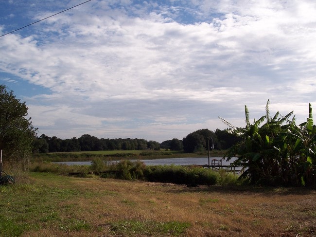
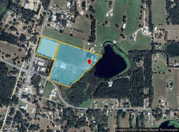
18813 Bent Tree Rd, Altoona, FL 32702
NEARBY LISTINGS FOR SALE OR LEASE
-
-
View all Altoona listings for sale on LoopNet.com
Property Detail
18813 Bent Tree Rd
Orlando-Kissimmee-Sanford, FL
F J Hinsons Plan Of The Town Of Altoona
31-17-27-0100-000-00100
F J HINSONS PLAN OF THE TOWN OF ALTOONA LOTS 1 2 40--LESS BEG AT SW COR OF LOT 40 SAID POINT ALSO BEING THE INTERSECTION OF N R/W LINE OF BENT TREE RD & E R/W LINE OF HINSON RD PER SAID PLAT THENCE RUN N 18-17-43 E ALONG E R/W LINE 25.17 FT TO A POIN
Pasture
Lake
AE
Florida
12069C0210E
1
2024
21.14 AC
2026
Lake County
030104
Orlando
1,232 SF
DEMOGRAPHICS near 18813 Bent Tree Rd
1 Mile
3 Mile
5 Mile
2024 Total Population
1,509
6,073
10,315
2029 Population
1,779
7,073
12,015
Pop Growth 2024-2029
+ 17.89%
+ 16.47%
+ 16.48%
Average Age
51
46
45
2024 Total Households
699
2,554
4,283
HH Growth 2024-2029
+ 17.74%
+ 16.41%
+ 16.39%
Median Household Inc
$69,876
$73,602
$71,778
Avg Household Size
2.10
2.30
2.40
2024 Avg HH Vehicles
2.00
2.00
2.00
Median Home Value
$277,058
$269,245
$261,016
Median Year Built
1986
1987
1986
Nearby Places
Map Layers
Map Styles
 Street
 Aerial
- Restaurants
- Banks
- Shops
- Fitness
- Groceries
PUBLIC TRANSPORTATION
AIRPORT
Orlando Sanford International
DRIVE
WALK
Distance
Orlando Sanford International
63 min
41.2 mi
Freight Ports
Port Canaveral
DRIVE
WALK
Distance
Port Canaveral
128 min
99.9 mi
Nearby Properties
Address
Land Use
TOTAL SIZE
Lot Size
Zoning
Address
Land Use
TOTAL SIZE
Lot Size
Zoning
601,069 SF
110.90 AC
CFD
Address
Land Use
TOTAL SIZE
Lot Size
Zoning
19,830 SF
69.88 AC
R3
Address
Land Use
TOTAL SIZE
Lot Size
Zoning
63,848 SF
6.80 AC
PFD
Address
Land Use
TOTAL SIZE
Lot Size
Zoning
2,000 SF
16.13 AC
PFD
Address
Land Use
TOTAL SIZE
Lot Size
Zoning
50,654 SF
9.83 AC
PFD
Address
Land Use
TOTAL SIZE
Lot Size
Zoning
60,034 SF
73.32 AC
AR
Address
Land Use
TOTAL SIZE
Lot Size
Zoning
48,132 SF
9.50 AC
C2
Address
Land Use
TOTAL SIZE
Lot Size
Zoning
2,000 SF
21.14 AC
PFD
Address
Land Use
TOTAL SIZE
Lot Size
Zoning
641.64 AC
A
Address
Land Use
TOTAL SIZE
Lot Size
Zoning
2,000 SF
28.22 AC
PFD
Address
Land Use
TOTAL SIZE
Lot Size
Zoning
40,448 SF
65.89 AC
CFD
Address
Land Use
TOTAL SIZE
Lot Size
Zoning
624 SF
159.67 AC
A
Address
Land Use
TOTAL SIZE
Lot Size
Zoning
14,012 SF
2.25 AC
RP
Address
Land Use
TOTAL SIZE
Lot Size
Zoning
364.29 AC
Address
Land Use
TOTAL SIZE
Lot Size
Zoning
330.30 AC
A
Address
Land Use
TOTAL SIZE
Lot Size
Zoning
21,577 SF
2.24 AC
C2
Address
Land Use
TOTAL SIZE
Lot Size
Zoning
25,898 SF
3.64 AC
RP
Address
Land Use
TOTAL SIZE
Lot Size
Zoning
13,008 SF
1.83 AC
C2
Address
Land Use
TOTAL SIZE
Lot Size
Zoning
6,863 SF
0.70 AC
C2
Address
Land Use
TOTAL SIZE
Lot Size
Zoning
18,170 SF
12.49 AC
A
Address
Land Use
TOTAL SIZE
Lot Size
Zoning
34,061 SF
4.51 AC
RP
Address
Land Use
TOTAL SIZE
Lot Size
Zoning
11,512 SF
6.92 AC
PFD
Address
Land Use
TOTAL SIZE
Lot Size
Zoning
28,360 SF
2.76 AC
C2
Address
Land Use
TOTAL SIZE
Lot Size
Zoning
13,466 SF
1.11 AC
R12
Address
Land Use
TOTAL SIZE
Lot Size
Zoning
7,600 SF
0.71 AC
C2
Address
Land Use
TOTAL SIZE
Lot Size
Zoning
2,301 SF
36.17 AC
CFD
Address
Land Use
TOTAL SIZE
Lot Size
Zoning
2,000 SF
4.38 AC
PFD
Address
Land Use
TOTAL SIZE
Lot Size
Zoning
192.33 AC
A
Address
Land Use
TOTAL SIZE
Lot Size
Zoning
3,051 SF
56.44 AC
CFD
Address
Land Use
TOTAL SIZE
Lot Size
Zoning
3,609 SF
0.67 AC
C2
The World's #1 Commercial Real Estate Marketplace
Connect with us
© 2025 CoStar Group
The information above has been obtained from sources believed reliable. While we do not doubt its accuracy we have not verified it and make no guarantee, warranty or representation about it. It is your responsibility to independently confirm its accuracy and completeness. Any projections, opinions, assumptions, or estimates used are for example only and do not represent the current or future performance of the property. The value of this transaction to you depends on tax and other factors which should be evaluated by your tax, financial, and legal advisors. You and your advisors should conduct a careful, independent investigation of the property to determine to your satisfaction the suitability of the property for your needs.