Property Record
1882 W Pulaski Hwy, Elkton, MD 21921

Save to a Folder
{{folder.Name}}
{{folder.ListingIds.length}} Properties
{{folder.ListingIds.length}} Property
Create a New Folder
Property Detail
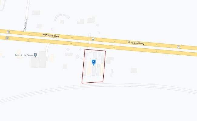
1882 W Pulaski Hwy
05-015502
1.331 ACRE 1882 W PULASKI HWY N/E OF NORTH EAST
Publicstorage
CECIL
BG
Maryland
B and X Area of moderate flood hazard, usually the area between the limits of the 100-year and 500-year floods.
216
2025
1.33 AC
2025
Cecil County
030903
Baltimore
15,200 SF
Philadelphia-Camden-Wilmington, PA-NJ-DE-MD
NEARBY LISTINGS FOR SALE OR LEASE
-
-
View all Elkton listings for sale on LoopNet.com
DEMOGRAPHICS near 1882 W Pulaski Hwy
1 mile
3 mile
5 mile
2025 Total Population
3,830
16,500
35,003
2030 Population
3,975
16,995
36,023
Pop Growth 2025-2030
+ 3.79%
+ 3.00%
+ 2.91%
Average Age
39
40
40
2025 Total Households
1,492
6,296
12,969
HH Growth 2025-2030
+ 3.82%
+ 3.03%
+ 2.98%
Median Household Inc
$84,436
$91,940
$97,736
Avg Household Size
2.50
2.60
2.60
2025 Avg HH Vehicles
2.00
2.00
2.00
Median Home Value
$197,320
$288,204
$330,275
Median Year Built
1996
1995
1992
Nearby Places
Map Layers
Map Styles
 Street
 Aerial
Layers
 Traffic
 Biking
Places
Listings with unknown addresses are not visible on the map
- Restaurants
- Banks
- Shops
- Fitness
- Groceries
PUBLIC TRANSPORTATION
COMMUTER RAIL
Perryville Marc (PENN - WASHINGTON - Maryland Transit Administration)
Drive
Walk
Distance
Perryville Marc (PENN - WASHINGTON - Maryland Transit Administration)
14 min
9.7 mi
Freight Ports
Port of Wilmington, RI
Drive
Walk
Distance
Port of Wilmington, RI
34 min
24.4 mi
Nearby Properties
Address
Land Use
TOTAL SIZE
Lot Size
Zoning
Address
Land Use
TOTAL SIZE
Lot Size
Zoning
10,000 SF
50.29 AC
HCHCO
Address
Land Use
TOTAL SIZE
Lot Size
Zoning
28,506 SF
20.23 AC
RM
Address
Land Use
TOTAL SIZE
Lot Size
Zoning
64,000 SF
99.85 AC
ST
Address
Land Use
TOTAL SIZE
Lot Size
Zoning
502,200 SF
50.87 AC
M2
Address
Land Use
TOTAL SIZE
Lot Size
Zoning
193,440 SF
36.74 AC
M1
Address
Land Use
TOTAL SIZE
Lot Size
Zoning
116,097 SF
64.11 AC
M1
Address
Land Use
TOTAL SIZE
Lot Size
Zoning
9,920 SF
27.68 AC
M1
Address
Land Use
TOTAL SIZE
Lot Size
Zoning
43,634 SF
3.52 AC
I
Address
Land Use
TOTAL SIZE
Lot Size
Zoning
201,694 SF
18.98 AC
BI
Address
Land Use
TOTAL SIZE
Lot Size
Zoning
69,721 SF
59.50 AC
ST
Address
Land Use
TOTAL SIZE
Lot Size
Zoning
23,800 SF
8.72 AC
BI
Address
Land Use
TOTAL SIZE
Lot Size
Zoning
9,944 SF
98.33 AC
UR
Address
Land Use
TOTAL SIZE
Lot Size
Zoning
121,404 SF
19.65 AC
HC
Address
Land Use
TOTAL SIZE
Lot Size
Zoning
142,582 SF
74 AC
RM
Address
Land Use
TOTAL SIZE
Lot Size
Zoning
4,020 SF
76.79 AC
M2
Address
Land Use
TOTAL SIZE
Lot Size
Zoning
60,850 SF
11.75 AC
R1
Address
Land Use
TOTAL SIZE
Lot Size
Zoning
77,905 SF
9.22 AC
I
Address
Land Use
TOTAL SIZE
Lot Size
Zoning
2,400.63 AC
OS
Address
Land Use
TOTAL SIZE
Lot Size
Zoning
105,041 SF
9.89 AC
R1
Address
Land Use
TOTAL SIZE
Lot Size
Zoning
170.50 AC
BG
Address
Land Use
TOTAL SIZE
Lot Size
Zoning
38,400 SF
11.42 AC
BI
Address
Land Use
TOTAL SIZE
Lot Size
Zoning
50,819 SF
1.10 AC
C2
Address
Land Use
TOTAL SIZE
Lot Size
Zoning
1,184 SF
101.71 AC
BI
Address
Land Use
TOTAL SIZE
Lot Size
Zoning
1,800 SF
43.92 AC
CM2
Address
Land Use
TOTAL SIZE
Lot Size
Zoning
30.71 AC
MH
Address
Land Use
TOTAL SIZE
Lot Size
Zoning
76,540 SF
20.58 AC
M1
Address
Land Use
TOTAL SIZE
Lot Size
Zoning
50,920 SF
5.01 AC
M1
Address
Land Use
TOTAL SIZE
Lot Size
Zoning
10,169 SF
18.04 AC
M1
Address
Land Use
TOTAL SIZE
Lot Size
Zoning
2,916 SF
139.53 AC
MEA
Address
Land Use
TOTAL SIZE
Lot Size
Zoning
16.10 AC
SPLIT
The World's #1 Commercial Real Estate Marketplace
Connect with us
© 2026 CoStar Group
The information above has been obtained from sources believed reliable. While we do not doubt its accuracy we have not verified it and make no guarantee, warranty or representation about it. It is your responsibility to independently confirm its accuracy and completeness. Any projections, opinions, assumptions, or estimates used are for example only and do not represent the current or future performance of the property. The value of this transaction to you depends on tax and other factors which should be evaluated by your tax, financial, and legal advisors. You and your advisors should conduct a careful, independent investigation of the property to determine to your satisfaction the suitability of the property for your needs.