Property Record
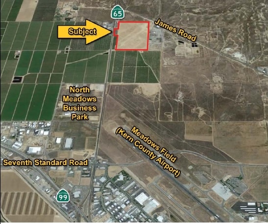
18836 Highway 65, Bakersfield, CA 93308

Property Detail
18836 Highway 65
482-020-16-00-7
SECTION 28 , TOWNSHIP 28 , RANGE 27 , QUARTER NE
Truckterminal
KERN
M2
California
B and X Area of moderate flood hazard, usually the area between the limits of the 100-year and 500-year floods.
2.17 AC
2024
North Bakersfield
2025
Bakersfield
000106
Bakersfield-Delano, CA
NEARBY LISTINGS FOR SALE OR LEASE
DEMOGRAPHICS near 18836 Highway 65
1 mile
3 mile
5 mile
2025 Total Population
186
6,086
74,411
2030 Population
182
6,222
75,313
Pop Growth 2025-2030
(2.15%)
+ 2.23%
+ 1.21%
Average Age
37
36
37
2025 Total Households
20
2,067
25,751
HH Growth 2025-2030
+ 5.00%
+ 2.32%
+ 1.19%
Median Household Inc
$58,999
$68,725
$74,326
Avg Household Size
3.40
2.80
2.80
2025 Avg HH Vehicles
2.00
2.00
2.00
Median Home Value
$607,143
$392,321
$390,124
Median Year Built
1970
1987
1989
Nearby Places
Map Layers
Map Styles
 Street
 Aerial
Layers
 Traffic
 Biking
Places
Listings with unknown addresses are not visible on the map
- Restaurants
- Banks
- Shops
- Fitness
- Groceries
PUBLIC TRANSPORTATION
COMMUTER RAIL
Bakersfield (San Joaquins - Amtrak)
Drive
Walk
Distance
Bakersfield (San Joaquins - Amtrak)
12 min
8.6 mi
AIRPORT
Meadows Field
Drive
Walk
Distance
Meadows Field
10 min
3.9 mi
Freight Ports
The Port of Hueneme
Drive
Walk
Distance
The Port of Hueneme
159 min
128.9 mi
SALE & LEASE HISTORY
LISTING DATE
SALE/LEASE

Sep 24, 2016
For Sale
Nov 05, 2018
For Sale
Nearby Properties
Address
Land Use
TOTAL SIZE
Lot Size
Zoning
Address
Land Use
TOTAL SIZE
Lot Size
Zoning
2,645,250 SF
64.24 AC
M-2 PD H
Address
Land Use
TOTAL SIZE
Lot Size
Zoning
Address
Land Use
TOTAL SIZE
Lot Size
Zoning
2,129 SF
11.42 AC
M-2
Address
Land Use
TOTAL SIZE
Lot Size
Zoning
3,497 SF
31.27 AC
E
Address
Land Use
TOTAL SIZE
Lot Size
Zoning
72,726 SF
13.15 AC
M2
Address
Land Use
TOTAL SIZE
Lot Size
Zoning
50,949 SF
78.05 AC
M-2
Address
Land Use
TOTAL SIZE
Lot Size
Zoning
54,960 SF
15.83 AC
M-2
Address
Land Use
TOTAL SIZE
Lot Size
Zoning
168,559 SF
5.34 AC
M-2
Address
Land Use
TOTAL SIZE
Lot Size
Zoning
12,000 SF
11.90 AC
M-2 PD
Address
Land Use
TOTAL SIZE
Lot Size
Zoning
357,609 SF
21.80 AC
M2
Address
Land Use
TOTAL SIZE
Lot Size
Zoning
7,196 SF
2.24 AC
Address
Land Use
TOTAL SIZE
Lot Size
Zoning
62,536 SF
2.11 AC
M2
Address
Land Use
TOTAL SIZE
Lot Size
Zoning
55,042 SF
0.49 AC
M1
Address
Land Use
TOTAL SIZE
Lot Size
Zoning
22,572 SF
44.92 AC
M-2 PD
Address
Land Use
TOTAL SIZE
Lot Size
Zoning
144,439 SF
10.04 AC
M-2
Address
Land Use
TOTAL SIZE
Lot Size
Zoning
Address
Land Use
TOTAL SIZE
Lot Size
Zoning
7,500 SF
3.28 AC
M-2 PD
Address
Land Use
TOTAL SIZE
Lot Size
Zoning
43,088 SF
2.07 AC
M2
Address
Land Use
TOTAL SIZE
Lot Size
Zoning
49,911 SF
2.20 AC
M-2
Address
Land Use
TOTAL SIZE
Lot Size
Zoning
4.94 AC
Address
Land Use
TOTAL SIZE
Lot Size
Zoning
36,642 SF
1.72 AC
M-2
Address
Land Use
TOTAL SIZE
Lot Size
Zoning
49,953 SF
3.99 AC
M-2-AA
Address
Land Use
TOTAL SIZE
Lot Size
Zoning
24,600 SF
3.79 AC
M-2-AA
Address
Land Use
TOTAL SIZE
Lot Size
Zoning
1.47 AC
M2
Address
Land Use
TOTAL SIZE
Lot Size
Zoning
40,221 SF
6.03 AC
M2
Address
Land Use
TOTAL SIZE
Lot Size
Zoning
85,780 SF
5.38 AC
M-1
Address
Land Use
TOTAL SIZE
Lot Size
Zoning
3,456 SF
1.16 AC
M-2
Address
Land Use
TOTAL SIZE
Lot Size
Zoning
28,800 SF
3.86 AC
M-2 PD
Address
Land Use
TOTAL SIZE
Lot Size
Zoning
27,250 SF
7.19 AC
M2
The World's #1 Commercial Real Estate Marketplace
Connect with us
© 2026 CoStar Group
The information above has been obtained from sources believed reliable. While we do not doubt its accuracy we have not verified it and make no guarantee, warranty or representation about it. It is your responsibility to independently confirm its accuracy and completeness. Any projections, opinions, assumptions, or estimates used are for example only and do not represent the current or future performance of the property. The value of this transaction to you depends on tax and other factors which should be evaluated by your tax, financial, and legal advisors. You and your advisors should conduct a careful, independent investigation of the property to determine to your satisfaction the suitability of the property for your needs.