Property Record
189 Arrowhead Dr, Toccoa, GA 30577

Property Detail
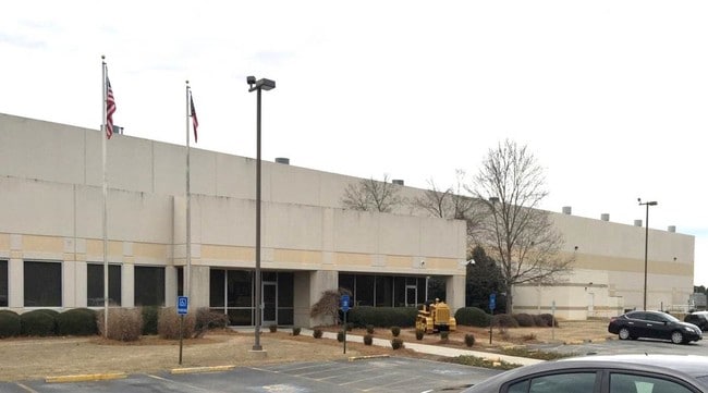
189 Arrowhead Dr
061-008A
PT LOT 22 HAYESTONE-BRADY INDUSTRIAL PARK
Publicstorage
Stephens
CI
Georgia
B and X Area of moderate flood hazard, usually the area between the limits of the 100-year and 500-year floods.
22
2025
10.53 AC
2025
Georgia Northeast
970402
Other Market Areas
109,260 SF
Toccoa, GA
NEARBY LISTINGS FOR SALE OR LEASE
DEMOGRAPHICS near 189 Arrowhead Dr
1 mile
3 mile
5 mile
2025 Total Population
213
2,920
9,040
2030 Population
225
3,011
9,402
Pop Growth 2025-2030
+ 5.63%
+ 3.12%
+ 4.00%
Average Age
44
43
43
2025 Total Households
85
1,138
3,527
HH Growth 2025-2030
+ 5.88%
+ 3.08%
+ 4.05%
Median Household Inc
$74,999
$52,198
$52,415
Avg Household Size
2.50
2.60
2.50
2025 Avg HH Vehicles
3.00
3.00
2.00
Median Home Value
$144,117
$160,798
$182,368
Median Year Built
1992
1989
1989
Nearby Places
Map Layers
Map Styles
 Street
 Aerial
Transit
 Traffic
 Biking
Places
Listings with unknown addresses are not visible on the map
- Restaurants
- Banks
- Shops
- Fitness
- Groceries
PUBLIC TRANSPORTATION
COMMUTER RAIL
Drive
Walk
Distance
14 min
9.2 mi
SALE & LEASE HISTORY
LISTING DATE
SALE/LEASE

Sep 24, 2016
For Sale
Sep 23, 2016
For Sale
Nearby Properties
Address
Land Use
TOTAL SIZE
Lot Size
Zoning
Address
Land Use
TOTAL SIZE
Lot Size
Zoning
215,538 SF
32.32 AC
CI
Address
Land Use
TOTAL SIZE
Lot Size
Zoning
53,410 SF
48.44 AC
CG
Address
Land Use
TOTAL SIZE
Lot Size
Zoning
75,274 SF
39.40 AC
CG
Address
Land Use
TOTAL SIZE
Lot Size
Zoning
154,176 SF
40.32 AC
CI
Address
Land Use
TOTAL SIZE
Lot Size
Zoning
5,100 SF
5.75 AC
CI
Address
Land Use
TOTAL SIZE
Lot Size
Zoning
4,000 SF
4 AC
CI
Address
Land Use
TOTAL SIZE
Lot Size
Zoning
Address
Land Use
TOTAL SIZE
Lot Size
Zoning
261.89 AC
UNZONED RU
Address
Land Use
TOTAL SIZE
Lot Size
Zoning
82,335 SF
6.79 AC
CI
Address
Land Use
TOTAL SIZE
Lot Size
Zoning
30,000 SF
71.21 AC
AI
Address
Land Use
TOTAL SIZE
Lot Size
Zoning
400 SF
95 AC
UNZONED RU
Address
Land Use
TOTAL SIZE
Lot Size
Zoning
30,000 SF
59.30 AC
AI
Address
Land Use
TOTAL SIZE
Lot Size
Zoning
177.71 AC
UNZONED RU
Address
Land Use
TOTAL SIZE
Lot Size
Zoning
Address
Land Use
TOTAL SIZE
Lot Size
Zoning
9,464 SF
4.24 AC
CG
Address
Land Use
TOTAL SIZE
Lot Size
Zoning
88.14 AC
CI
Address
Land Use
TOTAL SIZE
Lot Size
Zoning
19,195 SF
13.74 AC
CI
Address
Land Use
TOTAL SIZE
Lot Size
Zoning
4,020 SF
29.32 AC
CG
Address
Land Use
TOTAL SIZE
Lot Size
Zoning
25,000 SF
28.98 AC
AI
Address
Land Use
TOTAL SIZE
Lot Size
Zoning
800 SF
16 AC
CI
Address
Land Use
TOTAL SIZE
Lot Size
Zoning
29.77 AC
RM
Address
Land Use
TOTAL SIZE
Lot Size
Zoning
5,600 SF
5.44 AC
CG
Address
Land Use
TOTAL SIZE
Lot Size
Zoning
265.79 AC
AR
Address
Land Use
TOTAL SIZE
Lot Size
Zoning
17.85 AC
CI
Address
Land Use
TOTAL SIZE
Lot Size
Zoning
4,607 SF
4 AC
CG
Address
Land Use
TOTAL SIZE
Lot Size
Zoning
13.40 AC
CI
Address
Land Use
TOTAL SIZE
Lot Size
Zoning
864 SF
53.01 AC
RM
Address
Land Use
TOTAL SIZE
Lot Size
Zoning
17.67 AC
CI
Address
Land Use
TOTAL SIZE
Lot Size
Zoning
30,000 SF
17.12 AC
AI
The World's #1 Commercial Real Estate Marketplace
Connect with us
© 2026 CoStar Group
The information above has been obtained from sources believed reliable. While we do not doubt its accuracy we have not verified it and make no guarantee, warranty or representation about it. It is your responsibility to independently confirm its accuracy and completeness. Any projections, opinions, assumptions, or estimates used are for example only and do not represent the current or future performance of the property. The value of this transaction to you depends on tax and other factors which should be evaluated by your tax, financial, and legal advisors. You and your advisors should conduct a careful, independent investigation of the property to determine to your satisfaction the suitability of the property for your needs.