Property Record
189 Jacobstown New Egypt Rd, Wrightstown, NJ 08562


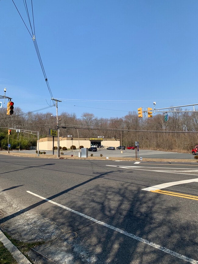
Property Detail
189 Jacobstown New Egypt Rd
Philadelphia-Camden-Wilmington, PA-NJ-DE-MD
Burlington
26-00402-0000-00008
New Jersey
Departmentstore
8
B and X Area of moderate flood hazard, usually the area between the limits of the 100-year and 500-year floods.
2 AC
2024
South Burlington County
2025
Philadelphia
704500
NEARBY LISTINGS FOR SALE OR LEASE
-
-
View all Wrightstown listings for sale on LoopNet.com
DEMOGRAPHICS near 189 Jacobstown New Egypt Rd
1 mile
3 mile
5 mile
2025 Total Population
1,340
12,873
22,232
2030 Population
1,386
13,421
22,932
Pop Growth 2025-2030
+ 3.43%
+ 4.26%
+ 3.15%
Average Age
44
35
38
2025 Total Households
538
4,395
7,544
HH Growth 2025-2030
+ 3.35%
+ 4.12%
+ 3.00%
Median Household Inc
$84,475
$79,231
$92,708
Avg Household Size
2.50
2.80
2.80
2025 Avg HH Vehicles
2.00
2.00
2.00
Median Home Value
$446,511
$435,628
$466,877
Median Year Built
1978
1988
1988
Nearby Places
Map Layers
Map Styles
 Street
 Aerial
Layers
 Traffic
 Biking
Places
Listings with unknown addresses are not visible on the map
- Restaurants
- Banks
- Shops
- Fitness
- Groceries
PUBLIC TRANSPORTATION
AIRPORT
Trenton Mercer
Drive
Walk
Distance
Trenton Mercer
38 min
22.7 mi
Freight Ports
Port of Philadelphia
Drive
Walk
Distance
Port of Philadelphia
52 min
35.6 mi
SALE & LEASE HISTORY
LISTING DATE
SALE/LEASE

Mar 20, 2024
For Sale
Nearby Properties
Address
Land Use
TOTAL SIZE
Lot Size
Zoning
Address
Land Use
TOTAL SIZE
Lot Size
Zoning
Address
Land Use
TOTAL SIZE
Lot Size
Zoning
Address
Land Use
TOTAL SIZE
Lot Size
Zoning
131.54 AC
L1
Address
Land Use
TOTAL SIZE
Lot Size
Zoning
38.06 AC
Address
Land Use
TOTAL SIZE
Lot Size
Zoning
16.15 AC
Address
Land Use
TOTAL SIZE
Lot Size
Zoning
680 SF
10 AC
C4
Address
Land Use
TOTAL SIZE
Lot Size
Zoning
14,136 SF
42.79 AC
AR
Address
Land Use
TOTAL SIZE
Lot Size
Zoning
15.01 AC
L1
Address
Land Use
TOTAL SIZE
Lot Size
Zoning
Address
Land Use
TOTAL SIZE
Lot Size
Zoning
Address
Land Use
TOTAL SIZE
Lot Size
Zoning
118.32 AC
Address
Land Use
TOTAL SIZE
Lot Size
Zoning
5.48 AC
Address
Land Use
TOTAL SIZE
Lot Size
Zoning
3,163 SF
22.95 AC
Address
Land Use
TOTAL SIZE
Lot Size
Zoning
24.11 AC
L1
Address
Land Use
TOTAL SIZE
Lot Size
Zoning
Address
Land Use
TOTAL SIZE
Lot Size
Zoning
2,610 SF
7.04 AC
LI
Address
Land Use
TOTAL SIZE
Lot Size
Zoning
10.02 AC
Address
Land Use
TOTAL SIZE
Lot Size
Zoning
38.58 AC
Address
Land Use
TOTAL SIZE
Lot Size
Zoning
Address
Land Use
TOTAL SIZE
Lot Size
Zoning
Address
Land Use
TOTAL SIZE
Lot Size
Zoning
20,703 SF
0.43 AC
VB
Address
Land Use
TOTAL SIZE
Lot Size
Zoning
10,075 SF
5.72 AC
GC
Address
Land Use
TOTAL SIZE
Lot Size
Zoning
Address
Land Use
TOTAL SIZE
Lot Size
Zoning
Address
Land Use
TOTAL SIZE
Lot Size
Zoning
7,764 SF
1 AC
AR
Address
Land Use
TOTAL SIZE
Lot Size
Zoning
89.96 AC
AR
Address
Land Use
TOTAL SIZE
Lot Size
Zoning
2,862 SF
63.02 AC
AR
Address
Land Use
TOTAL SIZE
Lot Size
Zoning
1.01 AC
C4
Address
Land Use
TOTAL SIZE
Lot Size
Zoning
3.67 AC
Address
Land Use
TOTAL SIZE
Lot Size
Zoning
The World's #1 Commercial Real Estate Marketplace
Connect with us
© 2026 CoStar Group
The information above has been obtained from sources believed reliable. While we do not doubt its accuracy we have not verified it and make no guarantee, warranty or representation about it. It is your responsibility to independently confirm its accuracy and completeness. Any projections, opinions, assumptions, or estimates used are for example only and do not represent the current or future performance of the property. The value of this transaction to you depends on tax and other factors which should be evaluated by your tax, financial, and legal advisors. You and your advisors should conduct a careful, independent investigation of the property to determine to your satisfaction the suitability of the property for your needs.