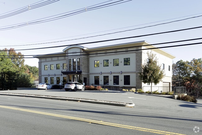
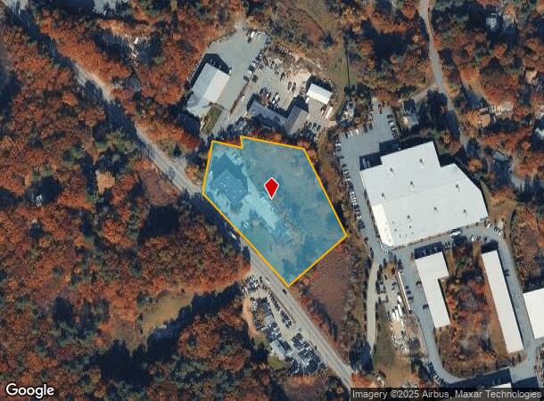
Property Record
189 N Main St, Middleton, MA 01949
NEARBY LISTINGS FOR SALE OR LEASE
Property Detail
189 N Main St
Boston-Cambridge-Newton, MA-NH
Harry Axelrod Prospect Brk & J
MIDD-000016-000000-000081
Essex
Taxexempt
Massachusetts
X
81
25009C0381G
2.96 AC
0
Lawrence/Andover
2025
Boston
212101
DEMOGRAPHICS near 189 N Main St
1 Mile
3 Mile
5 Mile
2024 Total Population
1,929
16,963
71,059
2029 Population
1,937
16,880
70,949
Pop Growth 2024-2029
+ 0.41%
(0.49%)
(0.15%)
Average Age
41
42
43
2024 Total Households
639
5,702
25,640
HH Growth 2024-2029
+ 0.31%
(0.60%)
(0.15%)
Median Household Inc
$164,088
$165,670
$135,053
Avg Household Size
3.00
2.90
2.70
2024 Avg HH Vehicles
3.00
2.00
2.00
Median Home Value
$743,604
$735,725
$697,072
Median Year Built
1985
1985
1977
Nearby Places
Map Layers
Map Styles
 Street
 Aerial
- Restaurants
- Banks
- Shops
- Fitness
- Groceries
PUBLIC TRANSPORTATION
COMMUTER RAIL
Andover (Haverhill Line - Massachusetts Bay Transportation Authority Commuter Rail (Purple Line))
DRIVE
WALK
Distance
Andover (Haverhill Line - Massachusetts Bay Transportation Authority Commuter Rail (Purple Line))
16 min
8.3 mi
AIRPORT
General Edward Lawrence Logan International
DRIVE
WALK
Distance
General Edward Lawrence Logan International
35 min
20.7 mi
Freight Ports
Port of Boston
DRIVE
WALK
Distance
Port of Boston
38 min
23.7 mi
SALE & LEASE HISTORY
LISTING DATE
SALE/LEASE

Oct 09, 2018
For Lease
Nearby Properties
Address
Land Use
TOTAL SIZE
Lot Size
Zoning
Address
Land Use
TOTAL SIZE
Lot Size
Zoning
198.74 AC
R3
Address
Land Use
TOTAL SIZE
Lot Size
Zoning
26.09 AC
R2
Address
Land Use
TOTAL SIZE
Lot Size
Zoning
101,389 SF
20 AC
I
Address
Land Use
TOTAL SIZE
Lot Size
Zoning
40.20 AC
R1B
Address
Land Use
TOTAL SIZE
Lot Size
Zoning
54,302 SF
83.70 AC
R3
Address
Land Use
TOTAL SIZE
Lot Size
Zoning
24.54 AC
M1
Address
Land Use
TOTAL SIZE
Lot Size
Zoning
36,156 SF
754.25 AC
R1A
Address
Land Use
TOTAL SIZE
Lot Size
Zoning
81,746 SF
10.50 AC
R1A
Address
Land Use
TOTAL SIZE
Lot Size
Zoning
24.87 AC
R3
Address
Land Use
TOTAL SIZE
Lot Size
Zoning
351,796 SF
37.30 AC
M1
Address
Land Use
TOTAL SIZE
Lot Size
Zoning
117,214 SF
8.49 AC
R1B
Address
Land Use
TOTAL SIZE
Lot Size
Zoning
72,600 SF
4.01 AC
B
Address
Land Use
TOTAL SIZE
Lot Size
Zoning
59,514 SF
10.40 AC
B
Address
Land Use
TOTAL SIZE
Lot Size
Zoning
Address
Land Use
TOTAL SIZE
Lot Size
Zoning
94,999 SF
B1A
Address
Land Use
TOTAL SIZE
Lot Size
Zoning
77 AC
I
Address
Land Use
TOTAL SIZE
Lot Size
Zoning
1,246.80 AC
R2
Address
Land Use
TOTAL SIZE
Lot Size
Zoning
79,616 SF
M1
Address
Land Use
TOTAL SIZE
Lot Size
Zoning
66,660 SF
B1A
Address
Land Use
TOTAL SIZE
Lot Size
Zoning
4.68 AC
B
Address
Land Use
TOTAL SIZE
Lot Size
Zoning
58,204 SF
15.35 AC
RA
Address
Land Use
TOTAL SIZE
Lot Size
Zoning
56,088 SF
0.18 AC
VR
Address
Land Use
TOTAL SIZE
Lot Size
Zoning
16,114 SF
1 AC
B
Address
Land Use
TOTAL SIZE
Lot Size
Zoning
55,869 SF
7.78 AC
B
Address
Land Use
TOTAL SIZE
Lot Size
Zoning
19.03 AC
M1
Address
Land Use
TOTAL SIZE
Lot Size
Zoning
10,615 SF
24.70 AC
RA
Address
Land Use
TOTAL SIZE
Lot Size
Zoning
24.49 AC
R1B
Address
Land Use
TOTAL SIZE
Lot Size
Zoning
30,180 SF
2.52 AC
M1
Address
Land Use
TOTAL SIZE
Lot Size
Zoning
40.25 AC
R3
Address
Land Use
TOTAL SIZE
Lot Size
Zoning
8.66 AC
R-2
The World's #1 Commercial Real Estate Marketplace
Connect with us
© 2026 CoStar Group
The information above has been obtained from sources believed reliable. While we do not doubt its accuracy we have not verified it and make no guarantee, warranty or representation about it. It is your responsibility to independently confirm its accuracy and completeness. Any projections, opinions, assumptions, or estimates used are for example only and do not represent the current or future performance of the property. The value of this transaction to you depends on tax and other factors which should be evaluated by your tax, financial, and legal advisors. You and your advisors should conduct a careful, independent investigation of the property to determine to your satisfaction the suitability of the property for your needs.