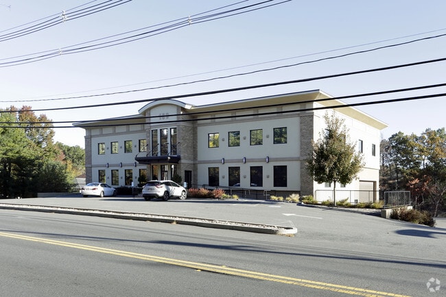
Property Record
189 N Main St, Middleton, MA 01949


Save to a Folder
{{folder.Name}}
{{folder.ListingIds.length}} Properties
{{folder.ListingIds.length}} Property
Create a New Folder
Current Lease Availabilities
Property Detail
189 N Main St
MIDD-000016-000000-000081
Essex
Taxexempt
Massachusetts
M1
81
B and X Area of moderate flood hazard, usually the area between the limits of the 100-year and 500-year floods.
2.96 AC
0
Lawrence/Andover
2025
Boston
212101
Boston-Cambridge-Newton, MA-NH
NEARBY LISTINGS FOR SALE OR LEASE
DEMOGRAPHICS near 189 N Main St
1 mile
3 mile
5 mile
2025 Total Population
1,955
17,639
72,892
2030 Population
2,014
18,225
75,225
Pop Growth 2025-2030
+ 3.02%
+ 3.32%
+ 3.20%
Average Age
42
42
44
2025 Total Households
647
5,945
26,223
HH Growth 2025-2030
+ 2.94%
+ 3.35%
+ 3.32%
Median Household Inc
$179,964
$174,457
$149,477
Avg Household Size
3.00
2.90
2.70
2025 Avg HH Vehicles
3.00
2.00
2.00
Median Home Value
$803,699
$818,061
$769,957
Median Year Built
1985
1986
1977
Nearby Places
Map Layers
Map Styles
 Street
 Aerial
Layers
 Traffic
 Biking
Places
Listings with unknown addresses are not visible on the map
- Restaurants
- Banks
- Shops
- Fitness
- Groceries
PUBLIC TRANSPORTATION
COMMUTER RAIL
Andover (Haverhill Line - Massachusetts Bay Transportation Authority Commuter Rail (Purple Line))
Drive
Walk
Distance
Andover (Haverhill Line - Massachusetts Bay Transportation Authority Commuter Rail (Purple Line))
16 min
8.2 mi
North Wilmington (Haverhill Line - Massachusetts Bay Transportation Authority Commuter Rail (Purple Line))
Drive
Walk
Distance
North Wilmington (Haverhill Line - Massachusetts Bay Transportation Authority Commuter Rail (Purple Line))
20 min
8.7 mi
AIRPORT
General Edward Lawrence Logan International
Drive
Walk
Distance
General Edward Lawrence Logan International
35 min
21.2 mi
Manchester Boston Regional
Drive
Walk
Distance
Manchester Boston Regional
59 min
38.2 mi
Portsmouth International at Pease
Drive
Walk
Distance
Portsmouth International at Pease
55 min
40.6 mi
Freight Ports
Port of Boston
Drive
Walk
Distance
Port of Boston
38 min
23.9 mi
Nearby Properties
Address
Land Use
TOTAL SIZE
Lot Size
Zoning
Address
Land Use
TOTAL SIZE
Lot Size
Zoning
26.09 AC
R2
Address
Land Use
TOTAL SIZE
Lot Size
Zoning
101,389 SF
20 AC
I
Address
Land Use
TOTAL SIZE
Lot Size
Zoning
40.20 AC
R1B
Address
Land Use
TOTAL SIZE
Lot Size
Zoning
24.54 AC
M1
Address
Land Use
TOTAL SIZE
Lot Size
Zoning
36,156 SF
754.25 AC
R1A
Address
Land Use
TOTAL SIZE
Lot Size
Zoning
81,746 SF
10.50 AC
R1A
Address
Land Use
TOTAL SIZE
Lot Size
Zoning
351,796 SF
37.30 AC
M1
Address
Land Use
TOTAL SIZE
Lot Size
Zoning
117,214 SF
8.49 AC
R1B
Address
Land Use
TOTAL SIZE
Lot Size
Zoning
72,600 SF
4.01 AC
B
Address
Land Use
TOTAL SIZE
Lot Size
Zoning
59,514 SF
10.40 AC
B
Address
Land Use
TOTAL SIZE
Lot Size
Zoning
Address
Land Use
TOTAL SIZE
Lot Size
Zoning
94,999 SF
B1A
Address
Land Use
TOTAL SIZE
Lot Size
Zoning
77 AC
I
Address
Land Use
TOTAL SIZE
Lot Size
Zoning
1,246.80 AC
R2
Address
Land Use
TOTAL SIZE
Lot Size
Zoning
79,616 SF
M1
Address
Land Use
TOTAL SIZE
Lot Size
Zoning
66,660 SF
B1A
Address
Land Use
TOTAL SIZE
Lot Size
Zoning
4.68 AC
B
Address
Land Use
TOTAL SIZE
Lot Size
Zoning
58,204 SF
15.35 AC
RA
Address
Land Use
TOTAL SIZE
Lot Size
Zoning
56,088 SF
0.18 AC
VR
Address
Land Use
TOTAL SIZE
Lot Size
Zoning
16,114 SF
1 AC
B
Address
Land Use
TOTAL SIZE
Lot Size
Zoning
55,869 SF
7.78 AC
B
Address
Land Use
TOTAL SIZE
Lot Size
Zoning
19.03 AC
M1
Address
Land Use
TOTAL SIZE
Lot Size
Zoning
10,615 SF
24.70 AC
RA
Address
Land Use
TOTAL SIZE
Lot Size
Zoning
24.49 AC
R1B
Address
Land Use
TOTAL SIZE
Lot Size
Zoning
30,180 SF
2.52 AC
M1
Address
Land Use
TOTAL SIZE
Lot Size
Zoning
40.25 AC
R3
Address
Land Use
TOTAL SIZE
Lot Size
Zoning
8.66 AC
R-2
Address
Land Use
TOTAL SIZE
Lot Size
Zoning
39,612 SF
2.46 AC
M1
Address
Land Use
TOTAL SIZE
Lot Size
Zoning
44,227 SF
M1
Address
Land Use
TOTAL SIZE
Lot Size
Zoning
19,803 SF
2.03 AC
GB
The World's #1 Commercial Real Estate Marketplace
Connect with us
© 2026 CoStar Group
The information above has been obtained from sources believed reliable. While we do not doubt its accuracy we have not verified it and make no guarantee, warranty or representation about it. It is your responsibility to independently confirm its accuracy and completeness. Any projections, opinions, assumptions, or estimates used are for example only and do not represent the current or future performance of the property. The value of this transaction to you depends on tax and other factors which should be evaluated by your tax, financial, and legal advisors. You and your advisors should conduct a careful, independent investigation of the property to determine to your satisfaction the suitability of the property for your needs.