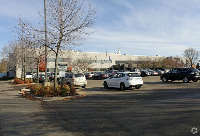
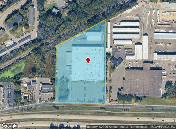
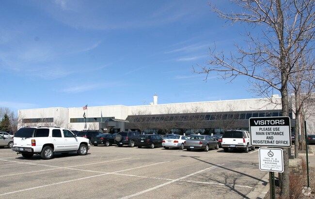
Property Record
18930 W 78Th St, Chanhassen, MN 55317

NEARBY LISTINGS FOR SALE OR LEASE
Property Detail
18930 W 78Th St
Minneapolis-St. Paul-Bloomington, MN-WI
Unplatted 07 116 22
07-116-22-33-0005
UNPLATTED 07 116 22 THAT PART OF E 479.05 FT OF W 628.05 FT OF SW 1/4 LYING S OF RR R/W AND LYING N OF HWY IRREGULAR
Industrialgeneral
Hennepin
X
Minnesota
27019C0232D
7.56 AC
2024
Southwest
2024
Minneapolis/St Paul
026014
DEMOGRAPHICS near 18930 W 78Th St
1 Mile
3 Mile
5 Mile
2024 Total Population
7,482
50,459
117,316
2029 Population
7,605
51,200
118,736
Pop Growth 2024-2029
+ 1.64%
+ 1.47%
+ 1.21%
Average Age
42
42
41
2024 Total Households
2,973
19,006
45,781
HH Growth 2024-2029
+ 1.98%
+ 1.57%
+ 1.19%
Median Household Inc
$111,801
$124,677
$112,952
Avg Household Size
2.50
2.60
2.50
2024 Avg HH Vehicles
2.00
2.00
2.00
Median Home Value
$438,595
$457,919
$444,320
Median Year Built
1985
1987
1986
Nearby Places
Map Layers
Map Styles
 Street
 Aerial
- Restaurants
- Banks
- Shops
- Fitness
- Groceries
PUBLIC TRANSPORTATION
AIRPORT
Minneapolis-St Paul International/Wold-Chamberlain
DRIVE
WALK
Distance
Minneapolis-St Paul International/Wold-Chamberlain
25 min
16.6 mi
Nearby Properties
Address
Land Use
TOTAL SIZE
Lot Size
Zoning
Address
Land Use
TOTAL SIZE
Lot Size
Zoning
136,782 SF
6.17 AC
Address
Land Use
TOTAL SIZE
Lot Size
Zoning
314,234 SF
2.31 AC
RM25
Address
Land Use
TOTAL SIZE
Lot Size
Zoning
73,017 SF
10.04 AC
Address
Land Use
TOTAL SIZE
Lot Size
Zoning
1.11 AC
Address
Land Use
TOTAL SIZE
Lot Size
Zoning
8.66 AC
Address
Land Use
TOTAL SIZE
Lot Size
Zoning
3,073 SF
155.36 AC
Address
Land Use
TOTAL SIZE
Lot Size
Zoning
330,000 SF
57.81 AC
Address
Land Use
TOTAL SIZE
Lot Size
Zoning
3.69 AC
Address
Land Use
TOTAL SIZE
Lot Size
Zoning
47,443 SF
10.11 AC
RM25
Address
Land Use
TOTAL SIZE
Lot Size
Zoning
24,363 SF
18.56 AC
Address
Land Use
TOTAL SIZE
Lot Size
Zoning
21.72 AC
Address
Land Use
TOTAL SIZE
Lot Size
Zoning
94,387 SF
14.77 AC
Address
Land Use
TOTAL SIZE
Lot Size
Zoning
17.67 AC
R4
Address
Land Use
TOTAL SIZE
Lot Size
Zoning
3.20 AC
Address
Land Use
TOTAL SIZE
Lot Size
Zoning
85,425 SF
8.21 AC
C-COM
Address
Land Use
TOTAL SIZE
Lot Size
Zoning
34,100 SF
12.99 AC
Address
Land Use
TOTAL SIZE
Lot Size
Zoning
79,847 SF
5.74 AC
RM25
Address
Land Use
TOTAL SIZE
Lot Size
Zoning
301,389 SF
36.47 AC
Address
Land Use
TOTAL SIZE
Lot Size
Zoning
16,576 SF
4.84 AC
Address
Land Use
TOTAL SIZE
Lot Size
Zoning
181,405 SF
14.06 AC
Address
Land Use
TOTAL SIZE
Lot Size
Zoning
16.38 AC
Address
Land Use
TOTAL SIZE
Lot Size
Zoning
140,800 SF
12.39 AC
Address
Land Use
TOTAL SIZE
Lot Size
Zoning
8.49 AC
Address
Land Use
TOTAL SIZE
Lot Size
Zoning
235,558 SF
32.85 AC
I-5
Address
Land Use
TOTAL SIZE
Lot Size
Zoning
30,970 SF
3.46 AC
Address
Land Use
TOTAL SIZE
Lot Size
Zoning
13.35 AC
Address
Land Use
TOTAL SIZE
Lot Size
Zoning
19.47 AC
Address
Land Use
TOTAL SIZE
Lot Size
Zoning
34,423 SF
2.02 AC
Address
Land Use
TOTAL SIZE
Lot Size
Zoning
88,205 SF
8.91 AC
Address
Land Use
TOTAL SIZE
Lot Size
Zoning
6 AC
I-GEN
The World's #1 Commercial Real Estate Marketplace
Connect with us
© 2026 CoStar Group
The information above has been obtained from sources believed reliable. While we do not doubt its accuracy we have not verified it and make no guarantee, warranty or representation about it. It is your responsibility to independently confirm its accuracy and completeness. Any projections, opinions, assumptions, or estimates used are for example only and do not represent the current or future performance of the property. The value of this transaction to you depends on tax and other factors which should be evaluated by your tax, financial, and legal advisors. You and your advisors should conduct a careful, independent investigation of the property to determine to your satisfaction the suitability of the property for your needs.