Property Record
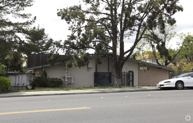
18949 Redwood Rd, Castro Valley, CA 94546


NEARBY LISTINGS FOR SALE OR LEASE
-
-
View all Castro Valley listings for sale on LoopNet.com
Property Detail
18949 Redwood Rd
084D-1358-001-02
Tract 1677
Hospitalpublic
LOT: 00002 BLK: 0001 AR: 084D PAGE: 1358
X
Alameda
06001C0279G
California
2024
0.92 AC
2025
Hayward/Castro Valley
430700
East Bay/Oakland
15,998 SF
Oakland-Hayward-Berkeley, CA
DEMOGRAPHICS near 18949 Redwood Rd
1 Mile
3 Mile
5 Mile
2024 Total Population
22,334
127,626
302,732
2029 Population
21,589
123,306
292,461
Pop Growth 2024-2029
(3.34%)
(3.38%)
(3.39%)
Average Age
42
41
41
2024 Total Households
7,642
43,786
100,291
HH Growth 2024-2029
(3.53%)
(3.56%)
(3.58%)
Median Household Inc
$117,918
$101,125
$98,093
Avg Household Size
2.90
2.80
2.90
2024 Avg HH Vehicles
2.00
2.00
2.00
Median Home Value
$903,700
$832,613
$783,717
Median Year Built
1959
1966
1964
Nearby Places
Map Layers
Map Styles
 Street
 Aerial
- Restaurants
- Banks
- Shops
- Fitness
- Groceries
PUBLIC TRANSPORTATION
COMMUTER RAIL
Hayward Amtrak (Capitol Corridor - Amtrak)
DRIVE
WALK
Distance
Hayward Amtrak (Capitol Corridor - Amtrak)
8 min
3.7 mi
Hayward (Capitol Corridor - Capitol Corridor Joint Powers Authority)
DRIVE
WALK
Distance
Hayward (Capitol Corridor - Capitol Corridor Joint Powers Authority)
8 min
3.7 mi
AIRPORT
Metro Oakland International
DRIVE
WALK
Distance
Metro Oakland International
16 min
11.2 mi
San Francisco International
DRIVE
WALK
Distance
San Francisco International
36 min
25.8 mi
Norman Y Mineta San Jose International
DRIVE
WALK
Distance
Norman Y Mineta San Jose International
41 min
30.4 mi
Freight Ports
Port of Oakland
DRIVE
WALK
Distance
Port of Oakland
21 min
15.8 mi
Nearby Properties
Address
Land Use
TOTAL SIZE
Lot Size
Zoning
Address
Land Use
TOTAL SIZE
Lot Size
Zoning
4.90 AC
Address
Land Use
TOTAL SIZE
Lot Size
Zoning
2.48 AC
Address
Land Use
TOTAL SIZE
Lot Size
Zoning
1.50 AC
Address
Land Use
TOTAL SIZE
Lot Size
Zoning
187,926 SF
1.19 AC
Address
Land Use
TOTAL SIZE
Lot Size
Zoning
310,072 SF
14.96 AC
Address
Land Use
TOTAL SIZE
Lot Size
Zoning
228,736 SF
5.95 AC
Address
Land Use
TOTAL SIZE
Lot Size
Zoning
169,371 SF
4.63 AC
Address
Land Use
TOTAL SIZE
Lot Size
Zoning
625,101 SF
35.95 AC
Address
Land Use
TOTAL SIZE
Lot Size
Zoning
105,730 SF
5.32 AC
Address
Land Use
TOTAL SIZE
Lot Size
Zoning
119,800 SF
5.72 AC
Address
Land Use
TOTAL SIZE
Lot Size
Zoning
92,534 SF
3.04 AC
Address
Land Use
TOTAL SIZE
Lot Size
Zoning
25,000 SF
1.24 AC
Address
Land Use
TOTAL SIZE
Lot Size
Zoning
147,525 SF
8.18 AC
Address
Land Use
TOTAL SIZE
Lot Size
Zoning
124,513 SF
7.52 AC
Address
Land Use
TOTAL SIZE
Lot Size
Zoning
61,330 SF
5.78 AC
Address
Land Use
TOTAL SIZE
Lot Size
Zoning
42,359 SF
3.79 AC
Address
Land Use
TOTAL SIZE
Lot Size
Zoning
61,355 SF
4.31 AC
Address
Land Use
TOTAL SIZE
Lot Size
Zoning
56,410 SF
5.01 AC
Address
Land Use
TOTAL SIZE
Lot Size
Zoning
46,540 SF
2.92 AC
R5D
Address
Land Use
TOTAL SIZE
Lot Size
Zoning
78,326 SF
6.88 AC
Address
Land Use
TOTAL SIZE
Lot Size
Zoning
138,960 SF
2.62 AC
Address
Land Use
TOTAL SIZE
Lot Size
Zoning
67,434 SF
3.68 AC
Address
Land Use
TOTAL SIZE
Lot Size
Zoning
48,998 SF
3.28 AC
Address
Land Use
TOTAL SIZE
Lot Size
Zoning
61,578 SF
2.53 AC
Address
Land Use
TOTAL SIZE
Lot Size
Zoning
44,796 SF
2.14 AC
Address
Land Use
TOTAL SIZE
Lot Size
Zoning
40,385 SF
1.42 AC
Address
Land Use
TOTAL SIZE
Lot Size
Zoning
3,499 SF
0.51 AC
Address
Land Use
TOTAL SIZE
Lot Size
Zoning
27,884 SF
0.91 AC
Address
Land Use
TOTAL SIZE
Lot Size
Zoning
Address
Land Use
TOTAL SIZE
Lot Size
Zoning
43,892 SF
2.38 AC
The World's #1 Commercial Real Estate Marketplace
Connect with us
© 2025 CoStar Group
The information above has been obtained from sources believed reliable. While we do not doubt its accuracy we have not verified it and make no guarantee, warranty or representation about it. It is your responsibility to independently confirm its accuracy and completeness. Any projections, opinions, assumptions, or estimates used are for example only and do not represent the current or future performance of the property. The value of this transaction to you depends on tax and other factors which should be evaluated by your tax, financial, and legal advisors. You and your advisors should conduct a careful, independent investigation of the property to determine to your satisfaction the suitability of the property for your needs.