Property Record
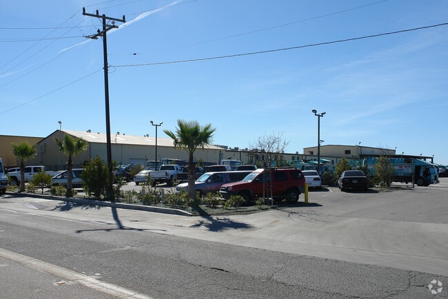
1895 Lirio Ave, Ventura, CA 93004


NEARBY LISTINGS FOR SALE OR LEASE
Property Detail
1895 Lirio Ave
128-0-060-325
Rancho Santa Paula Y Saticoy
Lightindustrial
PR APN 1280060105
A
Ventura
06111C0770E
California
2024
2.98 AC
2025
Ventura
001303
Los Angeles
55,914 SF
Oxnard-Thousand Oaks-Ventura, CA
DEMOGRAPHICS near 1895 Lirio Ave
1 Mile
3 Mile
5 Mile
2024 Total Population
6,951
47,331
139,448
2029 Population
6,826
46,472
137,639
Pop Growth 2024-2029
(1.80%)
(1.81%)
(1.30%)
Average Age
40
40
40
2024 Total Households
2,344
16,078
45,643
HH Growth 2024-2029
(2.01%)
(1.95%)
(1.34%)
Median Household Inc
$88,616
$105,737
$97,183
Avg Household Size
2.80
2.80
3.00
2024 Avg HH Vehicles
2.00
2.00
2.00
Median Home Value
$644,274
$693,119
$691,525
Median Year Built
1983
1981
1980
Nearby Places
Map Layers
Map Styles
 Street
 Aerial
- Restaurants
- Banks
- Shops
- Fitness
- Groceries
PUBLIC TRANSPORTATION
COMMUTER RAIL
DRIVE
WALK
Distance
12 min
5.3 mi
Oxnard (Ventura County Line - Southern California Regional Rail Authority (Metrolink))
DRIVE
WALK
Distance
Oxnard (Ventura County Line - Southern California Regional Rail Authority (Metrolink))
14 min
7.5 mi
Freight Ports
The Port of Hueneme
DRIVE
WALK
Distance
The Port of Hueneme
23 min
12.0 mi
Nearby Properties
Address
Land Use
TOTAL SIZE
Lot Size
Zoning
Address
Land Use
TOTAL SIZE
Lot Size
Zoning
480,733 SF
14.26 AC
Address
Land Use
TOTAL SIZE
Lot Size
Zoning
6.14 AC
Address
Land Use
TOTAL SIZE
Lot Size
Zoning
205,396 SF
12.48 AC
Address
Land Use
TOTAL SIZE
Lot Size
Zoning
24,154 SF
12.67 AC
R3-1
Address
Land Use
TOTAL SIZE
Lot Size
Zoning
138,475 SF
2.77 AC
Address
Land Use
TOTAL SIZE
Lot Size
Zoning
138,475 SF
2.77 AC
Address
Land Use
TOTAL SIZE
Lot Size
Zoning
4.76 AC
Address
Land Use
TOTAL SIZE
Lot Size
Zoning
151,422 SF
6.67 AC
Address
Land Use
TOTAL SIZE
Lot Size
Zoning
4.41 AC
Address
Land Use
TOTAL SIZE
Lot Size
Zoning
102,046 SF
3.72 AC
Address
Land Use
TOTAL SIZE
Lot Size
Zoning
14,098 SF
6.46 AC
Address
Land Use
TOTAL SIZE
Lot Size
Zoning
87,804 SF
6.68 AC
RPD-
Address
Land Use
TOTAL SIZE
Lot Size
Zoning
339.53 AC
Address
Land Use
TOTAL SIZE
Lot Size
Zoning
3,725 SF
429.19 AC
AE
Address
Land Use
TOTAL SIZE
Lot Size
Zoning
1.09 AC
Address
Land Use
TOTAL SIZE
Lot Size
Zoning
45,925 SF
1.68 AC
Address
Land Use
TOTAL SIZE
Lot Size
Zoning
64,976 SF
3 AC
R3-5D
Address
Land Use
TOTAL SIZE
Lot Size
Zoning
46,507 SF
1.02 AC
C1A
Address
Land Use
TOTAL SIZE
Lot Size
Zoning
53,658 SF
3.18 AC
RPD-1
Address
Land Use
TOTAL SIZE
Lot Size
Zoning
10,995 SF
17.26 AC
M2
Address
Land Use
TOTAL SIZE
Lot Size
Zoning
1.59 AC
POD
Address
Land Use
TOTAL SIZE
Lot Size
Zoning
34,819 SF
1.28 AC
R3-2
Address
Land Use
TOTAL SIZE
Lot Size
Zoning
3.89 AC
7
Address
Land Use
TOTAL SIZE
Lot Size
Zoning
2.88 AC
POD
Address
Land Use
TOTAL SIZE
Lot Size
Zoning
1.52 AC
Address
Land Use
TOTAL SIZE
Lot Size
Zoning
5.01 AC
R3PD
Address
Land Use
TOTAL SIZE
Lot Size
Zoning
153.13 AC
AE/MRP
Address
Land Use
TOTAL SIZE
Lot Size
Zoning
1.18 AC
Address
Land Use
TOTAL SIZE
Lot Size
Zoning
41.50 AC
AE/MRP
The World's #1 Commercial Real Estate Marketplace
Connect with us
© 2025 CoStar Group
The information above has been obtained from sources believed reliable. While we do not doubt its accuracy we have not verified it and make no guarantee, warranty or representation about it. It is your responsibility to independently confirm its accuracy and completeness. Any projections, opinions, assumptions, or estimates used are for example only and do not represent the current or future performance of the property. The value of this transaction to you depends on tax and other factors which should be evaluated by your tax, financial, and legal advisors. You and your advisors should conduct a careful, independent investigation of the property to determine to your satisfaction the suitability of the property for your needs.