Property Record
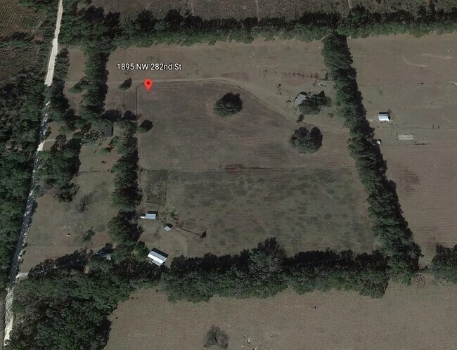
1895 Nw 282Nd St, Newberry, FL 32669


NEARBY LISTINGS FOR SALE OR LEASE
Property Detail
1895 Nw 282Nd St
01881-001-001
S1/2 OF SW1/4 LESS S 529.70 FT OF THE W 825.09 FT LESS COM SW COR SEC N 589.70 FT POB N 208.71 FT E 326.38 FT M/L S 208.71 FT W 326.38 FT M/L POB LESS R/W) LESS COM SW COR SEC N 1042.17 FT POB N 270.50 FT N 87 DEG E 2591.19 FT S 732.14 FT S 87 DEG W
Vacantlandnec
Alachua
X
Florida
12041C0220E
35.32 AC
2023
Gainesville
2025
Other Market Areas
002210
Gainesville, FL
DEMOGRAPHICS near 1895 Nw 282Nd St
1 Mile
3 Mile
5 Mile
2024 Total Population
49
5,108
10,787
2029 Population
53
5,486
11,715
Pop Growth 2024-2029
+ 8.16%
+ 7.40%
+ 8.60%
Average Age
36
39
40
2024 Total Households
18
1,896
4,027
HH Growth 2024-2029
+ 5.56%
+ 7.49%
+ 8.91%
Median Household Inc
$79,167
$77,426
$74,581
Avg Household Size
2.90
2.70
2.70
2024 Avg HH Vehicles
2.00
2.00
2.00
Median Home Value
$235,714
$234,494
$230,351
Median Year Built
2000
1999
1998
Nearby Places
Map Layers
Map Styles
 Street
 Aerial
- Restaurants
- Banks
- Shops
- Fitness
- Groceries
PUBLIC TRANSPORTATION
AIRPORT
Gainesville Regional
DRIVE
WALK
Distance
Gainesville Regional
56 min
27.0 mi
Freight Ports
Jacksonville Port
DRIVE
WALK
Distance
Jacksonville Port
142 min
96.8 mi
SALE & LEASE HISTORY
LISTING DATE
SALE/LEASE

Mar 30, 2023
For Sale
Nearby Properties
Address
Land Use
TOTAL SIZE
Lot Size
Zoning
Address
Land Use
TOTAL SIZE
Lot Size
Zoning
347,860 SF
9.62 AC
RSF-1
Address
Land Use
TOTAL SIZE
Lot Size
Zoning
568,885 SF
56.52 AC
RSF-2
Address
Land Use
TOTAL SIZE
Lot Size
Zoning
62,747 SF
9.96 AC
RSF-2
Address
Land Use
TOTAL SIZE
Lot Size
Zoning
10,950 SF
1.58 AC
C4
Address
Land Use
TOTAL SIZE
Lot Size
Zoning
42,650 SF
9.20 AC
CI
Address
Land Use
TOTAL SIZE
Lot Size
Zoning
28,103 SF
0.75 AC
PD
Address
Land Use
TOTAL SIZE
Lot Size
Zoning
24,500 SF
14.88 AC
I
Address
Land Use
TOTAL SIZE
Lot Size
Zoning
42,280 SF
6.94 AC
CA
Address
Land Use
TOTAL SIZE
Lot Size
Zoning
30,209 SF
9.86 AC
RMF-1
Address
Land Use
TOTAL SIZE
Lot Size
Zoning
52,224 SF
9.06 AC
CA
Address
Land Use
TOTAL SIZE
Lot Size
Zoning
20,925 SF
3.91 AC
MU
Address
Land Use
TOTAL SIZE
Lot Size
Zoning
19,925 SF
2.68 AC
CI
Address
Land Use
TOTAL SIZE
Lot Size
Zoning
11,570 SF
40 AC
A
Address
Land Use
TOTAL SIZE
Lot Size
Zoning
13,125 SF
3.04 AC
ILW
Address
Land Use
TOTAL SIZE
Lot Size
Zoning
4,200 SF
10.17 AC
I
Address
Land Use
TOTAL SIZE
Lot Size
Zoning
13,580 SF
0.24 AC
PD
Address
Land Use
TOTAL SIZE
Lot Size
Zoning
7,387 SF
1.65 AC
PF
Address
Land Use
TOTAL SIZE
Lot Size
Zoning
7,832 SF
0.14 AC
PD
Address
Land Use
TOTAL SIZE
Lot Size
Zoning
54.97 AC
PF
Address
Land Use
TOTAL SIZE
Lot Size
Zoning
7,080 SF
0.17 AC
PD
Address
Land Use
TOTAL SIZE
Lot Size
Zoning
13,772 SF
0.22 AC
PD
Address
Land Use
TOTAL SIZE
Lot Size
Zoning
8,190 SF
1 AC
ILW
Address
Land Use
TOTAL SIZE
Lot Size
Zoning
Address
Land Use
TOTAL SIZE
Lot Size
Zoning
15,184 SF
9.50 AC
I
Address
Land Use
TOTAL SIZE
Lot Size
Zoning
8,331 SF
2.50 AC
RSF-1
Address
Land Use
TOTAL SIZE
Lot Size
Zoning
960 SF
41.02 AC
PF
Address
Land Use
TOTAL SIZE
Lot Size
Zoning
10,850 SF
1 AC
CI
Address
Land Use
TOTAL SIZE
Lot Size
Zoning
5,280 SF
1.28 AC
CI
The World's #1 Commercial Real Estate Marketplace
Connect with us
© 2026 CoStar Group
The information above has been obtained from sources believed reliable. While we do not doubt its accuracy we have not verified it and make no guarantee, warranty or representation about it. It is your responsibility to independently confirm its accuracy and completeness. Any projections, opinions, assumptions, or estimates used are for example only and do not represent the current or future performance of the property. The value of this transaction to you depends on tax and other factors which should be evaluated by your tax, financial, and legal advisors. You and your advisors should conduct a careful, independent investigation of the property to determine to your satisfaction the suitability of the property for your needs.