Property Record
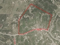
18970 Bandera Rd, Helotes, TX 78023

Property Detail
18970 Bandera Rd
San Antonio-New Braunfels, TX
CB 4510 P-1 (211.311), P-2(27.45), CB 4582 P-1 (5.869),CB 4585 P-2(24.474), CB 4586 P-1 (10.275), CB4593 P-1 (70.6786), P-3 (.4744) 2008-REMAINS PER SPLIT PER DEED 13147/1880 EXE 9-26-07
04510-000-0015
BEXAR
Privatepreserveopenspacevacantlandforestlandconservation
Texas
A Areas with a 1% annual chance of flooding and a 26% chance of flooding over the life of a 30-year mortgage.
15
2024
350.53 AC
2025
Far Northwest
182103
San Antonio
NEARBY LISTINGS FOR SALE OR LEASE
DEMOGRAPHICS near 18970 Bandera Rd
1 mile
3 mile
5 mile
2025 Total Population
103
1,357
6,900
2030 Population
114
1,468
7,437
Pop Growth 2025-2030
+ 10.68%
+ 8.18%
+ 7.78%
Average Age
35
39
41
2025 Total Households
32
435
2,298
HH Growth 2025-2030
+ 9.38%
+ 8.05%
+ 7.88%
Median Household Inc
$135,000
$138,541
$140,444
Avg Household Size
3.30
3.10
3.00
2025 Avg HH Vehicles
2.00
3.00
3.00
Median Home Value
$456,249
$498,989
$569,187
Median Year Built
2011
2010
2010
Nearby Places
Map Layers
Map Styles
 Street
 Aerial
Layers
 Traffic
 Biking
Places
Listings with unknown addresses are not visible on the map
- Restaurants
- Banks
- Shops
- Fitness
- Groceries
PUBLIC TRANSPORTATION
AIRPORT
San Antonio International
Drive
Walk
Distance
San Antonio International
35 min
24.5 mi
Freight Ports
Calhoun Port
Drive
Walk
Distance
Calhoun Port
213 min
177.7 mi
Nearby Properties
Address
Land Use
TOTAL SIZE
Lot Size
Zoning
Address
Land Use
TOTAL SIZE
Lot Size
Zoning
4,672 SF
1.17 AC
Address
Land Use
TOTAL SIZE
Lot Size
Zoning
Address
Land Use
TOTAL SIZE
Lot Size
Zoning
395.75 AC
Address
Land Use
TOTAL SIZE
Lot Size
Zoning
546.78 AC
Address
Land Use
TOTAL SIZE
Lot Size
Zoning
290.42 AC
Address
Land Use
TOTAL SIZE
Lot Size
Zoning
535.23 AC
Address
Land Use
TOTAL SIZE
Lot Size
Zoning
134.94 AC
Address
Land Use
TOTAL SIZE
Lot Size
Zoning
167.90 AC
Address
Land Use
TOTAL SIZE
Lot Size
Zoning
131.64 AC
Address
Land Use
TOTAL SIZE
Lot Size
Zoning
42,240 SF
3 AC
Address
Land Use
TOTAL SIZE
Lot Size
Zoning
151.51 AC
Address
Land Use
TOTAL SIZE
Lot Size
Zoning
24,940 SF
2.72 AC
Address
Land Use
TOTAL SIZE
Lot Size
Zoning
143.59 AC
Address
Land Use
TOTAL SIZE
Lot Size
Zoning
146.50 AC
Address
Land Use
TOTAL SIZE
Lot Size
Zoning
17,466 SF
5.13 AC
Address
Land Use
TOTAL SIZE
Lot Size
Zoning
83.60 AC
Address
Land Use
TOTAL SIZE
Lot Size
Zoning
8,813 SF
5.34 AC
Address
Land Use
TOTAL SIZE
Lot Size
Zoning
6,848 SF
18.22 AC
Address
Land Use
TOTAL SIZE
Lot Size
Zoning
171.15 AC
Address
Land Use
TOTAL SIZE
Lot Size
Zoning
2,781 SF
40.56 AC
Address
Land Use
TOTAL SIZE
Lot Size
Zoning
37.27 AC
Address
Land Use
TOTAL SIZE
Lot Size
Zoning
95.53 AC
Address
Land Use
TOTAL SIZE
Lot Size
Zoning
3,404 SF
30.59 AC
Address
Land Use
TOTAL SIZE
Lot Size
Zoning
13,249 SF
153.26 AC
Address
Land Use
TOTAL SIZE
Lot Size
Zoning
2,936 SF
46.18 AC
Address
Land Use
TOTAL SIZE
Lot Size
Zoning
992 SF
33.93 AC
Address
Land Use
TOTAL SIZE
Lot Size
Zoning
15,115 SF
96.30 AC
Address
Land Use
TOTAL SIZE
Lot Size
Zoning
3,062 SF
65.39 AC
Address
Land Use
TOTAL SIZE
Lot Size
Zoning
45.53 AC
The World's #1 Commercial Real Estate Marketplace
Connect with us
© 2026 CoStar Group
The information above has been obtained from sources believed reliable. While we do not doubt its accuracy we have not verified it and make no guarantee, warranty or representation about it. It is your responsibility to independently confirm its accuracy and completeness. Any projections, opinions, assumptions, or estimates used are for example only and do not represent the current or future performance of the property. The value of this transaction to you depends on tax and other factors which should be evaluated by your tax, financial, and legal advisors. You and your advisors should conduct a careful, independent investigation of the property to determine to your satisfaction the suitability of the property for your needs.