Property Record
1899 Waldemere St, Sarasota, FL 34239


NEARBY LISTINGS FOR SALE OR LEASE
-
-
View all Sarasota listings for sale on LoopNet.com
Property Detail
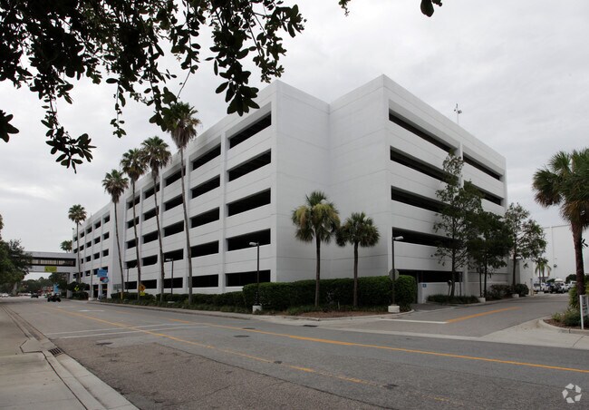
1899 Waldemere St
North Port-Sarasota-Bradenton, FL
Pine Grove
2037-08-0056
LASULA PARKING GARAGE LOTS 20 THRU 33 INCL BLK A PINE GROVE ORS 835/56 856/130 857/921 866/805 871/169 & 952/716
Hospitalpublic
Sarasota
X
Florida
12115C0133G
20-33
2024
2.09 AC
2025
Sarasota
000602
Tampa/St Petersburg
421,582 SF
DEMOGRAPHICS near 1899 Waldemere St
1 Mile
3 Mile
5 Mile
2024 Total Population
9,748
79,478
171,362
2029 Population
11,098
91,494
197,565
Pop Growth 2024-2029
+ 13.85%
+ 15.12%
+ 15.29%
Average Age
48
47
48
2024 Total Households
4,420
36,733
78,394
HH Growth 2024-2029
+ 13.73%
+ 15.33%
+ 15.54%
Median Household Inc
$71,687
$67,059
$70,414
Avg Household Size
2.00
2.00
2.10
2024 Avg HH Vehicles
2.00
2.00
2.00
Median Home Value
$471,666
$371,221
$356,243
Median Year Built
1968
1975
1977
Nearby Places
Map Layers
Map Styles
 Street
 Aerial
- Restaurants
- Banks
- Shops
- Fitness
- Groceries
PUBLIC TRANSPORTATION
AIRPORT
Sarasota/Bradenton International
DRIVE
WALK
Distance
Sarasota/Bradenton International
14 min
6.7 mi
Nearby Properties
Address
Land Use
TOTAL SIZE
Lot Size
Zoning
Address
Land Use
TOTAL SIZE
Lot Size
Zoning
2,010,667 SF
14.38 AC
SMH
Address
Land Use
TOTAL SIZE
Lot Size
Zoning
843,350 SF
5.13 AC
DTC
Address
Land Use
TOTAL SIZE
Lot Size
Zoning
124,840 SF
29.18 AC
G
Address
Land Use
TOTAL SIZE
Lot Size
Zoning
516,332 SF
7.62 AC
DTB
Address
Land Use
TOTAL SIZE
Lot Size
Zoning
439,798 SF
4.20 AC
DTC
Address
Land Use
TOTAL SIZE
Lot Size
Zoning
588,839 SF
42.33 AC
GU
Address
Land Use
TOTAL SIZE
Lot Size
Zoning
595,734 SF
1.63 AC
DTB
Address
Land Use
TOTAL SIZE
Lot Size
Zoning
595,368 SF
13.76 AC
MCI
Address
Land Use
TOTAL SIZE
Lot Size
Zoning
458,955 SF
3.99 AC
DTE
Address
Land Use
TOTAL SIZE
Lot Size
Zoning
409,998 SF
1.09 AC
DTC
Address
Land Use
TOTAL SIZE
Lot Size
Zoning
950 SF
26.80 AC
G
Address
Land Use
TOTAL SIZE
Lot Size
Zoning
394,304 SF
2.85 AC
DTE
Address
Land Use
TOTAL SIZE
Lot Size
Zoning
425,532 SF
3.05 AC
DTE
Address
Land Use
TOTAL SIZE
Lot Size
Zoning
253,844 SF
4.09 AC
WFR
Address
Land Use
TOTAL SIZE
Lot Size
Zoning
309,573 SF
7.06 AC
ORD
Address
Land Use
TOTAL SIZE
Lot Size
Zoning
60.62 AC
G
Address
Land Use
TOTAL SIZE
Lot Size
Zoning
463,072 SF
2.21 AC
DTC
Address
Land Use
TOTAL SIZE
Lot Size
Zoning
1.70 AC
DTB
Address
Land Use
TOTAL SIZE
Lot Size
Zoning
223,241 SF
7.80 AC
DTE
Address
Land Use
TOTAL SIZE
Lot Size
Zoning
321,015 SF
1.11 AC
DTB
Address
Land Use
TOTAL SIZE
Lot Size
Zoning
91,324 SF
2.18 AC
SMH
Address
Land Use
TOTAL SIZE
Lot Size
Zoning
146,948 SF
1.08 AC
SMH
Address
Land Use
TOTAL SIZE
Lot Size
Zoning
199,653 SF
0.38 AC
DTC
Address
Land Use
TOTAL SIZE
Lot Size
Zoning
298,970 SF
38.78 AC
G
Address
Land Use
TOTAL SIZE
Lot Size
Zoning
19,464 SF
38.95 AC
G
Address
Land Use
TOTAL SIZE
Lot Size
Zoning
286,339 SF
44.66 AC
G
Address
Land Use
TOTAL SIZE
Lot Size
Zoning
211,459 SF
2.36 AC
DTC
Address
Land Use
TOTAL SIZE
Lot Size
Zoning
258,407 SF
18.55 AC
RMF3
Address
Land Use
TOTAL SIZE
Lot Size
Zoning
237,930 SF
1.58 AC
DTC
Address
Land Use
TOTAL SIZE
Lot Size
Zoning
112,310 SF
36.83 AC
G
The World's #1 Commercial Real Estate Marketplace
Connect with us
© 2025 CoStar Group
The information above has been obtained from sources believed reliable. While we do not doubt its accuracy we have not verified it and make no guarantee, warranty or representation about it. It is your responsibility to independently confirm its accuracy and completeness. Any projections, opinions, assumptions, or estimates used are for example only and do not represent the current or future performance of the property. The value of this transaction to you depends on tax and other factors which should be evaluated by your tax, financial, and legal advisors. You and your advisors should conduct a careful, independent investigation of the property to determine to your satisfaction the suitability of the property for your needs.