Property Record
18Th St, Upland, CA 91784
Property Detail
18Th St
Riverside-San Bernardino-Ontario, CA
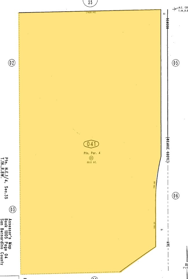
PARCEL MAP 9295 PARCEL 4 EX HWY
1005-242-05
SAN BERNARDINO
Miningfacilityoilgasmineralpreciousmetals
California
B and X Area of moderate flood hazard, usually the area between the limits of the 100-year and 500-year floods.
11,12
2025
2.26 AC
2025
Upland/Montclair
000813
Inland Empire (California)
NEARBY LISTINGS FOR SALE OR LEASE
DEMOGRAPHICS near 18Th St
1 mile
3 mile
5 mile
2025 Total Population
8,108
76,757
269,426
2030 Population
8,181
77,093
270,195
Pop Growth 2025-2030
+ 0.90%
+ 0.44%
+ 0.29%
Average Age
45
41
40
2025 Total Households
2,881
26,030
87,739
HH Growth 2025-2030
+ 0.80%
+ 0.45%
+ 0.27%
Median Household Inc
$143,273
$124,481
$101,652
Avg Household Size
2.80
2.70
2.90
2025 Avg HH Vehicles
2.00
2.00
2.00
Median Home Value
$793,336
$807,166
$745,379
Median Year Built
1983
1976
1973
Nearby Places
Map Layers
Map Styles
 Street
 Aerial
Layers
 Traffic
 Biking
Places
Listings with unknown addresses are not visible on the map
- Restaurants
- Banks
- Shops
- Fitness
- Groceries
PUBLIC TRANSPORTATION
COMMUTER RAIL
Montclair (San Bernardino Line - Southern California Regional Rail Authority (Metrolink))
Drive
Walk
Distance
Montclair (San Bernardino Line - Southern California Regional Rail Authority (Metrolink))
6 min
3.3 mi
Claremont (San Bernardino Line - Southern California Regional Rail Authority (Metrolink))
Drive
Walk
Distance
Claremont (San Bernardino Line - Southern California Regional Rail Authority (Metrolink))
7 min
3.7 mi
AIRPORT
Ontario International
Drive
Walk
Distance
Ontario International
16 min
9.7 mi
Freight Ports
Port of Long Beach
Drive
Walk
Distance
Port of Long Beach
62 min
50.8 mi
Nearby Properties
Address
Land Use
TOTAL SIZE
Lot Size
Zoning
Address
Land Use
TOTAL SIZE
Lot Size
Zoning
788,560 SF
36.86 AC
Address
Land Use
TOTAL SIZE
Lot Size
Zoning
672,929 SF
90.10 AC
CLE*
Address
Land Use
TOTAL SIZE
Lot Size
Zoning
167,013 SF
30.60 AC
CLE*
Address
Land Use
TOTAL SIZE
Lot Size
Zoning
43,129 SF
21.20 AC
CLE*
Address
Land Use
TOTAL SIZE
Lot Size
Zoning
134,182 SF
1.56 AC
CLE*
Address
Land Use
TOTAL SIZE
Lot Size
Zoning
167,512 SF
8.35 AC
Address
Land Use
TOTAL SIZE
Lot Size
Zoning
120,943 SF
CLE*
Address
Land Use
TOTAL SIZE
Lot Size
Zoning
250,772 SF
23.93 AC
CLE*
Address
Land Use
TOTAL SIZE
Lot Size
Zoning
538,944 SF
20.73 AC
Address
Land Use
TOTAL SIZE
Lot Size
Zoning
125,663 SF
7.04 AC
Address
Land Use
TOTAL SIZE
Lot Size
Zoning
218,376 SF
12.50 AC
Address
Land Use
TOTAL SIZE
Lot Size
Zoning
1.86 AC
Address
Land Use
TOTAL SIZE
Lot Size
Zoning
99,508 SF
16.74 AC
CLE*
Address
Land Use
TOTAL SIZE
Lot Size
Zoning
119,109 SF
10.39 AC
CLE*
Address
Land Use
TOTAL SIZE
Lot Size
Zoning
108,751 SF
16.41 AC
CLCP*
Address
Land Use
TOTAL SIZE
Lot Size
Zoning
178,472 SF
2.85 AC
CLE*
Address
Land Use
TOTAL SIZE
Lot Size
Zoning
73,190 SF
5.43 AC
Address
Land Use
TOTAL SIZE
Lot Size
Zoning
110,969 SF
3.06 AC
CLE*
Address
Land Use
TOTAL SIZE
Lot Size
Zoning
94,742 SF
4.91 AC
CLCP-E*
Address
Land Use
TOTAL SIZE
Lot Size
Zoning
129,480 SF
6.39 AC
Address
Land Use
TOTAL SIZE
Lot Size
Zoning
112,960 SF
6.30 AC
Address
Land Use
TOTAL SIZE
Lot Size
Zoning
203,092 SF
10 AC
Address
Land Use
TOTAL SIZE
Lot Size
Zoning
455,226 SF
18.15 AC
Address
Land Use
TOTAL SIZE
Lot Size
Zoning
240,226 SF
10.10 AC
Address
Land Use
TOTAL SIZE
Lot Size
Zoning
128,627 SF
11.70 AC
Address
Land Use
TOTAL SIZE
Lot Size
Zoning
130,680 SF
6.63 AC
Address
Land Use
TOTAL SIZE
Lot Size
Zoning
100,451 SF
7.44 AC
CLCP*
Address
Land Use
TOTAL SIZE
Lot Size
Zoning
50,274 SF
3.76 AC
CLI-CH*
Address
Land Use
TOTAL SIZE
Lot Size
Zoning
82,247 SF
1.10 AC
Address
Land Use
TOTAL SIZE
Lot Size
Zoning
53,170 SF
5.62 AC
The World's #1 Commercial Real Estate Marketplace
Connect with us
© 2026 CoStar Group
The information above has been obtained from sources believed reliable. While we do not doubt its accuracy we have not verified it and make no guarantee, warranty or representation about it. It is your responsibility to independently confirm its accuracy and completeness. Any projections, opinions, assumptions, or estimates used are for example only and do not represent the current or future performance of the property. The value of this transaction to you depends on tax and other factors which should be evaluated by your tax, financial, and legal advisors. You and your advisors should conduct a careful, independent investigation of the property to determine to your satisfaction the suitability of the property for your needs.