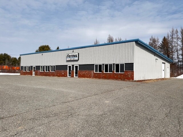
Property Record
19 Boggy Brook Rd, Ellsworth, ME 04605


NEARBY LISTINGS FOR SALE OR LEASE
Property Detail
19 Boggy Brook Rd
Commercialbuilding
Hancock
X
Maine
23009C0754D
2.12 AC
2024
Maine North & Bangor
2024
Other Market Areas
965504
ELLH-000050-000019
6,000 SF
DEMOGRAPHICS near 19 Boggy Brook Rd
1 Mile
3 Mile
5 Mile
2024 Total Population
436
4,796
8,555
2029 Population
461
5,052
9,039
Pop Growth 2024-2029
+ 5.73%
+ 5.34%
+ 5.66%
Average Age
44
44
44
2024 Total Households
185
2,121
3,773
HH Growth 2024-2029
+ 5.41%
+ 5.42%
+ 5.72%
Median Household Inc
$74,317
$66,262
$61,677
Avg Household Size
2.20
2.10
2.20
2024 Avg HH Vehicles
2.00
2.00
2.00
Median Home Value
$188,461
$188,461
$203,671
Median Year Built
1980
1976
1983
Nearby Places
Map Layers
Map Styles
 Street
 Aerial
- Restaurants
- Banks
- Shops
- Fitness
- Groceries
PUBLIC TRANSPORTATION
AIRPORT
Bangor International
DRIVE
WALK
Distance
Bangor International
44 min
28.3 mi
Freight Ports
Searsport, ME
DRIVE
WALK
Distance
Searsport, ME
54 min
33.5 mi
SALE & LEASE HISTORY
LISTING DATE
SALE/LEASE

Mar 29, 2025
For Lease
Nearby Properties
Address
Land Use
TOTAL SIZE
Lot Size
Zoning
Address
Land Use
TOTAL SIZE
Lot Size
Zoning
Address
Land Use
TOTAL SIZE
Lot Size
Zoning
14,581 SF
3.14 AC
DTT
Address
Land Use
TOTAL SIZE
Lot Size
Zoning
5 AC
EHNG
Address
Land Use
TOTAL SIZE
Lot Size
Zoning
13.76 AC
N
Address
Land Use
TOTAL SIZE
Lot Size
Zoning
60,708 SF
9.26 AC
U
Address
Land Use
TOTAL SIZE
Lot Size
Zoning
7,798 SF
0.49 AC
GDDT
Address
Land Use
TOTAL SIZE
Lot Size
Zoning
2,295.68 AC
RA
Address
Land Use
TOTAL SIZE
Lot Size
Zoning
6.50 AC
U
Address
Land Use
TOTAL SIZE
Lot Size
Zoning
10,846 SF
2.78 AC
DTT
Address
Land Use
TOTAL SIZE
Lot Size
Zoning
4.50 AC
U
Address
Land Use
TOTAL SIZE
Lot Size
Zoning
84.65 AC
Address
Land Use
TOTAL SIZE
Lot Size
Zoning
2.02 AC
CDD
Address
Land Use
TOTAL SIZE
Lot Size
Zoning
20,260 SF
1.34 AC
U
Address
Land Use
TOTAL SIZE
Lot Size
Zoning
14,138 SF
3.16 AC
U
Address
Land Use
TOTAL SIZE
Lot Size
Zoning
11,944 SF
4.02 AC
U
Address
Land Use
TOTAL SIZE
Lot Size
Zoning
2,028 SF
3.80 AC
U
Address
Land Use
TOTAL SIZE
Lot Size
Zoning
10,050 SF
2.11 AC
UTIF
Address
Land Use
TOTAL SIZE
Lot Size
Zoning
29.82 AC
ELRU
Address
Land Use
TOTAL SIZE
Lot Size
Zoning
11.72 AC
LRU
Address
Land Use
TOTAL SIZE
Lot Size
Zoning
2.97 AC
DT
Address
Land Use
TOTAL SIZE
Lot Size
Zoning
3,969 SF
1.59 AC
U
Address
Land Use
TOTAL SIZE
Lot Size
Zoning
5,411 SF
2.37 AC
U
Address
Land Use
TOTAL SIZE
Lot Size
Zoning
1.63 AC
DT
Address
Land Use
TOTAL SIZE
Lot Size
Zoning
3,000 SF
4.32 AC
Address
Land Use
TOTAL SIZE
Lot Size
Zoning
2,972 SF
1.33 AC
U
Address
Land Use
TOTAL SIZE
Lot Size
Zoning
12,052 SF
1.04 AC
DT
Address
Land Use
TOTAL SIZE
Lot Size
Zoning
1.37 AC
N
Address
Land Use
TOTAL SIZE
Lot Size
Zoning
10,131 SF
1.30 AC
ELR
Address
Land Use
TOTAL SIZE
Lot Size
Zoning
6,300 SF
1.38 AC
N
Address
Land Use
TOTAL SIZE
Lot Size
Zoning
10,880 SF
1.90 AC
UTIF
The World's #1 Commercial Real Estate Marketplace
Connect with us
© 2025 CoStar Group
The information above has been obtained from sources believed reliable. While we do not doubt its accuracy we have not verified it and make no guarantee, warranty or representation about it. It is your responsibility to independently confirm its accuracy and completeness. Any projections, opinions, assumptions, or estimates used are for example only and do not represent the current or future performance of the property. The value of this transaction to you depends on tax and other factors which should be evaluated by your tax, financial, and legal advisors. You and your advisors should conduct a careful, independent investigation of the property to determine to your satisfaction the suitability of the property for your needs.