Property Record
19 Cr, Davis, CA 95695
Save to a Folder
{{folder.Name}}
{{folder.ListingIds.length}} Properties
{{folder.ListingIds.length}} Property
Create a New Folder
Property Detail
19 Cr
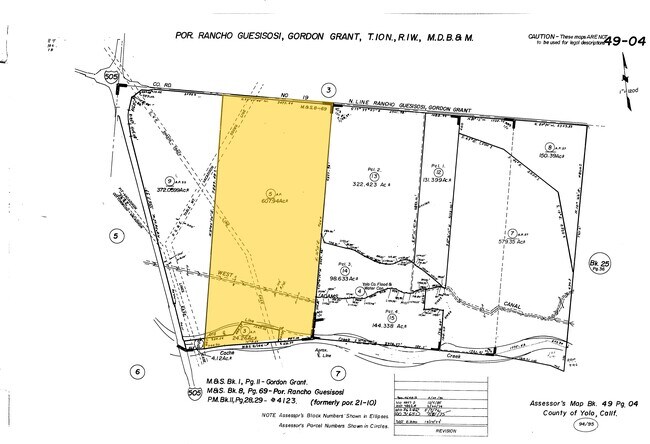
049-040-005-000
LEGAL DESC VERIFIED 2016-26570
Orchard
YOLO
AP
California
A Areas with a 1% annual chance of flooding and a 26% chance of flooding over the life of a 30-year mortgage.
607.94 AC
2024
Davis/Woodland
2025
Sacramento
010610
Sacramento-Roseville-Folsom, CA
NEARBY LISTINGS FOR SALE OR LEASE
-
-
View all Davis listings for sale on LoopNet.com
DEMOGRAPHICS near 19 Cr
1 mile
3 mile
5 mile
2025 Total Population
0
280
5,422
2030 Population
0
267
5,302
Pop Growth 2025-2030
0.00%
(4.64%)
(2.21%)
Average Age
0
41
40
2025 Total Households
0
97
1,753
HH Growth 2025-2030
0.00%
(4.12%)
(2.05%)
Median Household Inc
$0
$96,295
$117,152
Avg Household Size
.00
2.80
3.00
2025 Avg HH Vehicles
.00
2.00
3.00
Median Home Value
$0
$807,142
$672,048
Median Year Built
0
1981
1987
Nearby Places
Map Layers
Map Styles
 Street
 Aerial
Layers
 Traffic
 Biking
Places
Listings with unknown addresses are not visible on the map
- Restaurants
- Banks
- Shops
- Fitness
- Groceries
PUBLIC TRANSPORTATION
AIRPORT
Sacramento International
Drive
Walk
Distance
Sacramento International
39 min
30.4 mi
Freight Ports
Port of Richmond
Drive
Walk
Distance
Port of Richmond
86 min
71.0 mi
Nearby Properties
Address
Land Use
TOTAL SIZE
Lot Size
Zoning
Address
Land Use
TOTAL SIZE
Lot Size
Zoning
276.36 AC
A1
Address
Land Use
TOTAL SIZE
Lot Size
Zoning
417.33 AC
AP
Address
Land Use
TOTAL SIZE
Lot Size
Zoning
358.14 AC
A-P
Address
Land Use
TOTAL SIZE
Lot Size
Zoning
443.97 AC
AP
Address
Land Use
TOTAL SIZE
Lot Size
Zoning
291.14 AC
AP
Address
Land Use
TOTAL SIZE
Lot Size
Zoning
177.34 AC
A-P
Address
Land Use
TOTAL SIZE
Lot Size
Zoning
301.30 AC
A-P
Address
Land Use
TOTAL SIZE
Lot Size
Zoning
140.68 AC
A1
Address
Land Use
TOTAL SIZE
Lot Size
Zoning
254.70 AC
A-P
Address
Land Use
TOTAL SIZE
Lot Size
Zoning
115.37 AC
A-P
Address
Land Use
TOTAL SIZE
Lot Size
Zoning
190.65 AC
A-P
Address
Land Use
TOTAL SIZE
Lot Size
Zoning
142.30 AC
Address
Land Use
TOTAL SIZE
Lot Size
Zoning
2,365 SF
250.28 AC
AP
Address
Land Use
TOTAL SIZE
Lot Size
Zoning
1,976 SF
42.97 AC
AP
Address
Land Use
TOTAL SIZE
Lot Size
Zoning
340.97 AC
AP
Address
Land Use
TOTAL SIZE
Lot Size
Zoning
176.75 AC
AP
Address
Land Use
TOTAL SIZE
Lot Size
Zoning
579.35 AC
AP
Address
Land Use
TOTAL SIZE
Lot Size
Zoning
150 AC
AP
Address
Land Use
TOTAL SIZE
Lot Size
Zoning
322.75 AC
A-P
Address
Land Use
TOTAL SIZE
Lot Size
Zoning
2,229 SF
141 AC
A1
Address
Land Use
TOTAL SIZE
Lot Size
Zoning
372.06 AC
AP
Address
Land Use
TOTAL SIZE
Lot Size
Zoning
117.99 AC
AP
Address
Land Use
TOTAL SIZE
Lot Size
Zoning
186.40 AC
AP
Address
Land Use
TOTAL SIZE
Lot Size
Zoning
4,288 SF
64.59 AC
A1
Address
Land Use
TOTAL SIZE
Lot Size
Zoning
1,120 SF
344.89 AC
AP
Address
Land Use
TOTAL SIZE
Lot Size
Zoning
169.44 AC
AP
Address
Land Use
TOTAL SIZE
Lot Size
Zoning
200.16 AC
AP
Address
Land Use
TOTAL SIZE
Lot Size
Zoning
322.42 AC
AP
Address
Land Use
TOTAL SIZE
Lot Size
Zoning
119.36 AC
AP
The World's #1 Commercial Real Estate Marketplace
Connect with us
© 2026 CoStar Group
The information above has been obtained from sources believed reliable. While we do not doubt its accuracy we have not verified it and make no guarantee, warranty or representation about it. It is your responsibility to independently confirm its accuracy and completeness. Any projections, opinions, assumptions, or estimates used are for example only and do not represent the current or future performance of the property. The value of this transaction to you depends on tax and other factors which should be evaluated by your tax, financial, and legal advisors. You and your advisors should conduct a careful, independent investigation of the property to determine to your satisfaction the suitability of the property for your needs.