Property Record
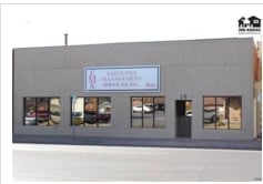
19 E 4Th Ave, Hutchinson, KS 67501

Property Detail
19 E 4Th Ave
Hutchinson, KS
4TH E ORIGINAL TOWN, S13, T23, R06W, ALL LOT 7 W/2 LOT 9 4TH AVE E AND RESERVE 1 MILLER & SMITH'S ADDN ADJ
126-13-0-10-06-002.00
Reno
Storebuilding
Kansas
I1
7
2025
0.19 AC
2025
Kansas Area
000600
Other Market Areas
4,900 SF
NEARBY LISTINGS FOR SALE OR LEASE
DEMOGRAPHICS near 19 E 4Th Ave
1 mile
3 mile
5 mile
2025 Total Population
10,816
38,385
43,636
2030 Population
10,975
38,301
43,495
Pop Growth 2025-2030
+ 1.47%
(0.22%)
(0.32%)
Average Age
39
41
42
2025 Total Households
4,712
16,613
18,589
HH Growth 2025-2030
+ 1.49%
(0.24%)
(0.33%)
Median Household Inc
$49,321
$54,533
$57,418
Avg Household Size
2.20
2.20
2.20
2025 Avg HH Vehicles
2.00
2.00
2.00
Median Home Value
$69,878
$118,616
$132,092
Median Year Built
1947
1957
1960
Nearby Places
Map Layers
Map Styles
 Street
 Aerial
Layers
 Traffic
 Biking
Places
Listings with unknown addresses are not visible on the map
- Restaurants
- Banks
- Shops
- Fitness
- Groceries
PUBLIC TRANSPORTATION
COMMUTER RAIL
Hutchinson Amtrak Station (Southwest Chief - Amtrak)
Drive
Walk
Distance
Hutchinson Amtrak Station (Southwest Chief - Amtrak)
0 min
3 min
0.2 mi
Freight Ports
Tulsa Port Of Catoosa
Drive
Walk
Distance
Tulsa Port Of Catoosa
263 min
242.4 mi
SALE & LEASE HISTORY
LISTING DATE
SALE/LEASE

Sep 24, 2016
For Sale
Oct 24, 2018
For Sale
Nearby Properties
Address
Land Use
TOTAL SIZE
Lot Size
Zoning
Address
Land Use
TOTAL SIZE
Lot Size
Zoning
279,450 SF
11 AC
P
Address
Land Use
TOTAL SIZE
Lot Size
Zoning
94,825 SF
10 AC
Address
Land Use
TOTAL SIZE
Lot Size
Zoning
13,170 SF
36.34 AC
PI
Address
Land Use
TOTAL SIZE
Lot Size
Zoning
89,458 SF
1.88 AC
P
Address
Land Use
TOTAL SIZE
Lot Size
Zoning
77,674 SF
44.42 AC
P
Address
Land Use
TOTAL SIZE
Lot Size
Zoning
82,859 SF
8.85 AC
R5
Address
Land Use
TOTAL SIZE
Lot Size
Zoning
9,509 SF
10.68 AC
P
Address
Land Use
TOTAL SIZE
Lot Size
Zoning
59.65 AC
P
Address
Land Use
TOTAL SIZE
Lot Size
Zoning
31,917 SF
10.36 AC
R5
Address
Land Use
TOTAL SIZE
Lot Size
Zoning
60,073 SF
4.58 AC
P
Address
Land Use
TOTAL SIZE
Lot Size
Zoning
121,446 SF
14.69 AC
PI
Address
Land Use
TOTAL SIZE
Lot Size
Zoning
42,440 SF
9.49 AC
Address
Land Use
TOTAL SIZE
Lot Size
Zoning
576 SF
110.23 AC
P
Address
Land Use
TOTAL SIZE
Lot Size
Zoning
79,601 SF
15.96 AC
Address
Land Use
TOTAL SIZE
Lot Size
Zoning
89,642 SF
19.83 AC
C1
Address
Land Use
TOTAL SIZE
Lot Size
Zoning
64,700 SF
5.73 AC
C4
Address
Land Use
TOTAL SIZE
Lot Size
Zoning
7,273 SF
6.40 AC
Address
Land Use
TOTAL SIZE
Lot Size
Zoning
29,431 SF
1.50 AC
C5
Address
Land Use
TOTAL SIZE
Lot Size
Zoning
61,650 SF
19.49 AC
Address
Land Use
TOTAL SIZE
Lot Size
Zoning
35,136 SF
3.86 AC
Address
Land Use
TOTAL SIZE
Lot Size
Zoning
1,320 SF
5.94 AC
Address
Land Use
TOTAL SIZE
Lot Size
Zoning
23,394 SF
35.24 AC
Address
Land Use
TOTAL SIZE
Lot Size
Zoning
69,395 SF
17.62 AC
P
Address
Land Use
TOTAL SIZE
Lot Size
Zoning
2,450 SF
4.68 AC
Address
Land Use
TOTAL SIZE
Lot Size
Zoning
101,932 SF
1.50 AC
P
Address
Land Use
TOTAL SIZE
Lot Size
Zoning
52,857 SF
12.35 AC
Address
Land Use
TOTAL SIZE
Lot Size
Zoning
89,591 SF
3.31 AC
P
Address
Land Use
TOTAL SIZE
Lot Size
Zoning
59,962 SF
2.52 AC
P
Address
Land Use
TOTAL SIZE
Lot Size
Zoning
18,200 SF
3.46 AC
Address
Land Use
TOTAL SIZE
Lot Size
Zoning
65,156 SF
8.10 AC
P
The World's #1 Commercial Real Estate Marketplace
Connect with us
© 2026 CoStar Group
The information above has been obtained from sources believed reliable. While we do not doubt its accuracy we have not verified it and make no guarantee, warranty or representation about it. It is your responsibility to independently confirm its accuracy and completeness. Any projections, opinions, assumptions, or estimates used are for example only and do not represent the current or future performance of the property. The value of this transaction to you depends on tax and other factors which should be evaluated by your tax, financial, and legal advisors. You and your advisors should conduct a careful, independent investigation of the property to determine to your satisfaction the suitability of the property for your needs.