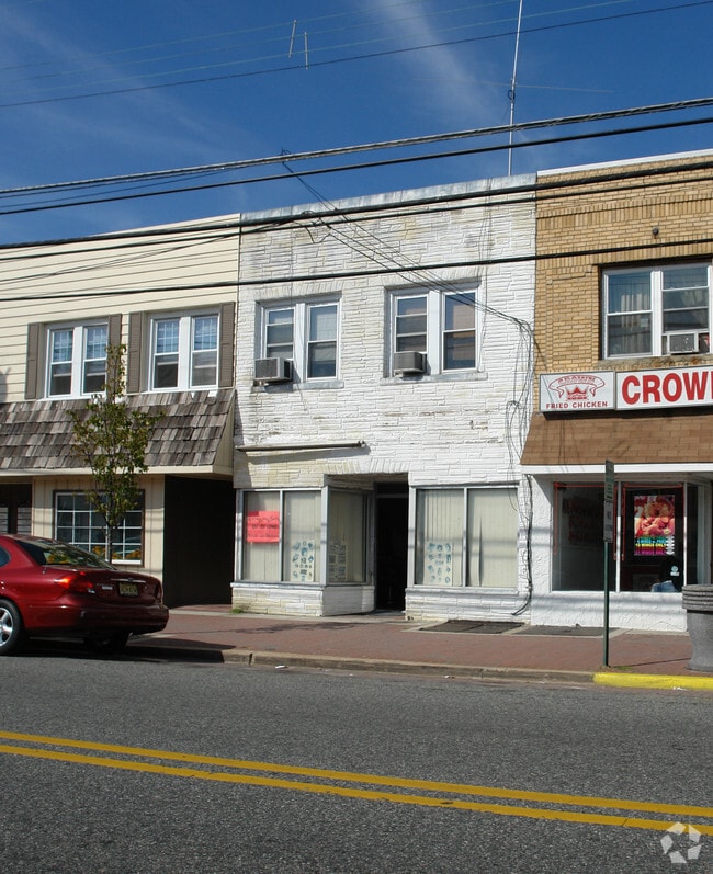
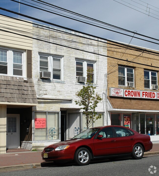
Property Record
19 E High St, Glassboro, NJ 08028
NEARBY LISTINGS FOR SALE OR LEASE
Property Detail
19 E High St
06-00027-0000-00006
Gloucester
Storemultistory
New Jersey
X
6
34015C0203E
0.04 AC
2024
Gloucester County
2025
Philadelphia
501402
Philadelphia-Camden-Wilmington, PA-NJ-DE-MD
1,964 SF
DEMOGRAPHICS near 19 E High St
1 Mile
3 Mile
5 Mile
2024 Total Population
15,799
49,315
101,091
2029 Population
16,526
51,141
104,637
Pop Growth 2024-2029
+ 4.60%
+ 3.70%
+ 3.51%
Average Age
31
38
40
2024 Total Households
3,863
16,576
35,204
HH Growth 2024-2029
+ 6.63%
+ 4.10%
+ 3.73%
Median Household Inc
$61,568
$87,411
$99,658
Avg Household Size
2.40
2.50
2.60
2024 Avg HH Vehicles
2.00
2.00
2.00
Median Home Value
$197,527
$251,621
$275,064
Median Year Built
1978
1978
1981
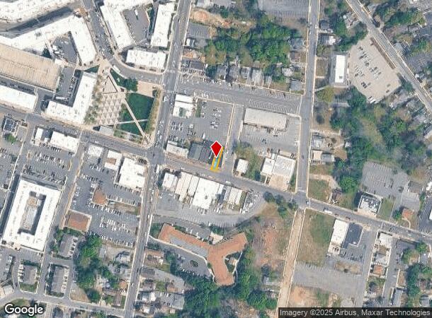
Nearby Places
Map Layers
Map Styles
 Street
 Aerial
- Restaurants
- Banks
- Shops
- Fitness
- Groceries
PUBLIC TRANSPORTATION
AIRPORT
Philadelphia International
DRIVE
WALK
Distance
Philadelphia International
40 min
24.7 mi
Atlantic City International
DRIVE
WALK
Distance
Atlantic City International
72 min
41.3 mi
Freight Ports
Broadway Terminal - Pier 5
DRIVE
WALK
Distance
Broadway Terminal - Pier 5
25 min
16.2 mi
Nearby Properties
Address
Land Use
TOTAL SIZE
Lot Size
Zoning
Address
Land Use
TOTAL SIZE
Lot Size
Zoning
2,302 SF
61.32 AC
C55
Address
Land Use
TOTAL SIZE
Lot Size
Zoning
96.68 AC
P
Address
Land Use
TOTAL SIZE
Lot Size
Zoning
3.34 AC
R3
Address
Land Use
TOTAL SIZE
Lot Size
Zoning
4.41 AC
Address
Land Use
TOTAL SIZE
Lot Size
Zoning
Address
Land Use
TOTAL SIZE
Lot Size
Zoning
Address
Land Use
TOTAL SIZE
Lot Size
Zoning
4.52 AC
P
Address
Land Use
TOTAL SIZE
Lot Size
Zoning
46.38 AC
P
Address
Land Use
TOTAL SIZE
Lot Size
Zoning
Address
Land Use
TOTAL SIZE
Lot Size
Zoning
25.71 AC
Address
Land Use
TOTAL SIZE
Lot Size
Zoning
Address
Land Use
TOTAL SIZE
Lot Size
Zoning
23.27 AC
C5
Address
Land Use
TOTAL SIZE
Lot Size
Zoning
26.35 AC
R4
Address
Land Use
TOTAL SIZE
Lot Size
Zoning
4.89 AC
RA
Address
Land Use
TOTAL SIZE
Lot Size
Zoning
1.77 AC
Address
Land Use
TOTAL SIZE
Lot Size
Zoning
1.29 AC
Address
Land Use
TOTAL SIZE
Lot Size
Zoning
Address
Land Use
TOTAL SIZE
Lot Size
Zoning
Address
Land Use
TOTAL SIZE
Lot Size
Zoning
22.31 AC
C5
Address
Land Use
TOTAL SIZE
Lot Size
Zoning
14.57 AC
P
Address
Land Use
TOTAL SIZE
Lot Size
Zoning
2.68 AC
P
Address
Land Use
TOTAL SIZE
Lot Size
Zoning
1.52 AC
Address
Land Use
TOTAL SIZE
Lot Size
Zoning
7.57 AC
P
Address
Land Use
TOTAL SIZE
Lot Size
Zoning
Address
Land Use
TOTAL SIZE
Lot Size
Zoning
26.26 AC
P
Address
Land Use
TOTAL SIZE
Lot Size
Zoning
12.01 AC
RA
Address
Land Use
TOTAL SIZE
Lot Size
Zoning
Address
Land Use
TOTAL SIZE
Lot Size
Zoning
21.14 AC
CF/I
Address
Land Use
TOTAL SIZE
Lot Size
Zoning
25.12 AC
PR3
Address
Land Use
TOTAL SIZE
Lot Size
Zoning
20.08 AC
INS
The World's #1 Commercial Real Estate Marketplace
Connect with us
© 2025 CoStar Group
The information above has been obtained from sources believed reliable. While we do not doubt its accuracy we have not verified it and make no guarantee, warranty or representation about it. It is your responsibility to independently confirm its accuracy and completeness. Any projections, opinions, assumptions, or estimates used are for example only and do not represent the current or future performance of the property. The value of this transaction to you depends on tax and other factors which should be evaluated by your tax, financial, and legal advisors. You and your advisors should conduct a careful, independent investigation of the property to determine to your satisfaction the suitability of the property for your needs.