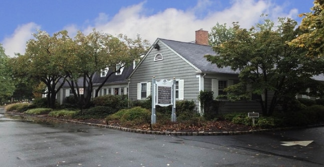
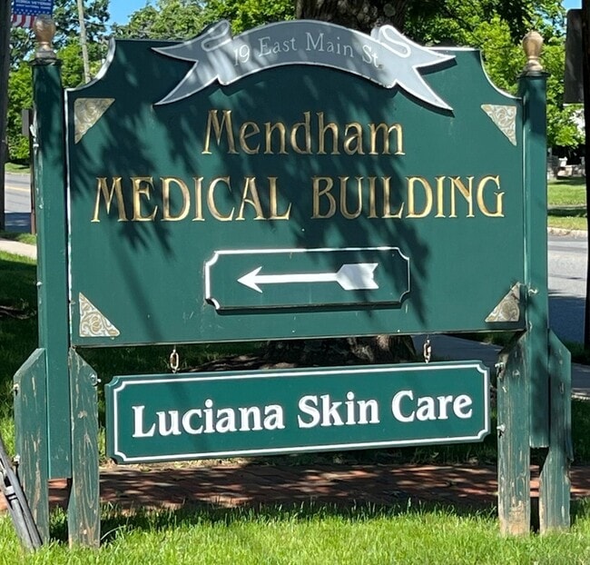
Property Record
19 E Main St, Mendham, NJ 07945


Property Detail
19 E Main St
Newark, NJ
Morris
18-01501-0000-00008
New Jersey
Medicalbuilding
8
B
0.56 AC
2024
Western Morris
2025
Northern New Jersey
046400
NEARBY LISTINGS FOR SALE OR LEASE
-
-
View all Mendham listings for lease on LoopNet.com
DEMOGRAPHICS near 19 E Main St
1 mile
3 mile
5 mile
2025 Total Population
4,116
12,165
43,118
2030 Population
4,193
12,387
44,067
Pop Growth 2025-2030
+ 1.87%
+ 1.82%
+ 2.20%
Average Age
44
43
42
2025 Total Households
1,453
4,128
14,662
HH Growth 2025-2030
+ 1.86%
+ 1.82%
+ 2.25%
Median Household Inc
$210,691
$231,441
$225,885
Avg Household Size
2.70
2.90
2.90
2025 Avg HH Vehicles
2.00
2.00
2.00
Median Home Value
$817,567
$928,648
$826,958
Median Year Built
1969
1972
1973
Nearby Places
Map Layers
Map Styles
 Street
 Aerial
Layers
 Traffic
 Biking
Places
Listings with unknown addresses are not visible on the map
- Restaurants
- Banks
- Shops
- Fitness
- Groceries
PUBLIC TRANSPORTATION
COMMUTER RAIL
Bernardsville (Morris & Essex Gladstone Branch - NJ Transit Commuter Rail (NJ Transit))
Drive
Walk
Distance
Bernardsville (Morris & Essex Gladstone Branch - NJ Transit Commuter Rail (NJ Transit))
11 min
5.5 mi
Gladstone (Morris & Essex Gladstone Branch - NJ Transit Commuter Rail (NJ Transit))
Drive
Walk
Distance
Gladstone (Morris & Essex Gladstone Branch - NJ Transit Commuter Rail (NJ Transit))
16 min
6.1 mi
AIRPORT
Newark Liberty International
Drive
Walk
Distance
Newark Liberty International
40 min
28.7 mi
Trenton Mercer
Drive
Walk
Distance
Trenton Mercer
80 min
45.8 mi
Freight Ports
Maher Terminal
Drive
Walk
Distance
Maher Terminal
44 min
29.2 mi
SALE & LEASE HISTORY
LISTING DATE
SALE/LEASE

Oct 04, 2018
For Sale
Oct 04, 2017
For Lease
Mar 13, 2019
For Lease
Jun 15, 2022
For Lease
Nearby Properties
Address
Land Use
TOTAL SIZE
Lot Size
Zoning
Address
Land Use
TOTAL SIZE
Lot Size
Zoning
79 AC
5-AC
Address
Land Use
TOTAL SIZE
Lot Size
Zoning
23.75 AC
12AC
Address
Land Use
TOTAL SIZE
Lot Size
Zoning
12.87 AC
EB
Address
Land Use
TOTAL SIZE
Lot Size
Zoning
282.25 AC
CR-1
Address
Land Use
TOTAL SIZE
Lot Size
Zoning
277.10 AC
R-10
Address
Land Use
TOTAL SIZE
Lot Size
Zoning
14.47 AC
OBDS
Address
Land Use
TOTAL SIZE
Lot Size
Zoning
16,496 SF
157.52 AC
R110
Address
Land Use
TOTAL SIZE
Lot Size
Zoning
2,396 SF
28.60 AC
R
Address
Land Use
TOTAL SIZE
Lot Size
Zoning
11.60 AC
1/2A
Address
Land Use
TOTAL SIZE
Lot Size
Zoning
126 AC
R-10
Address
Land Use
TOTAL SIZE
Lot Size
Zoning
1,440 SF
125.03 AC
R-5
Address
Land Use
TOTAL SIZE
Lot Size
Zoning
28,381 SF
90.71 AC
5-AC
Address
Land Use
TOTAL SIZE
Lot Size
Zoning
14.57 AC
R-10
Address
Land Use
TOTAL SIZE
Lot Size
Zoning
3.57 AC
1/4A
Address
Land Use
TOTAL SIZE
Lot Size
Zoning
15,207 SF
5.50 AC
R110
Address
Land Use
TOTAL SIZE
Lot Size
Zoning
20.88 AC
R-5
Address
Land Use
TOTAL SIZE
Lot Size
Zoning
23,068 SF
3.70 AC
R110
Address
Land Use
TOTAL SIZE
Lot Size
Zoning
2,084 SF
4.30 AC
R-10
Address
Land Use
TOTAL SIZE
Lot Size
Zoning
64.70 AC
R110
Address
Land Use
TOTAL SIZE
Lot Size
Zoning
10 AC
1/4A
Address
Land Use
TOTAL SIZE
Lot Size
Zoning
172.90 AC
R-10
Address
Land Use
TOTAL SIZE
Lot Size
Zoning
9.78 AC
1/2A
Address
Land Use
TOTAL SIZE
Lot Size
Zoning
14,996 SF
1.75 AC
R-10
Address
Land Use
TOTAL SIZE
Lot Size
Zoning
2,086 SF
91 AC
R-10
Address
Land Use
TOTAL SIZE
Lot Size
Zoning
10,706 SF
2.50 AC
R110
Address
Land Use
TOTAL SIZE
Lot Size
Zoning
12,943 SF
4 AC
R110
Address
Land Use
TOTAL SIZE
Lot Size
Zoning
14,500 SF
1.10 AC
R5
Address
Land Use
TOTAL SIZE
Lot Size
Zoning
13,073 SF
6.06 AC
R-10
Address
Land Use
TOTAL SIZE
Lot Size
Zoning
85 AC
R-10
Address
Land Use
TOTAL SIZE
Lot Size
Zoning
14,624 SF
2.80 AC
5AC
The World's #1 Commercial Real Estate Marketplace
Connect with us
© 2026 CoStar Group
The information above has been obtained from sources believed reliable. While we do not doubt its accuracy we have not verified it and make no guarantee, warranty or representation about it. It is your responsibility to independently confirm its accuracy and completeness. Any projections, opinions, assumptions, or estimates used are for example only and do not represent the current or future performance of the property. The value of this transaction to you depends on tax and other factors which should be evaluated by your tax, financial, and legal advisors. You and your advisors should conduct a careful, independent investigation of the property to determine to your satisfaction the suitability of the property for your needs.