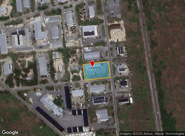
Property Record
19 E Line Rd, Edgartown, MA 02539


NEARBY LISTINGS FOR SALE OR LEASE
-
-
View all Edgartown listings for sale on LoopNet.com
Property Detail
19 E Line Rd
EDGA-000024-000002-000017
Dukes
Officebuilding
Massachusetts
X
17
25007C0113J
0.89 AC
2025
Cape Cod
2025
Other Market Areas
200300
Vineyard Haven, MA
3,795 SF
DEMOGRAPHICS near 19 E Line Rd
1 Mile
3 Mile
5 Mile
2024 Total Population
118
4,574
16,084
2029 Population
112
4,510
16,212
Pop Growth 2024-2029
(5.08%)
(1.40%)
+ 0.80%
Average Age
46
45
45
2024 Total Households
51
1,907
6,894
HH Growth 2024-2029
(5.88%)
(1.94%)
+ 0.23%
Median Household Inc
$99,999
$117,569
$97,309
Avg Household Size
2.30
2.30
2.30
2024 Avg HH Vehicles
2.00
2.00
2.00
Median Home Value
$972,221
$919,465
$863,774
Median Year Built
1990
1987
1985
Nearby Places
Map Layers
Map Styles
 Street
 Aerial
- Restaurants
- Banks
- Shops
- Fitness
- Groceries
PUBLIC TRANSPORTATION
AIRPORT
Martha's Vineyard
DRIVE
WALK
Distance
Martha's Vineyard
2 min
0.5 mi
Freight Ports
Port of New Bedford Harbor
DRIVE
WALK
Distance
Port of New Bedford Harbor
121 min
58.1 mi
SALE & LEASE HISTORY
LISTING DATE
SALE/LEASE

May 24, 2021
For Sale
May 23, 2023
For Sale
Nearby Properties
Address
Land Use
TOTAL SIZE
Lot Size
Zoning
Address
Land Use
TOTAL SIZE
Lot Size
Zoning
1,848.37 AC
Address
Land Use
TOTAL SIZE
Lot Size
Zoning
419.50 AC
RU
Address
Land Use
TOTAL SIZE
Lot Size
Zoning
160,000 SF
23.70 AC
R3
Address
Land Use
TOTAL SIZE
Lot Size
Zoning
2,295.68 AC
RU
Address
Land Use
TOTAL SIZE
Lot Size
Zoning
Address
Land Use
TOTAL SIZE
Lot Size
Zoning
3,275 SF
378.55 AC
Address
Land Use
TOTAL SIZE
Lot Size
Zoning
12.70 AC
Address
Land Use
TOTAL SIZE
Lot Size
Zoning
Address
Land Use
TOTAL SIZE
Lot Size
Zoning
10.50 AC
Address
Land Use
TOTAL SIZE
Lot Size
Zoning
294.90 AC
Address
Land Use
TOTAL SIZE
Lot Size
Zoning
194.30 AC
Address
Land Use
TOTAL SIZE
Lot Size
Zoning
193.05 AC
RU
Address
Land Use
TOTAL SIZE
Lot Size
Zoning
1,568 SF
163.50 AC
Address
Land Use
TOTAL SIZE
Lot Size
Zoning
410.28 AC
LI2
Address
Land Use
TOTAL SIZE
Lot Size
Zoning
99.10 AC
Address
Land Use
TOTAL SIZE
Lot Size
Zoning
75.60 AC
RU
Address
Land Use
TOTAL SIZE
Lot Size
Zoning
15.10 AC
RU
Address
Land Use
TOTAL SIZE
Lot Size
Zoning
13.20 AC
Address
Land Use
TOTAL SIZE
Lot Size
Zoning
14.90 AC
Address
Land Use
TOTAL SIZE
Lot Size
Zoning
24.60 AC
Address
Land Use
TOTAL SIZE
Lot Size
Zoning
15.10 AC
Address
Land Use
TOTAL SIZE
Lot Size
Zoning
13.80 AC
Address
Land Use
TOTAL SIZE
Lot Size
Zoning
8.50 AC
Address
Land Use
TOTAL SIZE
Lot Size
Zoning
12.30 AC
Address
Land Use
TOTAL SIZE
Lot Size
Zoning
13.60 AC
Address
Land Use
TOTAL SIZE
Lot Size
Zoning
26.90 AC
Address
Land Use
TOTAL SIZE
Lot Size
Zoning
Address
Land Use
TOTAL SIZE
Lot Size
Zoning
Address
Land Use
TOTAL SIZE
Lot Size
Zoning
8.20 AC
Address
Land Use
TOTAL SIZE
Lot Size
Zoning
28,841 SF
5 AC
R3
The World's #1 Commercial Real Estate Marketplace
Connect with us
© 2025 CoStar Group
The information above has been obtained from sources believed reliable. While we do not doubt its accuracy we have not verified it and make no guarantee, warranty or representation about it. It is your responsibility to independently confirm its accuracy and completeness. Any projections, opinions, assumptions, or estimates used are for example only and do not represent the current or future performance of the property. The value of this transaction to you depends on tax and other factors which should be evaluated by your tax, financial, and legal advisors. You and your advisors should conduct a careful, independent investigation of the property to determine to your satisfaction the suitability of the property for your needs.