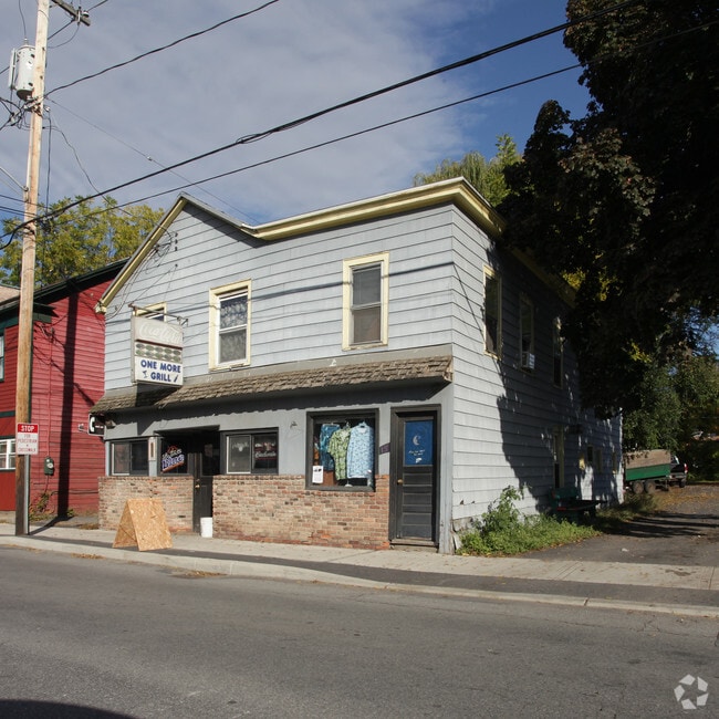
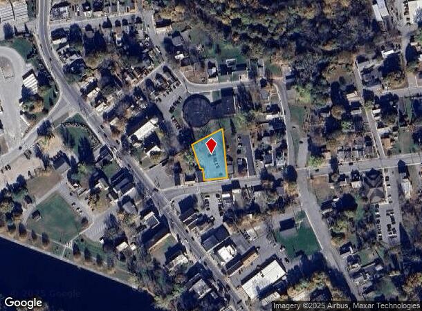
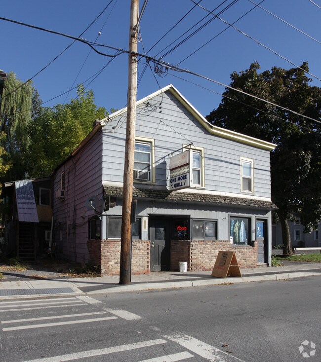
Property Record
19 East St, Fort Edward, NY 12828
NEARBY LISTINGS FOR SALE OR LEASE
-
-
View all Fort Edward listings for sale on LoopNet.com
Property Detail
19 East St
Albany/Schenectady/Troy
VL
Glens Falls, NY
Washington
533001-163-018-0001-037-000-0000
New York
Residentialacreage
37.000
2025
0.46 AC
2024
Washington County
088002
DEMOGRAPHICS near 19 East St
1 Mile
3 Mile
5 Mile
2024 Total Population
3,713
17,633
45,582
2029 Population
3,677
17,576
45,452
Pop Growth 2024-2029
(0.97%)
(0.32%)
(0.29%)
Average Age
41
41
42
2024 Total Households
1,536
7,341
19,799
HH Growth 2024-2029
(1.04%)
(0.40%)
(0.38%)
Median Household Inc
$52,650
$58,258
$64,895
Avg Household Size
2.30
2.30
2.20
2024 Avg HH Vehicles
2.00
2.00
2.00
Median Home Value
$130,936
$157,525
$173,008
Median Year Built
1950
1954
1957
Nearby Places
- Restaurants
- Banks
- Shops
- Fitness
- Groceries
PUBLIC TRANSPORTATION
COMMUTER RAIL
Fort Edward Amtrak (Adirondack - Amtrak, Ethan Allen Express - Amtrak)
DRIVE
WALK
Distance
Fort Edward Amtrak (Adirondack - Amtrak, Ethan Allen Express - Amtrak)
1 min
5 min
0.3 mi
Freight Ports
Albany, NY Port
DRIVE
WALK
Distance
Albany, NY Port
71 min
54.4 mi
Nearby Properties
Address
Land Use
TOTAL SIZE
Lot Size
Zoning
Address
Land Use
TOTAL SIZE
Lot Size
Zoning
16.34 AC
M1
Address
Land Use
TOTAL SIZE
Lot Size
Zoning
116,696 SF
23.70 AC
04 - FARM
Address
Land Use
TOTAL SIZE
Lot Size
Zoning
393,880 SF
23.90 AC
M1
Address
Land Use
TOTAL SIZE
Lot Size
Zoning
9,216 SF
32.20 AC
UR
Address
Land Use
TOTAL SIZE
Lot Size
Zoning
82,922 SF
8.03 AC
I
Address
Land Use
TOTAL SIZE
Lot Size
Zoning
5,680 SF
39.79 AC
UR
Address
Land Use
TOTAL SIZE
Lot Size
Zoning
Address
Land Use
TOTAL SIZE
Lot Size
Zoning
113.40 AC
04 - FARM
Address
Land Use
TOTAL SIZE
Lot Size
Zoning
6,549 SF
17.26 AC
M1
Address
Land Use
TOTAL SIZE
Lot Size
Zoning
3,000 SF
14.95 AC
M1
Address
Land Use
TOTAL SIZE
Lot Size
Zoning
134,998 SF
20.10 AC
05 - COMME
Address
Land Use
TOTAL SIZE
Lot Size
Zoning
42,156 SF
5.93 AC
05 - COMME
Address
Land Use
TOTAL SIZE
Lot Size
Zoning
56,884 SF
8.73 AC
R2
Address
Land Use
TOTAL SIZE
Lot Size
Zoning
41,280 SF
50.96 AC
M1
Address
Land Use
TOTAL SIZE
Lot Size
Zoning
62,278 SF
6.86 AC
C1
Address
Land Use
TOTAL SIZE
Lot Size
Zoning
36,657 SF
5.12 AC
C2
Address
Land Use
TOTAL SIZE
Lot Size
Zoning
106,209 SF
6.22 AC
M1
Address
Land Use
TOTAL SIZE
Lot Size
Zoning
Address
Land Use
TOTAL SIZE
Lot Size
Zoning
53,590 SF
13.74 AC
R1
Address
Land Use
TOTAL SIZE
Lot Size
Zoning
2,400 SF
27.88 AC
M1
Address
Land Use
TOTAL SIZE
Lot Size
Zoning
4,715 SF
43.55 AC
RP
Address
Land Use
TOTAL SIZE
Lot Size
Zoning
4,200 SF
10.74 AC
LDR25
Address
Land Use
TOTAL SIZE
Lot Size
Zoning
131,704 SF
3.19 AC
M1
Address
Land Use
TOTAL SIZE
Lot Size
Zoning
6,300 SF
3.27 AC
C1
Address
Land Use
TOTAL SIZE
Lot Size
Zoning
Address
Land Use
TOTAL SIZE
Lot Size
Zoning
69,290 SF
1.84 AC
C
Address
Land Use
TOTAL SIZE
Lot Size
Zoning
8,348 SF
13.60 AC
UR
Address
Land Use
TOTAL SIZE
Lot Size
Zoning
55,979 SF
6.76 AC
06 - INDUS
Address
Land Use
TOTAL SIZE
Lot Size
Zoning
19,052 SF
6.21 AC
R1
Address
Land Use
TOTAL SIZE
Lot Size
Zoning
2,790 SF
387.84 AC
M1
The World's #1 Commercial Real Estate Marketplace
Connect with us
© 2025 CoStar Group
The information above has been obtained from sources believed reliable. While we do not doubt its accuracy we have not verified it and make no guarantee, warranty or representation about it. It is your responsibility to independently confirm its accuracy and completeness. Any projections, opinions, assumptions, or estimates used are for example only and do not represent the current or future performance of the property. The value of this transaction to you depends on tax and other factors which should be evaluated by your tax, financial, and legal advisors. You and your advisors should conduct a careful, independent investigation of the property to determine to your satisfaction the suitability of the property for your needs.