Property Record
19 Haverhill Rd, Amesbury, MA 01913
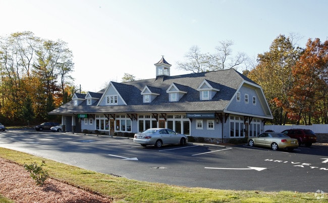

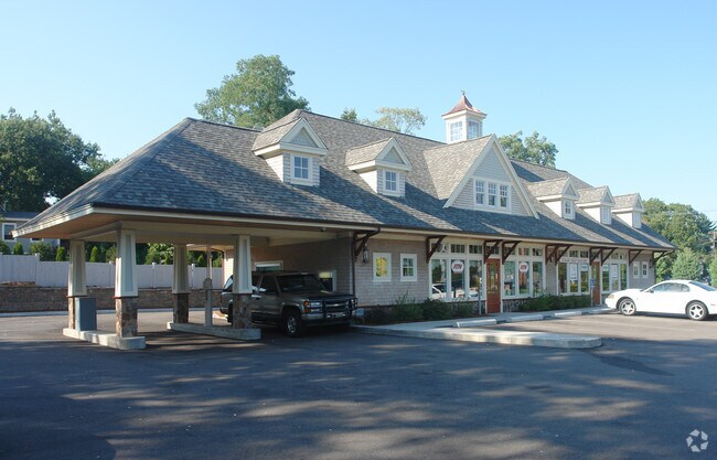
Property Detail
19 Haverhill Rd
Storebuilding
Essex
C
Massachusetts
B and X Area of moderate flood hazard, usually the area between the limits of the 100-year and 500-year floods.
0.51 AC
2025
Amesbury/Ipswich
2025
Boston
266100
Boston-Cambridge-Newton, MA-NH
4,256 SF
AMES-000076-000000-000062
NEARBY LISTINGS FOR SALE OR LEASE
DEMOGRAPHICS near 19 Haverhill Rd
1 mile
3 mile
5 mile
2025 Total Population
6,434
29,299
64,111
2030 Population
6,596
30,093
66,025
Pop Growth 2025-2030
+ 2.52%
+ 2.71%
+ 2.99%
Average Age
43
44
45
2025 Total Households
2,828
12,067
26,637
HH Growth 2025-2030
+ 2.48%
+ 2.67%
+ 2.90%
Median Household Inc
$100,578
$110,247
$111,297
Avg Household Size
2.20
2.40
2.30
2025 Avg HH Vehicles
2.00
2.00
2.00
Median Home Value
$527,640
$632,931
$658,901
Median Year Built
1969
1972
1973
Nearby Places
Map Layers
Map Styles
 Street
 Aerial
Layers
 Traffic
 Biking
Places
Listings with unknown addresses are not visible on the map
- Restaurants
- Banks
- Shops
- Fitness
- Groceries
PUBLIC TRANSPORTATION
COMMUTER RAIL
Newburyport (Newburyport/Rockport Line - Massachusetts Bay Transportation Authority Commuter Rail (Purple Line))
Drive
Walk
Distance
Newburyport (Newburyport/Rockport Line - Massachusetts Bay Transportation Authority Commuter Rail (Purple Line))
14 min
5.8 mi
Nearby Properties
Address
Land Use
TOTAL SIZE
Lot Size
Zoning
Address
Land Use
TOTAL SIZE
Lot Size
Zoning
26.44 AC
OP
Address
Land Use
TOTAL SIZE
Lot Size
Zoning
107,053 SF
17.51 AC
Address
Land Use
TOTAL SIZE
Lot Size
Zoning
176,157 SF
25.53 AC
OSC
Address
Land Use
TOTAL SIZE
Lot Size
Zoning
2,362 SF
342.02 AC
Address
Land Use
TOTAL SIZE
Lot Size
Zoning
145,676 SF
17.42 AC
OSC
Address
Land Use
TOTAL SIZE
Lot Size
Zoning
9.31 AC
R8
Address
Land Use
TOTAL SIZE
Lot Size
Zoning
94,943 SF
15.52 AC
RCZD
Address
Land Use
TOTAL SIZE
Lot Size
Zoning
191,775 SF
23.50 AC
C
Address
Land Use
TOTAL SIZE
Lot Size
Zoning
79,991 SF
2.66 AC
IC
Address
Land Use
TOTAL SIZE
Lot Size
Zoning
2.47 AC
R8
Address
Land Use
TOTAL SIZE
Lot Size
Zoning
4.30 AC
R40
Address
Land Use
TOTAL SIZE
Lot Size
Zoning
3.68 AC
R40
Address
Land Use
TOTAL SIZE
Lot Size
Zoning
106,820 SF
9.97 AC
Address
Land Use
TOTAL SIZE
Lot Size
Zoning
274,050 SF
29.02 AC
I
Address
Land Use
TOTAL SIZE
Lot Size
Zoning
129.11 AC
RC
Address
Land Use
TOTAL SIZE
Lot Size
Zoning
147,462 SF
10.60 AC
I
Address
Land Use
TOTAL SIZE
Lot Size
Zoning
112,559 SF
11.27 AC
Address
Land Use
TOTAL SIZE
Lot Size
Zoning
61,320 SF
35.32 AC
OSC
Address
Land Use
TOTAL SIZE
Lot Size
Zoning
118,008 SF
11.04 AC
Address
Land Use
TOTAL SIZE
Lot Size
Zoning
148,744 SF
4.10 AC
Address
Land Use
TOTAL SIZE
Lot Size
Zoning
126,144 SF
5.41 AC
I
Address
Land Use
TOTAL SIZE
Lot Size
Zoning
3,394 SF
4 AC
Address
Land Use
TOTAL SIZE
Lot Size
Zoning
58,391 SF
14.11 AC
OSC
Address
Land Use
TOTAL SIZE
Lot Size
Zoning
5.98 AC
R8
Address
Land Use
TOTAL SIZE
Lot Size
Zoning
14.35 AC
R20
Address
Land Use
TOTAL SIZE
Lot Size
Zoning
424,000 SF
42.54 AC
I
Address
Land Use
TOTAL SIZE
Lot Size
Zoning
37,886 SF
0.78 AC
IC
Address
Land Use
TOTAL SIZE
Lot Size
Zoning
3 AC
OP
Address
Land Use
TOTAL SIZE
Lot Size
Zoning
1.18 AC
R8
Address
Land Use
TOTAL SIZE
Lot Size
Zoning
33,675 SF
27.18 AC
C3
The World's #1 Commercial Real Estate Marketplace
Connect with us
© 2026 CoStar Group
The information above has been obtained from sources believed reliable. While we do not doubt its accuracy we have not verified it and make no guarantee, warranty or representation about it. It is your responsibility to independently confirm its accuracy and completeness. Any projections, opinions, assumptions, or estimates used are for example only and do not represent the current or future performance of the property. The value of this transaction to you depends on tax and other factors which should be evaluated by your tax, financial, and legal advisors. You and your advisors should conduct a careful, independent investigation of the property to determine to your satisfaction the suitability of the property for your needs.