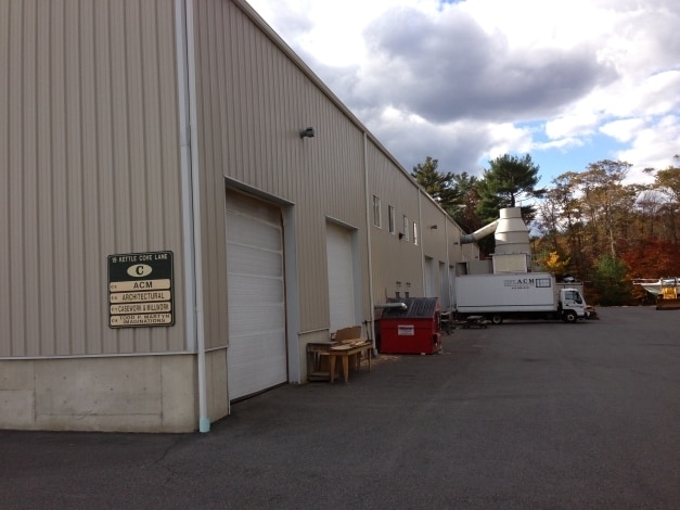
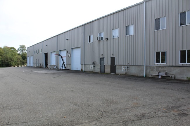
Property Record
19 Kettle Cove Ln, Gloucester, MA 01930
Property Detail
19 Kettle Cove Ln
GLOU-000194-000010-000005C
Essex
Industrialcondominium
Massachusetts
GI
5c
A Areas with a 1% annual chance of flooding and a 26% chance of flooding over the life of a 30-year mortgage.
5.75 AC
2025
Essex/Gloucester
2025
Boston
221901
Boston-Cambridge-Newton, MA-NH
3,200 SF
NEARBY LISTINGS FOR SALE OR LEASE
DEMOGRAPHICS near 19 Kettle Cove Ln
1 mile
3 mile
5 mile
2025 Total Population
2,630
10,900
38,717
2030 Population
2,724
11,282
39,940
Pop Growth 2025-2030
+ 3.57%
+ 3.50%
+ 3.16%
Average Age
49
46
45
2025 Total Households
1,179
4,662
16,557
HH Growth 2025-2030
+ 3.56%
+ 3.45%
+ 3.09%
Median Household Inc
$122,611
$131,769
$104,937
Avg Household Size
2.20
2.30
2.30
2025 Avg HH Vehicles
2.00
2.00
2.00
Median Home Value
$817,154
$812,100
$761,453
Median Year Built
1966
1963
1952
Nearby Places
Map Layers
Map Styles
 Street
 Aerial
Layers
 Traffic
 Biking
Places
Listings with unknown addresses are not visible on the map
- Restaurants
- Banks
- Shops
- Fitness
- Groceries
PUBLIC TRANSPORTATION
COMMUTER RAIL
West Gloucester (Newburyport/Rockport Line - Massachusetts Bay Transportation Authority Commuter Rail (Purple Line))
Drive
Walk
Distance
West Gloucester (Newburyport/Rockport Line - Massachusetts Bay Transportation Authority Commuter Rail (Purple Line))
7 min
2.6 mi
Manchester (Newburyport/Rockport Line - Massachusetts Bay Transportation Authority Commuter Rail (Purple Line))
Drive
Walk
Distance
Manchester (Newburyport/Rockport Line - Massachusetts Bay Transportation Authority Commuter Rail (Purple Line))
8 min
3.6 mi
AIRPORT
General Edward Lawrence Logan International
Drive
Walk
Distance
General Edward Lawrence Logan International
51 min
26.7 mi
Portsmouth International at Pease
Drive
Walk
Distance
Portsmouth International at Pease
75 min
46.5 mi
SALE & LEASE HISTORY
LISTING DATE
SALE/LEASE

Sep 25, 2016
For Lease
Sep 19, 2017
For Sale
Oct 08, 2019
For Lease
Nearby Properties
Address
Land Use
TOTAL SIZE
Lot Size
Zoning
Address
Land Use
TOTAL SIZE
Lot Size
Zoning
246,863 SF
18.84 AC
R-20
Address
Land Use
TOTAL SIZE
Lot Size
Zoning
184,976 SF
7.13 AC
A
Address
Land Use
TOTAL SIZE
Lot Size
Zoning
11,513 SF
17.50 AC
R-20
Address
Land Use
TOTAL SIZE
Lot Size
Zoning
180.40 AC
A
Address
Land Use
TOTAL SIZE
Lot Size
Zoning
67,972 SF
20.94 AC
R-20
Address
Land Use
TOTAL SIZE
Lot Size
Zoning
91,450 SF
11.31 AC
G
Address
Land Use
TOTAL SIZE
Lot Size
Zoning
4.02 AC
E
Address
Land Use
TOTAL SIZE
Lot Size
Zoning
7,801 SF
2.76 AC
E
Address
Land Use
TOTAL SIZE
Lot Size
Zoning
1.69 AC
E
Address
Land Use
TOTAL SIZE
Lot Size
Zoning
14,042 SF
12 AC
R-20
Address
Land Use
TOTAL SIZE
Lot Size
Zoning
14,914 SF
2.25 AC
RC-40
Address
Land Use
TOTAL SIZE
Lot Size
Zoning
1.34 AC
E
Address
Land Use
TOTAL SIZE
Lot Size
Zoning
1.80 AC
E
Address
Land Use
TOTAL SIZE
Lot Size
Zoning
1,557 SF
598 AC
R-30
Address
Land Use
TOTAL SIZE
Lot Size
Zoning
2.28 AC
E
Address
Land Use
TOTAL SIZE
Lot Size
Zoning
61 AC
R-20
Address
Land Use
TOTAL SIZE
Lot Size
Zoning
41.14 AC
LCD
Address
Land Use
TOTAL SIZE
Lot Size
Zoning
24.60 AC
RC-40
Address
Land Use
TOTAL SIZE
Lot Size
Zoning
86,343 SF
6.36 AC
LCD
Address
Land Use
TOTAL SIZE
Lot Size
Zoning
12.20 AC
E
Address
Land Use
TOTAL SIZE
Lot Size
Zoning
6.79 AC
RC-40
Address
Land Use
TOTAL SIZE
Lot Size
Zoning
23.96 AC
E
Address
Land Use
TOTAL SIZE
Lot Size
Zoning
7,879 SF
2.95 AC
E
Address
Land Use
TOTAL SIZE
Lot Size
Zoning
2,718 SF
1.29 AC
E
Address
Land Use
TOTAL SIZE
Lot Size
Zoning
684 SF
1.18 AC
E
Address
Land Use
TOTAL SIZE
Lot Size
Zoning
9.74 AC
EB
Address
Land Use
TOTAL SIZE
Lot Size
Zoning
4,938 SF
3.50 AC
E
Address
Land Use
TOTAL SIZE
Lot Size
Zoning
2.07 AC
E
Address
Land Use
TOTAL SIZE
Lot Size
Zoning
1.54 AC
G
Address
Land Use
TOTAL SIZE
Lot Size
Zoning
2.20 AC
E
The World's #1 Commercial Real Estate Marketplace
Connect with us
© 2026 CoStar Group
The information above has been obtained from sources believed reliable. While we do not doubt its accuracy we have not verified it and make no guarantee, warranty or representation about it. It is your responsibility to independently confirm its accuracy and completeness. Any projections, opinions, assumptions, or estimates used are for example only and do not represent the current or future performance of the property. The value of this transaction to you depends on tax and other factors which should be evaluated by your tax, financial, and legal advisors. You and your advisors should conduct a careful, independent investigation of the property to determine to your satisfaction the suitability of the property for your needs.