Property Record
19 Leonard St, Norton, MA 02766


Property Detail
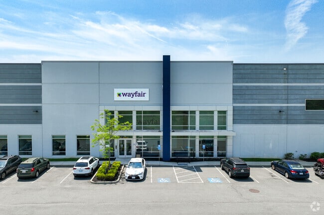
19 Leonard St
NORT-000011-000000-000066
BRISTOL
Commercialbuilding
Massachusetts
AE The base floodplain where base flood elevations are provided. AE Zones are now used on new format FIRMs instead of A1-A30 Zones.
37.59 AC
2025
Attleboro/New Bedford
2025
Boston
611101
Providence-Warwick, RI-MA
223,480 SF
NEARBY LISTINGS FOR SALE OR LEASE
DEMOGRAPHICS near 19 Leonard St
1 mile
3 mile
5 mile
2025 Total Population
2,697
19,211
64,158
2030 Population
2,740
19,599
65,412
Pop Growth 2025-2030
+ 1.59%
+ 2.02%
+ 1.95%
Average Age
41
41
42
2025 Total Households
977
6,645
24,041
HH Growth 2025-2030
+ 1.64%
+ 2.21%
+ 2.08%
Median Household Inc
$114,986
$121,165
$118,220
Avg Household Size
2.60
2.60
2.60
2025 Avg HH Vehicles
2.00
2.00
2.00
Median Home Value
$595,783
$548,663
$570,181
Median Year Built
1986
1983
1980
Nearby Places
Map Layers
Map Styles
 Street
 Aerial
Layers
 Traffic
 Biking
Places
Listings with unknown addresses are not visible on the map
- Restaurants
- Banks
- Shops
- Fitness
- Groceries
PUBLIC TRANSPORTATION
COMMUTER RAIL
Mansfield (Foxboro Line (Special Events Only) - Massachusetts Bay Transportation Authority Commuter Rail (Purple Line), Providence/Stoughton Line - Massachusetts Bay Transportation Authority Commuter Rail (Purple Line))
Drive
Walk
Distance
Mansfield (Foxboro Line (Special Events Only) - Massachusetts Bay Transportation Authority Commuter Rail (Purple Line), Providence/Stoughton Line - Massachusetts Bay Transportation Authority Commuter Rail (Purple Line))
14 min
6.9 mi
Attleboro (Foxboro Event Service - MBTA, Providence/Stoughton Line - MBTA)
Drive
Walk
Distance
Attleboro (Foxboro Event Service - MBTA, Providence/Stoughton Line - MBTA)
17 min
8.5 mi
AIRPORT
Rhode Island Tf Green International
Drive
Walk
Distance
Rhode Island Tf Green International
50 min
33.2 mi
General Edward Lawrence Logan International
Drive
Walk
Distance
General Edward Lawrence Logan International
56 min
35.2 mi
Freight Ports
Port of Boston
Drive
Walk
Distance
Port of Boston
53 min
33.0 mi
SALE & LEASE HISTORY
LISTING DATE
SALE/LEASE

Aug 06, 2018
For Lease
Nearby Properties
Address
Land Use
TOTAL SIZE
Lot Size
Zoning
Address
Land Use
TOTAL SIZE
Lot Size
Zoning
559,641 SF
73.61 AC
Address
Land Use
TOTAL SIZE
Lot Size
Zoning
3,838 SF
1.11 AC
R80
Address
Land Use
TOTAL SIZE
Lot Size
Zoning
177,218 SF
50.82 AC
Address
Land Use
TOTAL SIZE
Lot Size
Zoning
315,896 SF
24.53 AC
INDUST
Address
Land Use
TOTAL SIZE
Lot Size
Zoning
225,600 SF
18.47 AC
R80
Address
Land Use
TOTAL SIZE
Lot Size
Zoning
335,092 SF
27.12 AC
INDUST
Address
Land Use
TOTAL SIZE
Lot Size
Zoning
212,672 SF
34.40 AC
Address
Land Use
TOTAL SIZE
Lot Size
Zoning
201,634 SF
12.01 AC
Address
Land Use
TOTAL SIZE
Lot Size
Zoning
361,737 SF
20 AC
INDUST
Address
Land Use
TOTAL SIZE
Lot Size
Zoning
25.26 AC
INDUST
Address
Land Use
TOTAL SIZE
Lot Size
Zoning
145,360 SF
11.80 AC
Address
Land Use
TOTAL SIZE
Lot Size
Zoning
Address
Land Use
TOTAL SIZE
Lot Size
Zoning
Address
Land Use
TOTAL SIZE
Lot Size
Zoning
123,740 SF
10.67 AC
R80
Address
Land Use
TOTAL SIZE
Lot Size
Zoning
213,128 SF
12 AC
INDUST
Address
Land Use
TOTAL SIZE
Lot Size
Zoning
200,000 SF
14.56 AC
INDUST
Address
Land Use
TOTAL SIZE
Lot Size
Zoning
26.70 AC
Address
Land Use
TOTAL SIZE
Lot Size
Zoning
153,057 SF
13.96 AC
INDUST
Address
Land Use
TOTAL SIZE
Lot Size
Zoning
239,923 SF
14.24 AC
INDUST
Address
Land Use
TOTAL SIZE
Lot Size
Zoning
198,720 SF
15.10 AC
INDUST
Address
Land Use
TOTAL SIZE
Lot Size
Zoning
32.93 AC
BIZDIS
Address
Land Use
TOTAL SIZE
Lot Size
Zoning
114,057 SF
6.43 AC
INDUST
Address
Land Use
TOTAL SIZE
Lot Size
Zoning
191,828 SF
17.09 AC
INDUST
Address
Land Use
TOTAL SIZE
Lot Size
Zoning
82,946 SF
25.50 AC
Address
Land Use
TOTAL SIZE
Lot Size
Zoning
117,076 SF
5.16 AC
INDUST
Address
Land Use
TOTAL SIZE
Lot Size
Zoning
62,555 SF
5.09 AC
OFFDIS
Address
Land Use
TOTAL SIZE
Lot Size
Zoning
143,860 SF
12.71 AC
INDUST
Address
Land Use
TOTAL SIZE
Lot Size
Zoning
3,153 SF
53 AC
Address
Land Use
TOTAL SIZE
Lot Size
Zoning
112,500 SF
13.83 AC
The World's #1 Commercial Real Estate Marketplace
Connect with us
© 2026 CoStar Group
The information above has been obtained from sources believed reliable. While we do not doubt its accuracy we have not verified it and make no guarantee, warranty or representation about it. It is your responsibility to independently confirm its accuracy and completeness. Any projections, opinions, assumptions, or estimates used are for example only and do not represent the current or future performance of the property. The value of this transaction to you depends on tax and other factors which should be evaluated by your tax, financial, and legal advisors. You and your advisors should conduct a careful, independent investigation of the property to determine to your satisfaction the suitability of the property for your needs.