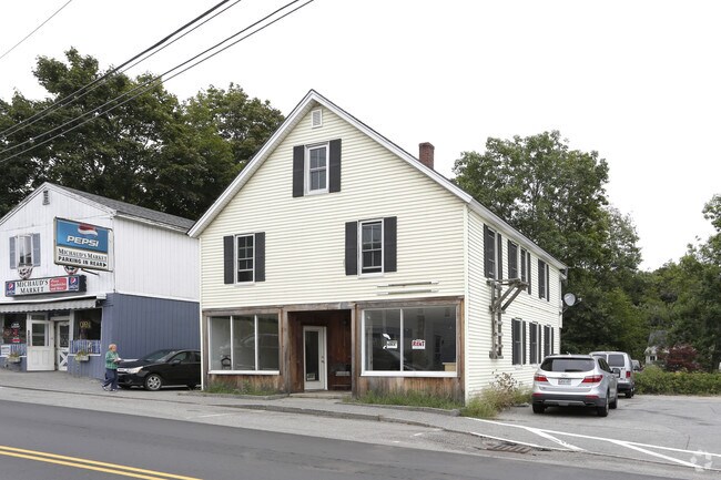
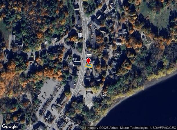
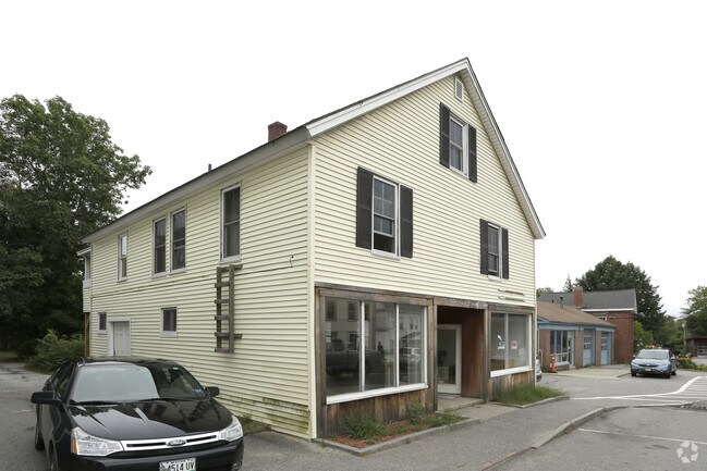
Property Record
19 Main St, Topsham, ME 04086
NEARBY LISTINGS FOR SALE OR LEASE
Property Detail
19 Main St
TOPM-000006-000000-000040U
Sagadahoc
Departmentstore
Maine
X
40
23005C0362F
0.04 AC
2025
Sagadahoc County
2025
Portland/South Portland
970302
Portland-South Portland, ME
2,104 SF
DEMOGRAPHICS near 19 Main St
1 mile
3 mile
5 mile
2024 Total Population
6,044
22,486
31,408
2029 Population
6,276
23,344
32,683
Pop Growth 2024-2029
+ 3.84%
+ 3.82%
+ 4.06%
Average Age
47
44
44
2024 Total Households
3,042
9,561
13,353
HH Growth 2024-2029
+ 3.85%
+ 3.88%
+ 4.13%
Median Household Inc
$61,765
$72,715
$71,828
Avg Household Size
1.90
2.10
2.10
2024 Avg HH Vehicles
1.00
2.00
2.00
Median Home Value
$301,279
$326,690
$323,838
Median Year Built
1959
1973
1980
Nearby Places
Map Layers
Map Styles
 Street
 Aerial
Transit
 Traffic
 Biking
Places
Listings with unknown addresses are not visible on the map
- Restaurants
- Banks
- Shops
- Fitness
- Groceries
PUBLIC TRANSPORTATION
COMMUTER RAIL
Drive
Walk
Distance
2 min
1.1 mi
AIRPORT
Portland International Jetport
Drive
Walk
Distance
Portland International Jetport
43 min
31.1 mi
Freight Ports
Portland, ME
Drive
Walk
Distance
Portland, ME
36 min
28.1 mi
SALE & LEASE HISTORY
LISTING DATE
SALE/LEASE

Sep 25, 2016
For Lease
Nov 30, 2016
For Sale
Nearby Properties
Address
Land Use
TOTAL SIZE
Lot Size
Zoning
Address
Land Use
TOTAL SIZE
Lot Size
Zoning
21,788 SF
34.10 AC
RA
Address
Land Use
TOTAL SIZE
Lot Size
Zoning
616.11 AC
NO
Address
Land Use
TOTAL SIZE
Lot Size
Zoning
Address
Land Use
TOTAL SIZE
Lot Size
Zoning
252,409 SF
24.20 AC
Address
Land Use
TOTAL SIZE
Lot Size
Zoning
17,228 SF
67.60 AC
Address
Land Use
TOTAL SIZE
Lot Size
Zoning
199,222 SF
46.56 AC
NO
Address
Land Use
TOTAL SIZE
Lot Size
Zoning
11.05 AC
Address
Land Use
TOTAL SIZE
Lot Size
Zoning
5.77 AC
Address
Land Use
TOTAL SIZE
Lot Size
Zoning
30.78 AC
NO
Address
Land Use
TOTAL SIZE
Lot Size
Zoning
96,823 SF
13 AC
Address
Land Use
TOTAL SIZE
Lot Size
Zoning
166,328 SF
29.13 AC
Address
Land Use
TOTAL SIZE
Lot Size
Zoning
193,840 SF
11.61 AC
Address
Land Use
TOTAL SIZE
Lot Size
Zoning
111,099 SF
10.40 AC
Address
Land Use
TOTAL SIZE
Lot Size
Zoning
124,514 SF
10.76 AC
NO
Address
Land Use
TOTAL SIZE
Lot Size
Zoning
11,760 SF
5.68 AC
Address
Land Use
TOTAL SIZE
Lot Size
Zoning
5,238 SF
3.99 AC
Address
Land Use
TOTAL SIZE
Lot Size
Zoning
413,793 SF
4.94 AC
Address
Land Use
TOTAL SIZE
Lot Size
Zoning
74,778 SF
23.51 AC
Address
Land Use
TOTAL SIZE
Lot Size
Zoning
147,471 SF
Address
Land Use
TOTAL SIZE
Lot Size
Zoning
51,162 SF
29.25 AC
Address
Land Use
TOTAL SIZE
Lot Size
Zoning
73,164 SF
5.94 AC
GI
Address
Land Use
TOTAL SIZE
Lot Size
Zoning
101,903 SF
7.25 AC
NO
Address
Land Use
TOTAL SIZE
Lot Size
Zoning
168,560 SF
11.61 AC
Address
Land Use
TOTAL SIZE
Lot Size
Zoning
94,968 SF
16.88 AC
NO
Address
Land Use
TOTAL SIZE
Lot Size
Zoning
78,120 SF
28.71 AC
NO
Address
Land Use
TOTAL SIZE
Lot Size
Zoning
49,175 SF
6.70 AC
Address
Land Use
TOTAL SIZE
Lot Size
Zoning
86,743 SF
10.94 AC
NO
Address
Land Use
TOTAL SIZE
Lot Size
Zoning
Address
Land Use
TOTAL SIZE
Lot Size
Zoning
44,245 SF
2.81 AC
Address
Land Use
TOTAL SIZE
Lot Size
Zoning
27,134 SF
2.45 AC
The World's #1 Commercial Real Estate Marketplace
Connect with us
© 2026 CoStar Group
The information above has been obtained from sources believed reliable. While we do not doubt its accuracy we have not verified it and make no guarantee, warranty or representation about it. It is your responsibility to independently confirm its accuracy and completeness. Any projections, opinions, assumptions, or estimates used are for example only and do not represent the current or future performance of the property. The value of this transaction to you depends on tax and other factors which should be evaluated by your tax, financial, and legal advisors. You and your advisors should conduct a careful, independent investigation of the property to determine to your satisfaction the suitability of the property for your needs.