Property Record
19 N 42Nd Ave, Brighton, CO 80601


Property Detail
19 N 42Nd Ave
Denver-Aurora-Centennial, CO
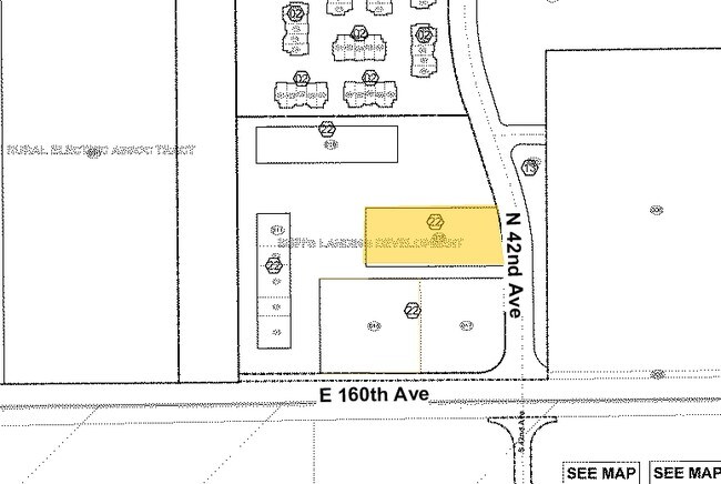
SUB:BUFFS LANDING DEVELOPMENT DESC: BLDG PAD C DESC AS FOLS THAT PORT OF LOT 1 BLK 34 BRIGHTON EAST FARMS FLG 1 COMM AT THE SW COR OF SD LOT 1 TH N 89D 42M 46S E A DIST OF 168 FT TO POB TH N 00D 22M 09S W A DIST OF 203.95 FT TH N 89D 37M 51S E A DIST
1569-03-3-22-016
Adams
Officebuilding
Colorado
B and X Area of moderate flood hazard, usually the area between the limits of the 100-year and 500-year floods.
1
2024
1.02 AC
2025
Northeast Denver
008562
Denver
9,504 SF
NEARBY LISTINGS FOR SALE OR LEASE
DEMOGRAPHICS near 19 N 42Nd Ave
1 mile
3 mile
5 mile
2024 Total Population
11,237
47,772
59,186
2029 Population
11,932
51,040
63,148
Pop Growth 2024-2029
+ 6.18%
+ 6.84%
+ 6.69%
Average Age
36
37
37
2024 Total Households
3,526
15,778
19,574
HH Growth 2024-2029
+ 6.47%
+ 7.12%
+ 6.95%
Median Household Inc
$124,413
$108,060
$105,955
Avg Household Size
3.10
3.00
3.00
2024 Avg HH Vehicles
2.00
2.00
2.00
Median Home Value
$542,258
$512,217
$498,120
Median Year Built
2007
2003
2003
Nearby Places
Map Layers
Map Styles
 Street
 Aerial
Transit
 Traffic
 Biking
Places
Listings with unknown addresses are not visible on the map
- Restaurants
- Banks
- Shops
- Fitness
- Groceries
PUBLIC TRANSPORTATION
AIRPORT
Denver International
Drive
Walk
Distance
Denver International
27 min
20.4 mi
Nearby Properties
Address
Land Use
TOTAL SIZE
Lot Size
Zoning
Address
Land Use
TOTAL SIZE
Lot Size
Zoning
374,830 SF
49.94 AC
Address
Land Use
TOTAL SIZE
Lot Size
Zoning
413,138 SF
20.74 AC
Address
Land Use
TOTAL SIZE
Lot Size
Zoning
275,217 SF
27.30 AC
Address
Land Use
TOTAL SIZE
Lot Size
Zoning
113,764 SF
4.24 AC
Address
Land Use
TOTAL SIZE
Lot Size
Zoning
119,714 SF
4.93 AC
Address
Land Use
TOTAL SIZE
Lot Size
Zoning
116,223 SF
7.38 AC
Address
Land Use
TOTAL SIZE
Lot Size
Zoning
614,010 SF
41.81 AC
Address
Land Use
TOTAL SIZE
Lot Size
Zoning
546,000 SF
35.70 AC
Address
Land Use
TOTAL SIZE
Lot Size
Zoning
1,305,700 SF
103.31 AC
A3
Address
Land Use
TOTAL SIZE
Lot Size
Zoning
526,400 SF
29.21 AC
Address
Land Use
TOTAL SIZE
Lot Size
Zoning
243,589 SF
16.71 AC
Address
Land Use
TOTAL SIZE
Lot Size
Zoning
11,840 SF
6 AC
Address
Land Use
TOTAL SIZE
Lot Size
Zoning
198,433 SF
40.09 AC
Address
Land Use
TOTAL SIZE
Lot Size
Zoning
352,240 SF
19.96 AC
Address
Land Use
TOTAL SIZE
Lot Size
Zoning
300,300 SF
16.38 AC
Address
Land Use
TOTAL SIZE
Lot Size
Zoning
268,226 SF
13.89 AC
Address
Land Use
TOTAL SIZE
Lot Size
Zoning
266,280 SF
12.68 AC
Address
Land Use
TOTAL SIZE
Lot Size
Zoning
223,459 SF
27.46 AC
Address
Land Use
TOTAL SIZE
Lot Size
Zoning
123,627 SF
11.22 AC
Address
Land Use
TOTAL SIZE
Lot Size
Zoning
289,524 SF
15 AC
Address
Land Use
TOTAL SIZE
Lot Size
Zoning
281,164 SF
15.57 AC
Address
Land Use
TOTAL SIZE
Lot Size
Zoning
109,032 SF
13.88 AC
Address
Land Use
TOTAL SIZE
Lot Size
Zoning
61,700 SF
10 AC
Address
Land Use
TOTAL SIZE
Lot Size
Zoning
91,534 SF
23.03 AC
Address
Land Use
TOTAL SIZE
Lot Size
Zoning
85,398 SF
15 AC
Address
Land Use
TOTAL SIZE
Lot Size
Zoning
256,102 SF
6.66 AC
Address
Land Use
TOTAL SIZE
Lot Size
Zoning
174,724 SF
14.75 AC
Address
Land Use
TOTAL SIZE
Lot Size
Zoning
69,919 SF
6.73 AC
The World's #1 Commercial Real Estate Marketplace
Connect with us
© 2026 CoStar Group
The information above has been obtained from sources believed reliable. While we do not doubt its accuracy we have not verified it and make no guarantee, warranty or representation about it. It is your responsibility to independently confirm its accuracy and completeness. Any projections, opinions, assumptions, or estimates used are for example only and do not represent the current or future performance of the property. The value of this transaction to you depends on tax and other factors which should be evaluated by your tax, financial, and legal advisors. You and your advisors should conduct a careful, independent investigation of the property to determine to your satisfaction the suitability of the property for your needs.