Property Record
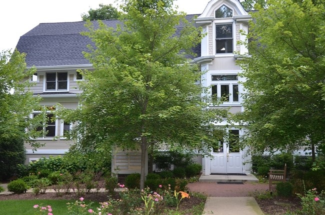
19 N Grant St, Hinsdale, IL 60521


Current Lease Availabilities
NEARBY LISTINGS FOR SALE OR LEASE
Property Detail
19 N Grant St
Chicago-Naperville-Elgin, IL-IN-WI
Stoughs Add To Twn Of Hins
09-01-330-001
STOUGHS ADD TO TWN OF HINS /EX S 55 FT/
Commercialnec
DuPage
X
Illinois
17043C0191J
4
2024
0.42 AC
2024
Eastern East/West Corr
845300
Chicago
1,463 SF
DEMOGRAPHICS near 19 N Grant St
1 Mile
3 Mile
5 Mile
2024 Total Population
13,574
95,332
265,879
2029 Population
13,579
94,688
262,274
Pop Growth 2024-2029
+ 0.04%
(0.68%)
(1.36%)
Average Age
38
43
43
2024 Total Households
4,142
35,333
103,375
HH Growth 2024-2029
(0.05%)
(0.76%)
(1.52%)
Median Household Inc
$235,177
$130,424
$105,376
Avg Household Size
3.20
2.60
2.50
2024 Avg HH Vehicles
2.00
2.00
2.00
Median Home Value
$914,852
$600,622
$406,990
Median Year Built
1974
1974
1970
Nearby Places
Map Layers
Map Styles
 Street
 Aerial
- Restaurants
- Banks
- Shops
- Fitness
- Groceries
PUBLIC TRANSPORTATION
COMMUTER RAIL
Hinsdale Station (Burlington Northern-Santa Fe Railway Line - Northeast Illinois Regional Commuter Railroad (Metra))
DRIVE
WALK
Distance
Hinsdale Station (Burlington Northern-Santa Fe Railway Line - Northeast Illinois Regional Commuter Railroad (Metra))
1 min
6 min
0.3 mi
Highlands Station (Burlington Northern-Santa Fe Railway Line - Northeast Illinois Regional Commuter Railroad (Metra))
DRIVE
WALK
Distance
Highlands Station (Burlington Northern-Santa Fe Railway Line - Northeast Illinois Regional Commuter Railroad (Metra))
3 min
16 min
0.8 mi
AIRPORT
Chicago Midway International
DRIVE
WALK
Distance
Chicago Midway International
18 min
10.1 mi
Chicago O'Hare International
DRIVE
WALK
Distance
Chicago O'Hare International
27 min
18.1 mi
Freight Ports
Port Milwaukee
DRIVE
WALK
Distance
Port Milwaukee
108 min
89.8 mi
Nearby Properties
Address
Land Use
TOTAL SIZE
Lot Size
Zoning
Address
Land Use
TOTAL SIZE
Lot Size
Zoning
4.69 AC
Address
Land Use
TOTAL SIZE
Lot Size
Zoning
403,248 SF
24.98 AC
M
Address
Land Use
TOTAL SIZE
Lot Size
Zoning
12.40 AC
Address
Land Use
TOTAL SIZE
Lot Size
Zoning
470,838 SF
17.13 AC
M
Address
Land Use
TOTAL SIZE
Lot Size
Zoning
54,675 SF
3.05 AC
C
Address
Land Use
TOTAL SIZE
Lot Size
Zoning
4.69 AC
C
Address
Land Use
TOTAL SIZE
Lot Size
Zoning
260,052 SF
48.39 AC
C
Address
Land Use
TOTAL SIZE
Lot Size
Zoning
274,406 SF
17.67 AC
M
Address
Land Use
TOTAL SIZE
Lot Size
Zoning
105,443 SF
5.15 AC
C
Address
Land Use
TOTAL SIZE
Lot Size
Zoning
318,592 SF
16.59 AC
C
Address
Land Use
TOTAL SIZE
Lot Size
Zoning
436,456 SF
59.11 AC
I
Address
Land Use
TOTAL SIZE
Lot Size
Zoning
182,295 SF
21.84 AC
C
Address
Land Use
TOTAL SIZE
Lot Size
Zoning
225,318 SF
6.64 AC
C
Address
Land Use
TOTAL SIZE
Lot Size
Zoning
230,187 SF
15.38 AC
M
Address
Land Use
TOTAL SIZE
Lot Size
Zoning
250,892 SF
9.04 AC
C
Address
Land Use
TOTAL SIZE
Lot Size
Zoning
202,562 SF
16.17 AC
M
Address
Land Use
TOTAL SIZE
Lot Size
Zoning
265,215 SF
18.12 AC
C
Address
Land Use
TOTAL SIZE
Lot Size
Zoning
108,021 SF
0.89 AC
Address
Land Use
TOTAL SIZE
Lot Size
Zoning
91,818 SF
7.87 AC
Address
Land Use
TOTAL SIZE
Lot Size
Zoning
205,536 SF
14.09 AC
C
Address
Land Use
TOTAL SIZE
Lot Size
Zoning
Address
Land Use
TOTAL SIZE
Lot Size
Zoning
137,144 SF
11.77 AC
Address
Land Use
TOTAL SIZE
Lot Size
Zoning
58,902 SF
9.47 AC
Address
Land Use
TOTAL SIZE
Lot Size
Zoning
174,930 SF
5.61 AC
C
Address
Land Use
TOTAL SIZE
Lot Size
Zoning
125,376 SF
5.38 AC
C
Address
Land Use
TOTAL SIZE
Lot Size
Zoning
140,579 SF
11.30 AC
Address
Land Use
TOTAL SIZE
Lot Size
Zoning
151,680 SF
13.52 AC
C
Address
Land Use
TOTAL SIZE
Lot Size
Zoning
23,043 SF
9.85 AC
M
Address
Land Use
TOTAL SIZE
Lot Size
Zoning
113,756 SF
2.60 AC
C
Address
Land Use
TOTAL SIZE
Lot Size
Zoning
111,892 SF
8.69 AC
I
The World's #1 Commercial Real Estate Marketplace
Connect with us
© 2025 CoStar Group
The information above has been obtained from sources believed reliable. While we do not doubt its accuracy we have not verified it and make no guarantee, warranty or representation about it. It is your responsibility to independently confirm its accuracy and completeness. Any projections, opinions, assumptions, or estimates used are for example only and do not represent the current or future performance of the property. The value of this transaction to you depends on tax and other factors which should be evaluated by your tax, financial, and legal advisors. You and your advisors should conduct a careful, independent investigation of the property to determine to your satisfaction the suitability of the property for your needs.