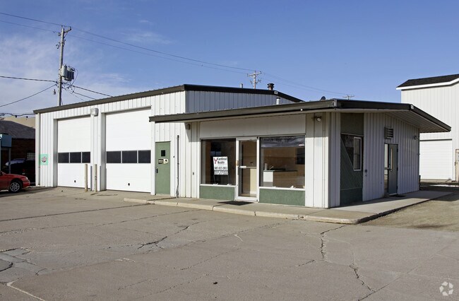
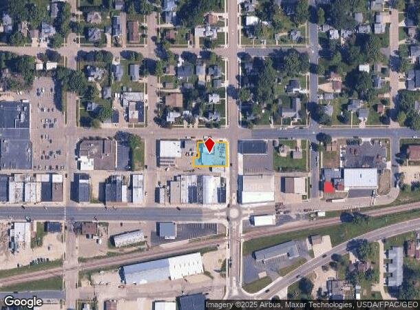
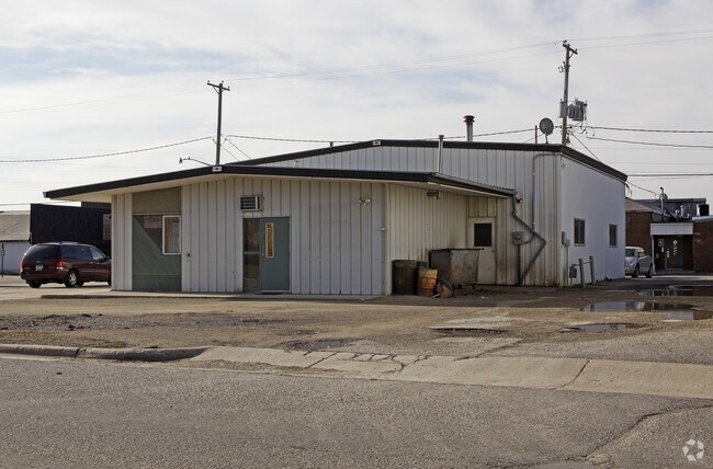
Property Record
19 N Mantorville Ave, Kasson, MN 55944
NEARBY LISTINGS FOR SALE OR LEASE
Property Detail
19 N Mantorville Ave
24.100.1410
Original Plat
Commercialnec
163800 0 24100 SECT-33 TWP-107 RANGE-016 ORIGINAL PLAT N36FT OF S1/2 OF LOTS 1 & 2 BLK 13 COMM AT NECOR BLK 13 AND A TRACT OF
X
Dodge
27039C0188C
Minnesota
2025
1,2
2025
0.30 AC
950500
Other Market Areas
2,200 SF
Rochester, MN
DEMOGRAPHICS near 19 N Mantorville Ave
1 Mile
3 Mile
5 Mile
2024 Total Population
6,289
9,595
13,258
2029 Population
6,430
9,780
13,473
Pop Growth 2024-2029
+ 2.24%
+ 1.93%
+ 1.62%
Average Age
37
38
38
2024 Total Households
2,408
3,586
4,905
HH Growth 2024-2029
+ 2.16%
+ 1.90%
+ 1.61%
Median Household Inc
$87,391
$95,678
$99,114
Avg Household Size
2.60
2.70
2.70
2024 Avg HH Vehicles
2.00
2.00
2.00
Median Home Value
$240,265
$266,924
$277,536
Median Year Built
1993
1993
1992
Nearby Places
Map Layers
Map Styles
 Street
 Aerial
- Restaurants
- Banks
- Shops
- Fitness
- Groceries
PUBLIC TRANSPORTATION
AIRPORT
Rochester International
DRIVE
WALK
Distance
Rochester International
31 min
23.0 mi
Nearby Properties
Address
Land Use
TOTAL SIZE
Lot Size
Zoning
Address
Land Use
TOTAL SIZE
Lot Size
Zoning
199,081 SF
50.63 AC
Address
Land Use
TOTAL SIZE
Lot Size
Zoning
125,562 SF
19.39 AC
Address
Land Use
TOTAL SIZE
Lot Size
Zoning
148,405 SF
44.32 AC
Address
Land Use
TOTAL SIZE
Lot Size
Zoning
59,776 SF
6.12 AC
Address
Land Use
TOTAL SIZE
Lot Size
Zoning
50,936 SF
5 AC
Address
Land Use
TOTAL SIZE
Lot Size
Zoning
2.39 AC
Address
Land Use
TOTAL SIZE
Lot Size
Zoning
1,025 SF
27.93 AC
Address
Land Use
TOTAL SIZE
Lot Size
Zoning
12,340 SF
1.30 AC
Address
Land Use
TOTAL SIZE
Lot Size
Zoning
26,598 SF
80 AC
Address
Land Use
TOTAL SIZE
Lot Size
Zoning
21,608 SF
2.30 AC
Address
Land Use
TOTAL SIZE
Lot Size
Zoning
281.57 AC
Address
Land Use
TOTAL SIZE
Lot Size
Zoning
6.33 AC
Address
Land Use
TOTAL SIZE
Lot Size
Zoning
29,345 SF
5.67 AC
Address
Land Use
TOTAL SIZE
Lot Size
Zoning
238.84 AC
Address
Land Use
TOTAL SIZE
Lot Size
Zoning
10,923 SF
2.80 AC
Address
Land Use
TOTAL SIZE
Lot Size
Zoning
22,638 SF
0.70 AC
Address
Land Use
TOTAL SIZE
Lot Size
Zoning
35,698 SF
2.10 AC
Address
Land Use
TOTAL SIZE
Lot Size
Zoning
12.44 AC
Address
Land Use
TOTAL SIZE
Lot Size
Zoning
Address
Land Use
TOTAL SIZE
Lot Size
Zoning
209.70 AC
Address
Land Use
TOTAL SIZE
Lot Size
Zoning
1,064 SF
185.83 AC
Address
Land Use
TOTAL SIZE
Lot Size
Zoning
2,500 SF
8.08 AC
Address
Land Use
TOTAL SIZE
Lot Size
Zoning
9,643 SF
4.30 AC
Address
Land Use
TOTAL SIZE
Lot Size
Zoning
226.82 AC
Address
Land Use
TOTAL SIZE
Lot Size
Zoning
Address
Land Use
TOTAL SIZE
Lot Size
Zoning
9,680 SF
3.97 AC
Address
Land Use
TOTAL SIZE
Lot Size
Zoning
30,380 SF
1.03 AC
Address
Land Use
TOTAL SIZE
Lot Size
Zoning
157.68 AC
Address
Land Use
TOTAL SIZE
Lot Size
Zoning
Address
Land Use
TOTAL SIZE
Lot Size
Zoning
150 AC
The World's #1 Commercial Real Estate Marketplace
Connect with us
© 2025 CoStar Group
The information above has been obtained from sources believed reliable. While we do not doubt its accuracy we have not verified it and make no guarantee, warranty or representation about it. It is your responsibility to independently confirm its accuracy and completeness. Any projections, opinions, assumptions, or estimates used are for example only and do not represent the current or future performance of the property. The value of this transaction to you depends on tax and other factors which should be evaluated by your tax, financial, and legal advisors. You and your advisors should conduct a careful, independent investigation of the property to determine to your satisfaction the suitability of the property for your needs.