Property Record
19 Newport Dr, Forest Hill, MD 21050


NEARBY LISTINGS FOR SALE OR LEASE
Property Detail
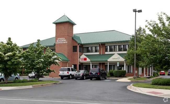
19 Newport Dr
Baltimore-Columbia-Towson, MD
Forest Hill Bus Center
03-254925
LT 11-A 1.0763 AC 19-A NEWPORT DRIVE FOR HILL BUS CTN P 75/23
Officebuilding
Harford
X
Maryland
24025C0134E
11a
2025
1.26 AC
2025
Outlying Harford County
303201
Baltimore
16,130 SF
DEMOGRAPHICS near 19 Newport Dr
1 Mile
3 Mile
5 Mile
2024 Total Population
6,216
35,191
75,756
2029 Population
6,404
36,052
77,702
Pop Growth 2024-2029
+ 3.02%
+ 2.45%
+ 2.57%
Average Age
42
41
42
2024 Total Households
2,307
12,914
28,290
HH Growth 2024-2029
+ 3.12%
+ 2.50%
+ 2.66%
Median Household Inc
$108,550
$108,338
$105,909
Avg Household Size
2.60
2.60
2.60
2024 Avg HH Vehicles
2.00
2.00
2.00
Median Home Value
$371,710
$383,156
$377,199
Median Year Built
1997
1990
1986
Nearby Places
Map Layers
Map Styles
 Street
 Aerial
- Restaurants
- Banks
- Shops
- Fitness
- Groceries
PUBLIC TRANSPORTATION
AIRPORT
Baltimore/Washington International Thurgood Marshall
DRIVE
WALK
Distance
Baltimore/Washington International Thurgood Marshall
61 min
40.8 mi
Freight Ports
Port Newark Container Terminal
DRIVE
WALK
Distance
Port Newark Container Terminal
53 min
33.1 mi
SALE & LEASE HISTORY
LISTING DATE
SALE/LEASE

Sep 24, 2016
For Sale
Nov 13, 2024
For Lease
May 12, 2023
For Lease
Feb 14, 2023
For Sale
Nearby Properties
Address
Land Use
TOTAL SIZE
Lot Size
Zoning
Address
Land Use
TOTAL SIZE
Lot Size
Zoning
51,475 SF
7.85 AC
C1
Address
Land Use
TOTAL SIZE
Lot Size
Zoning
12.38 AC
R2
Address
Land Use
TOTAL SIZE
Lot Size
Zoning
6,084 SF
6.03 AC
B2
Address
Land Use
TOTAL SIZE
Lot Size
Zoning
101,236 SF
23.52 AC
R1
Address
Land Use
TOTAL SIZE
Lot Size
Zoning
78,264 SF
16.71 AC
AG
Address
Land Use
TOTAL SIZE
Lot Size
Zoning
52,245 SF
2.43 AC
R3/B1
Address
Land Use
TOTAL SIZE
Lot Size
Zoning
10.73 AC
B2
Address
Land Use
TOTAL SIZE
Lot Size
Zoning
229,355 SF
59.83 AC
R2
Address
Land Use
TOTAL SIZE
Lot Size
Zoning
46,247 SF
10.45 AC
R2 B2
Address
Land Use
TOTAL SIZE
Lot Size
Zoning
78,394 SF
24.56 AC
CI
Address
Land Use
TOTAL SIZE
Lot Size
Zoning
7,104 SF
10.95 AC
R2 R3
Address
Land Use
TOTAL SIZE
Lot Size
Zoning
77,649 SF
10.42 AC
GI
Address
Land Use
TOTAL SIZE
Lot Size
Zoning
63,392 SF
8.44 AC
VR
Address
Land Use
TOTAL SIZE
Lot Size
Zoning
9,464 SF
3.51 AC
R3
Address
Land Use
TOTAL SIZE
Lot Size
Zoning
97,060 SF
8.39 AC
B2
Address
Land Use
TOTAL SIZE
Lot Size
Zoning
19,224 SF
6.43 AC
R2
Address
Land Use
TOTAL SIZE
Lot Size
Zoning
84,100 SF
2.58 AC
B3
Address
Land Use
TOTAL SIZE
Lot Size
Zoning
5,690 SF
10.86 AC
R2
Address
Land Use
TOTAL SIZE
Lot Size
Zoning
45,890 SF
20.67 AC
R2
Address
Land Use
TOTAL SIZE
Lot Size
Zoning
49,265 SF
4.30 AC
B3
Address
Land Use
TOTAL SIZE
Lot Size
Zoning
49,700 SF
5.89 AC
B2
Address
Land Use
TOTAL SIZE
Lot Size
Zoning
52,530 SF
5.60 AC
B3
Address
Land Use
TOTAL SIZE
Lot Size
Zoning
67,606 SF
23.04 AC
AG
Address
Land Use
TOTAL SIZE
Lot Size
Zoning
16,000 SF
6.16 AC
GI
Address
Land Use
TOTAL SIZE
Lot Size
Zoning
7,773 SF
1.39 AC
B3
Address
Land Use
TOTAL SIZE
Lot Size
Zoning
14,735 SF
2.37 AC
B2
Address
Land Use
TOTAL SIZE
Lot Size
Zoning
2,943 SF
10.30 AC
B3
Address
Land Use
TOTAL SIZE
Lot Size
Zoning
16,157 SF
4.21 AC
B2
Address
Land Use
TOTAL SIZE
Lot Size
Zoning
80,604 SF
5.38 AC
B2
Address
Land Use
TOTAL SIZE
Lot Size
Zoning
58,438 SF
6.74 AC
B2
The World's #1 Commercial Real Estate Marketplace
Connect with us
© 2025 CoStar Group
The information above has been obtained from sources believed reliable. While we do not doubt its accuracy we have not verified it and make no guarantee, warranty or representation about it. It is your responsibility to independently confirm its accuracy and completeness. Any projections, opinions, assumptions, or estimates used are for example only and do not represent the current or future performance of the property. The value of this transaction to you depends on tax and other factors which should be evaluated by your tax, financial, and legal advisors. You and your advisors should conduct a careful, independent investigation of the property to determine to your satisfaction the suitability of the property for your needs.