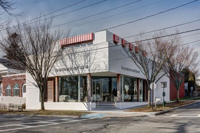
Property Record
19 Pond Ln, Ridge, NY 11961


NEARBY LISTINGS FOR SALE OR LEASE
Property Detail
19 Pond Ln
0904-014-00-03-00-013-000
88 LD EQ + 500
Commercialnec
Suffolk
AE
New York
36103C0519H
13
2023
0.06 AC
2024
Eastern Suffolk
158710
Long Island (New York)
2,579 SF
Nassau County-Suffolk County, NY
DEMOGRAPHICS near 19 Pond Ln
1 Mile
3 Mile
5 Mile
2024 Total Population
5,845
16,420
26,761
2029 Population
6,174
17,436
28,418
Pop Growth 2024-2029
+ 5.63%
+ 6.19%
+ 6.19%
Average Age
45
44
44
2024 Total Households
2,150
6,255
10,231
HH Growth 2024-2029
+ 5.77%
+ 6.20%
+ 6.19%
Median Household Inc
$141,550
$134,678
$141,316
Avg Household Size
2.50
2.50
2.50
2024 Avg HH Vehicles
2.00
2.00
2.00
Median Home Value
$1,100,725
$1,063,338
$1,052,978
Median Year Built
1975
1979
1981
Nearby Places
Map Layers
Map Styles
 Street
 Aerial
- Restaurants
- Banks
- Shops
- Fitness
- Groceries
PUBLIC TRANSPORTATION
COMMUTER RAIL
Yaphank Station (Greenport Branch - Long Island Rail Road)
DRIVE
WALK
Distance
Yaphank Station (Greenport Branch - Long Island Rail Road)
10 min
6.5 mi
Mastic-Shirley Station (Montauk Branch - Long Island Rail Road)
DRIVE
WALK
Distance
Mastic-Shirley Station (Montauk Branch - Long Island Rail Road)
14 min
8.2 mi
AIRPORT
Long Island MacArthur
DRIVE
WALK
Distance
Long Island MacArthur
31 min
18.6 mi
Freight Ports
Port of New Haven
DRIVE
WALK
Distance
Port of New Haven
131 min
50.3 mi
SALE & LEASE HISTORY
LISTING DATE
SALE/LEASE

Dec 01, 2016
For Lease
Apr 15, 2019
For Sale
Nearby Properties
Address
Land Use
TOTAL SIZE
Lot Size
Zoning
Address
Land Use
TOTAL SIZE
Lot Size
Zoning
1,180.32 AC
Address
Land Use
TOTAL SIZE
Lot Size
Zoning
1.68 AC
Address
Land Use
TOTAL SIZE
Lot Size
Zoning
7.31 AC
LI200
Address
Land Use
TOTAL SIZE
Lot Size
Zoning
6.82 AC
LI200
Address
Land Use
TOTAL SIZE
Lot Size
Zoning
9,220 SF
2.66 AC
R40
Address
Land Use
TOTAL SIZE
Lot Size
Zoning
286.40 AC
4
Address
Land Use
TOTAL SIZE
Lot Size
Zoning
Address
Land Use
TOTAL SIZE
Lot Size
Zoning
173.60 AC
09
Address
Land Use
TOTAL SIZE
Lot Size
Zoning
265 AC
NRP
Address
Land Use
TOTAL SIZE
Lot Size
Zoning
48.38 AC
Address
Land Use
TOTAL SIZE
Lot Size
Zoning
56.60 AC
RB80
Address
Land Use
TOTAL SIZE
Lot Size
Zoning
0.07 AC
VILLA
Address
Land Use
TOTAL SIZE
Lot Size
Zoning
18.67 AC
Address
Land Use
TOTAL SIZE
Lot Size
Zoning
17.30 AC
Address
Land Use
TOTAL SIZE
Lot Size
Zoning
47.70 AC
DEFINS
Address
Land Use
TOTAL SIZE
Lot Size
Zoning
Address
Land Use
TOTAL SIZE
Lot Size
Zoning
29.45 AC
Address
Land Use
TOTAL SIZE
Lot Size
Zoning
32.90 AC
04
Address
Land Use
TOTAL SIZE
Lot Size
Zoning
Address
Land Use
TOTAL SIZE
Lot Size
Zoning
Address
Land Use
TOTAL SIZE
Lot Size
Zoning
398 AC
Address
Land Use
TOTAL SIZE
Lot Size
Zoning
0.07 AC
VILLA
Address
Land Use
TOTAL SIZE
Lot Size
Zoning
2.20 AC
9
Address
Land Use
TOTAL SIZE
Lot Size
Zoning
11.20 AC
09
Address
Land Use
TOTAL SIZE
Lot Size
Zoning
Address
Land Use
TOTAL SIZE
Lot Size
Zoning
Address
Land Use
TOTAL SIZE
Lot Size
Zoning
Address
Land Use
TOTAL SIZE
Lot Size
Zoning
20.44 AC
Address
Land Use
TOTAL SIZE
Lot Size
Zoning
349.60 AC
The World's #1 Commercial Real Estate Marketplace
Connect with us
© 2026 CoStar Group
The information above has been obtained from sources believed reliable. While we do not doubt its accuracy we have not verified it and make no guarantee, warranty or representation about it. It is your responsibility to independently confirm its accuracy and completeness. Any projections, opinions, assumptions, or estimates used are for example only and do not represent the current or future performance of the property. The value of this transaction to you depends on tax and other factors which should be evaluated by your tax, financial, and legal advisors. You and your advisors should conduct a careful, independent investigation of the property to determine to your satisfaction the suitability of the property for your needs.