Property Record
19 Progress Rd, Billerica, MA 01821


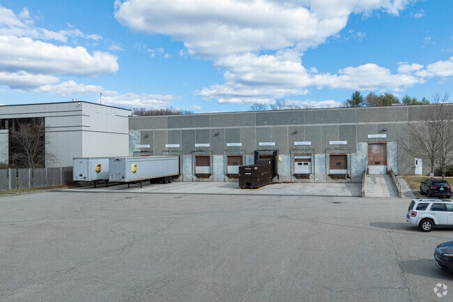

Property Detail
19 Progress Rd
BILL-000105-000132-000003-000002
MIDDLESEX
Warehouse
Massachusetts
5
3-2
AE The base floodplain where base flood elevations are provided. AE Zones are now used on new format FIRMs instead of A1-A30 Zones.
9.19 AC
2025
Lowell/Chelmsford
2025
Boston
316102
Boston-Cambridge-Newton, MA-NH
120,010 SF
NEARBY LISTINGS FOR SALE OR LEASE
DEMOGRAPHICS near 19 Progress Rd
1 mile
3 mile
5 mile
2024 Total Population
6,082
54,856
143,632
2029 Population
6,296
57,001
149,138
Pop Growth 2024-2029
+ 3.52%
+ 3.91%
+ 3.83%
Average Age
42
43
43
2024 Total Households
2,173
19,745
52,298
HH Growth 2024-2029
+ 3.91%
+ 4.08%
+ 3.99%
Median Household Inc
$140,148
$144,060
$144,205
Avg Household Size
2.80
2.70
2.70
2024 Avg HH Vehicles
2.00
2.00
2.00
Median Home Value
$714,398
$732,223
$745,167
Median Year Built
1974
1971
1971
Nearby Places
Map Layers
Map Styles
 Street
 Aerial
Transit
 Traffic
 Biking
Places
Listings with unknown addresses are not visible on the map
- Restaurants
- Banks
- Shops
- Fitness
- Groceries
PUBLIC TRANSPORTATION
COMMUTER RAIL
Wilmington (Lowell Line - Massachusetts Bay Transportation Authority Commuter Rail (Purple Line))
Drive
Walk
Distance
Wilmington (Lowell Line - Massachusetts Bay Transportation Authority Commuter Rail (Purple Line))
18 min
7.8 mi
Anderson/Woburn Regional Transportation Center (Lowell Line - Massachusetts Bay Transportation Authority Commuter Rail (Purple Line))
Drive
Walk
Distance
Anderson/Woburn Regional Transportation Center (Lowell Line - Massachusetts Bay Transportation Authority Commuter Rail (Purple Line))
19 min
8.1 mi
AIRPORT
General Edward Lawrence Logan International
Drive
Walk
Distance
General Edward Lawrence Logan International
39 min
22.6 mi
Freight Ports
Port of Boston
Drive
Walk
Distance
Port of Boston
40 min
22.3 mi
Nearby Properties
Address
Land Use
TOTAL SIZE
Lot Size
Zoning
Address
Land Use
TOTAL SIZE
Lot Size
Zoning
72,799 SF
69.22 AC
IND
Address
Land Use
TOTAL SIZE
Lot Size
Zoning
135,300 SF
30.85 AC
PD
Address
Land Use
TOTAL SIZE
Lot Size
Zoning
35.90 AC
5
Address
Land Use
TOTAL SIZE
Lot Size
Zoning
253,078 SF
4.18 AC
5
Address
Land Use
TOTAL SIZE
Lot Size
Zoning
346,106 SF
42.04 AC
RO
Address
Land Use
TOTAL SIZE
Lot Size
Zoning
330,500 SF
7.44 AC
PD
Address
Land Use
TOTAL SIZE
Lot Size
Zoning
32.07 AC
PD
Address
Land Use
TOTAL SIZE
Lot Size
Zoning
262,278 SF
3.80 AC
PD
Address
Land Use
TOTAL SIZE
Lot Size
Zoning
325,799 SF
21.70 AC
IND
Address
Land Use
TOTAL SIZE
Lot Size
Zoning
30,480 SF
179 AC
A
Address
Land Use
TOTAL SIZE
Lot Size
Zoning
225,792 SF
9.90 AC
4
Address
Land Use
TOTAL SIZE
Lot Size
Zoning
9.50 AC
Address
Land Use
TOTAL SIZE
Lot Size
Zoning
275,751 SF
41.30 AC
R20
Address
Land Use
TOTAL SIZE
Lot Size
Zoning
27.48 AC
5
Address
Land Use
TOTAL SIZE
Lot Size
Zoning
25.50 AC
BG
Address
Land Use
TOTAL SIZE
Lot Size
Zoning
20,382 SF
11.61 AC
IND
Address
Land Use
TOTAL SIZE
Lot Size
Zoning
14.82 AC
RO
Address
Land Use
TOTAL SIZE
Lot Size
Zoning
244,756 SF
15.91 AC
5
Address
Land Use
TOTAL SIZE
Lot Size
Zoning
216,224 SF
5.71 AC
NPD
Address
Land Use
TOTAL SIZE
Lot Size
Zoning
102,899 SF
28.88 AC
IND
Address
Land Use
TOTAL SIZE
Lot Size
Zoning
16.63 AC
2
Address
Land Use
TOTAL SIZE
Lot Size
Zoning
30,578 SF
13.22 AC
R
Address
Land Use
TOTAL SIZE
Lot Size
Zoning
110,162 SF
16.67 AC
5
Address
Land Use
TOTAL SIZE
Lot Size
Zoning
6.36 AC
5
Address
Land Use
TOTAL SIZE
Lot Size
Zoning
264,936 SF
23.16 AC
IND
Address
Land Use
TOTAL SIZE
Lot Size
Zoning
44,528 SF
23.01 AC
IND
Address
Land Use
TOTAL SIZE
Lot Size
Zoning
120,600 SF
4.75 AC
NPD
Address
Land Use
TOTAL SIZE
Lot Size
Zoning
188,042 SF
32.31 AC
COM
Address
Land Use
TOTAL SIZE
Lot Size
Zoning
85,490 SF
59.36 AC
A
The World's #1 Commercial Real Estate Marketplace
Connect with us
© 2026 CoStar Group
The information above has been obtained from sources believed reliable. While we do not doubt its accuracy we have not verified it and make no guarantee, warranty or representation about it. It is your responsibility to independently confirm its accuracy and completeness. Any projections, opinions, assumptions, or estimates used are for example only and do not represent the current or future performance of the property. The value of this transaction to you depends on tax and other factors which should be evaluated by your tax, financial, and legal advisors. You and your advisors should conduct a careful, independent investigation of the property to determine to your satisfaction the suitability of the property for your needs.